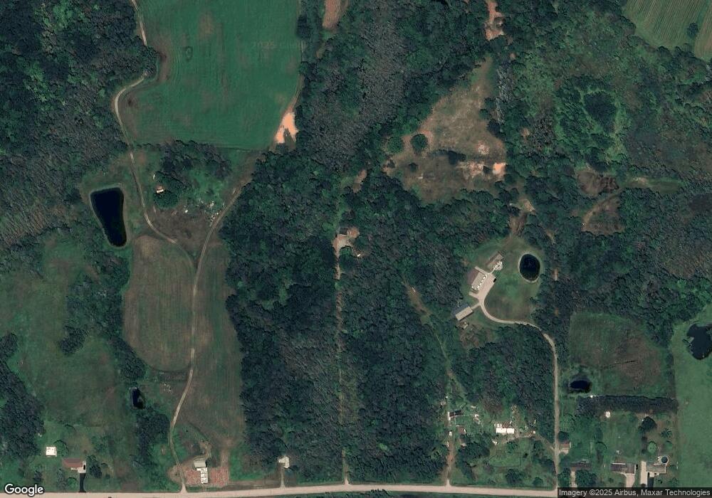
W6698 Number 10 Rd Wallace, MI 49893
Estimated Value: $133,679 - $287,000
3
Beds
1
Bath
938
Sq Ft
$240/Sq Ft
Est. Value
About This Home
This home is located at W6698 Number 10 Rd, Wallace, MI 49893 and is currently estimated at $224,893, approximately $239 per square foot. W6698 Number 10 Rd is a home with nearby schools including Stephenson High School.
Ownership History
Date
Name
Owned For
Owner Type
Purchase Details
Closed on
Oct 4, 2006
Sold by
First Bank Upper Michigan
Bought by
Majkrzak Walter
Current Estimated Value
Purchase Details
Closed on
Oct 1, 2006
Sold by
First Bank Upper Michigan
Bought by
Majkrzak Walter
Purchase Details
Closed on
Sep 14, 2006
Sold by
Biello Nick and Biello Darlene
Bought by
Biello Darlene
Purchase Details
Closed on
Apr 10, 2006
Sold by
Biello Darlene
Purchase Details
Closed on
Jun 2, 2004
Sold by
Planka Timothy R and Planka Karen M
Bought by
Biello Nick and Biello Darlene
Purchase Details
Closed on
Jun 1, 2000
Sold by
Kannianinen Dean A and Kannianinen Susan
Bought by
Planka Timoty R and Planka Karen M
Create a Home Valuation Report for This Property
The Home Valuation Report is an in-depth analysis detailing your home's value as well as a comparison with similar homes in the area
Purchase History
| Date | Buyer | Sale Price | Title Company |
|---|---|---|---|
| Majkrzak Walter | $52,000 | -- | |
| Majkrzak Walter | $52,000 | -- | |
| Biello Darlene | -- | -- | |
| -- | -- | -- | |
| Biello Nick | $56,000 | -- | |
| Planka Timoty R | $52,000 | -- |
Source: Public Records
Tax History Compared to Growth
Tax History
| Year | Tax Paid | Tax Assessment Tax Assessment Total Assessment is a certain percentage of the fair market value that is determined by local assessors to be the total taxable value of land and additions on the property. | Land | Improvement |
|---|---|---|---|---|
| 2025 | $1,434 | $39,700 | $12,600 | $27,100 |
| 2024 | $1,282 | $35,500 | $11,900 | $23,600 |
| 2023 | $323 | $34,700 | $34,700 | $0 |
| 2020 | $323 | $31,100 | $0 | $0 |
| 2019 | -- | $36,800 | $0 | $0 |
| 2018 | -- | $34,700 | $34,700 | $0 |
| 2017 | -- | $34,500 | $34,500 | $0 |
| 2016 | -- | $35,100 | $0 | $0 |
| 2015 | -- | $35,100 | $0 | $0 |
| 2014 | -- | $37,600 | $37,600 | $0 |
| 2013 | $323 | $37,400 | $0 | $0 |
Source: Public Records
Map
Nearby Homes
- 0 Park Place Dr
- 0 Sobieski 8 Rd
- N9598 Cottage Ln
- 0 State Hwy 180 Unit 50254736
- 0 State Hwy 180 Unit 50254740
- 0 State Hwy 180 Unit 50254737
- W6285 Co G-08 Rd
- N6403 County Road 577
- N2108 S R1 Ln
- 0 Million Dollar Rd Unit 2220028560
- 5 O4 Ln
- n 2119 Bay de Noc Dr
- W3030 State Highway 180
- N6568 State Highway 180
- w 4794 Birch Creek Road No 6
- W6939 3 5 Rd
- N11217 Rademaker Rd
- N11169 Rademaker Rd
- N1796 S N-3 Dr
- 0 Hwy 180 Unit 50254733
- W6674 Number 10 Rd
- W6570 Number 10 Rd
- W6556 Number 10 Rd
- W6556 Number 10 Rd
- W6698 #10 Rd
- W6548 Number 10 Rd
- W6782 Number 10 Rd
- W6540 Number 10 Rd
- W6697 Number 10 Rd
- W6535 Number 10 Rd
- W6840 Number 10 Rd
- N4124 County Road 577
- N3955 County Road 577
- N4309 County Road 577
- N3893 County Road 577
- W6911 Number 10 Rd
- N3887 County Road 577
- W6658 County Road 338
- N3888 County Road 577
- N4378 County Road 577
