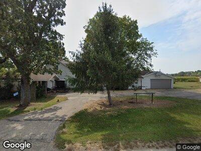
W6725 Golden Rd Dalton, WI 53926
Estimated Value: $190,000 - $277,000
--
Bed
--
Bath
--
Sq Ft
2.08
Acres
About This Home
This home is located at W6725 Golden Rd, Dalton, WI 53926 and is currently estimated at $252,782. W6725 Golden Rd is a home located in Green Lake County with nearby schools including Markesan Primary School, Markesan Intermediate School, and Markesan Middle School.
Ownership History
Date
Name
Owned For
Owner Type
Purchase Details
Closed on
Aug 3, 2021
Sold by
Tonn Joseph A and Oechsner Theresa L
Bought by
Yoder Wilbur W and Yoder Dorothy L
Current Estimated Value
Purchase Details
Closed on
Nov 19, 2020
Sold by
Joseph A Tonn Revocable Trust
Bought by
Tonn Joseph A and Oechsner Theresa L
Purchase Details
Closed on
Oct 15, 2020
Sold by
Tonn Joseph A and Oeschsner Theresa L
Bought by
Tonn Joseph A and Oeschsner Theresa L
Purchase Details
Closed on
Jan 20, 2020
Sold by
Tonn Constanze M
Bought by
Constanze M Tonn Revocable Trust
Create a Home Valuation Report for This Property
The Home Valuation Report is an in-depth analysis detailing your home's value as well as a comparison with similar homes in the area
Home Values in the Area
Average Home Value in this Area
Purchase History
| Date | Buyer | Sale Price | Title Company |
|---|---|---|---|
| Yoder Wilbur W | $170,000 | None Available | |
| Tonn Joseph A | -- | None Available | |
| Constanze M Tonn Revocable Trust | -- | None Available |
Source: Public Records
Mortgage History
| Date | Status | Borrower | Loan Amount |
|---|---|---|---|
| Previous Owner | Tonn Constanze M | $110,000 |
Source: Public Records
Tax History Compared to Growth
Tax History
| Year | Tax Paid | Tax Assessment Tax Assessment Total Assessment is a certain percentage of the fair market value that is determined by local assessors to be the total taxable value of land and additions on the property. | Land | Improvement |
|---|---|---|---|---|
| 2024 | $2,648 | $167,200 | $22,800 | $144,400 |
| 2023 | $2,452 | $167,200 | $22,800 | $144,400 |
| 2022 | $2,383 | $167,200 | $22,800 | $144,400 |
| 2021 | $2,437 | $167,200 | $22,800 | $144,400 |
| 2020 | $2,211 | $142,700 | $17,200 | $125,500 |
| 2019 | $2,160 | $142,700 | $17,200 | $125,500 |
| 2018 | $2,188 | $142,700 | $17,200 | $125,500 |
| 2017 | $2,260 | $142,700 | $17,200 | $125,500 |
| 2016 | $2,389 | $142,700 | $17,200 | $125,500 |
| 2015 | $2,929 | $142,700 | $17,200 | $125,500 |
| 2014 | $2,785 | $154,100 | $19,800 | $134,300 |
| 2013 | $3,014 | $154,100 | $19,800 | $134,300 |
Source: Public Records
Map
Nearby Homes
- W6391 E Oak St
- W6055 County Road B
- W6051/W6055 County Road B
- W6051 County B Rd
- N9717 County Road H
- 0 County Road B Unit 1983714
- 0 County Road B Unit 1983405
- 230 Gilbertson St
- 241 N Forest St
- 261 N Forest St
- W6726 Puckaway Rd
- W6654 Puckaway Rd
- 303 S Main St
- W6782 Marine Dr
- W6208 Lakeview Dr N
- W2470 County Road B
- W983 W North Shore Dr Unit 6
- W983 W North Shore Dr Unit 7
- 260 Lake St
- W1002 Laurie Ln
- W6725 Golden Rd
- 0 Lovers Ln
- N1213 Lovers Ln
- W7221 Hwy B
- W5733 Hwy B
- N1236 Lovers Ln
- 38.07 County Road B
- 80 Ac 18th Rd
- 80 Acres 18th Rd
- 36 Ac Fountain Ln
- 5 Ac 17th Rd
- 35.55 Ac Gillette Dr
- 40 Ac County Road B
- 40 Acres County Road B
- 35.31 Ac Jacobson Dr
- 3.8 Ac County Road H
- 41.55 Ac County Rd II
- 80 Ac County Road B
- 80 Acres 18th Rd
- 40 Acres County Road B