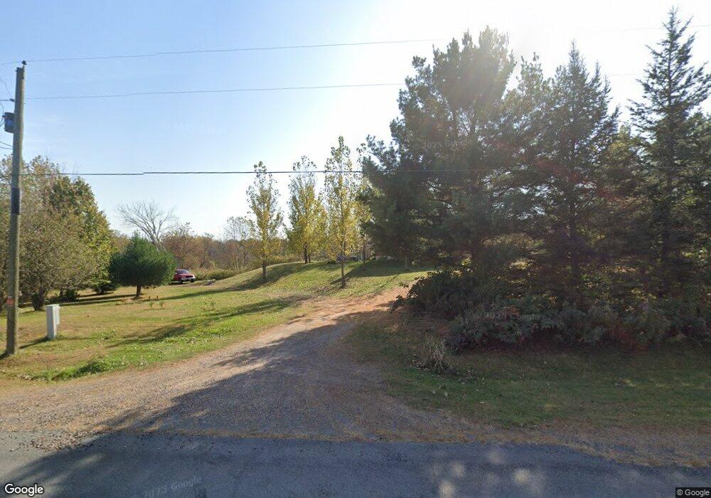
W8975 Broken Arrow Rd Conrath, WI 54731
Estimated Value: $164,000 - $373,000
--
Bed
--
Bath
--
Sq Ft
40
Acres
About This Home
This home is located at W8975 Broken Arrow Rd, Conrath, WI 54731 and is currently estimated at $269,417. W8975 Broken Arrow Rd is a home located in Rusk County with nearby schools including Holcombe Elementary School and Holcombe High School.
Ownership History
Date
Name
Owned For
Owner Type
Purchase Details
Closed on
Jul 14, 2008
Sold by
Bowe Margaret M
Bought by
Skrypek Michael
Current Estimated Value
Purchase Details
Closed on
Jun 8, 2007
Sold by
Skrypek Michael
Bought by
Skrypek Michael
Create a Home Valuation Report for This Property
The Home Valuation Report is an in-depth analysis detailing your home's value as well as a comparison with similar homes in the area
Home Values in the Area
Average Home Value in this Area
Purchase History
| Date | Buyer | Sale Price | Title Company |
|---|---|---|---|
| Skrypek Michael | $43,000 | -- | |
| Skrypek Michael | $20,000 | -- | |
| Skrypek Michael | $20,000 | -- |
Source: Public Records
Mortgage History
| Date | Status | Borrower | Loan Amount |
|---|---|---|---|
| Closed | Skrypek Michael | $0 |
Source: Public Records
Tax History Compared to Growth
Tax History
| Year | Tax Paid | Tax Assessment Tax Assessment Total Assessment is a certain percentage of the fair market value that is determined by local assessors to be the total taxable value of land and additions on the property. | Land | Improvement |
|---|---|---|---|---|
| 2024 | $1,896 | $174,600 | $36,200 | $138,400 |
| 2023 | $1,759 | $174,500 | $36,100 | $138,400 |
| 2022 | $1,705 | $102,300 | $24,300 | $78,000 |
| 2021 | $1,643 | $102,300 | $24,300 | $78,000 |
| 2020 | $1,695 | $102,200 | $24,200 | $78,000 |
| 2019 | $1,714 | $102,200 | $24,200 | $78,000 |
| 2018 | $1,686 | $102,200 | $24,200 | $78,000 |
| 2017 | $1,697 | $102,200 | $24,200 | $78,000 |
| 2016 | $617 | $44,300 | $24,200 | $20,100 |
| 2015 | $877 | $44,300 | $24,200 | $20,100 |
| 2014 | $583 | $44,400 | $24,300 | $20,100 |
| 2013 | $619 | $44,400 | $24,300 | $20,100 |
Source: Public Records
Map
Nearby Homes
- W9514 Stansbury Rd
- N 900 Joes Rd
- 9620 County Road D
- W9346 Woodlawn Dr
- 27269 305th Ave
- ON Dean Rd
- TBD Homestead Rd
- W74TBD Homestead Rd
- 28034 295th Ave
- 27728 295th St
- Lot 4 297th Ave
- Lot 7, 1.83 +/- Acre 295th Ave
- 1.50 Acre On 290th Ave
- W10765 County Road D
- N3830 Kostka Rd
- W9902 Flohr Rd
- 27320 256th St
- Lot 28 Round Lake Rd
- 27183 Other
- 27183 & 27185 250th St Unit 27183/27185
- W9021 Broken Arrow Rd
- W8883 Broken Arrow Rd
- W8815 Broken Arrow Rd
- W9002 Broken Arrow Rd
- W9002 Broken Arrow Rd
- W8894 Broken Arrow Rd
- 9002 Broken Arrow Rd
- W8851 Broken Arrow Rd
- W8833 Broken Arrow Rd
- W8852 Broken Arrow Rd
- 8852 Broken Arrow Rd
- W8813 Broken Arrow Rd
- W9034 Broken Arrow Rd
- W9092 Broken Arrow Rd
- W8769 Broken Arrow Rd
- W8760 Broken Arrow Rd
- W9158 Broken Arrow Rd
- W9203 Broken Arrow Rd
- W9220 Broken Arrow Rd
- W9294 Broken Arrow Rd
