

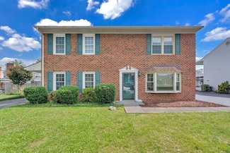
$374,950
- 3 Beds
- 3 Baths
- 2,144 Sq Ft
2553 S Clearing Rd, Salem, VA 24153
Richard Wimberley RE/MAX ALL POINTS
Explore Similar Townhomes Within 2 Miles of South Washington Heights, VA
$374,950
2553 S Clearing Rd, Salem, VA 24153
Richard Wimberley RE/MAX ALL POINTS
Explore South Washington Heights
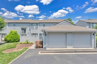
$240,000
1312 Parkdale Manor Dr, Salem, VA 24153
Greg Alexander KELLER WILLIAMS REALTY ROANOKE
$317,500
2404 Post Oak Rd, Salem, VA 24153
William Jones THE GOOD SIGN REAL ESTATE CO.
Copyright © 2025 CoStar Group