A rating for the building relative to other buildings of the same type throughout the country.Learn more
228Units
25Stories
1983Year Built
$86.9K - $285KValue Range
Available Units
For Sale
For Rent
Highlights
Concierge
Fitness Center
24-Hour Guard
Heated In Ground Pool
Rooftop Deck
City View
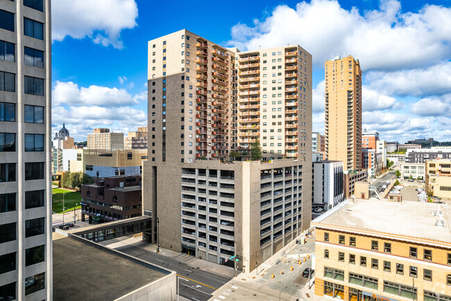
Urban living in the heart of St. Paul
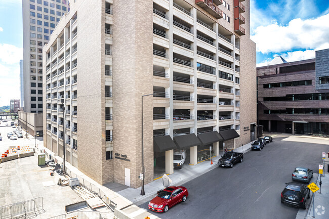
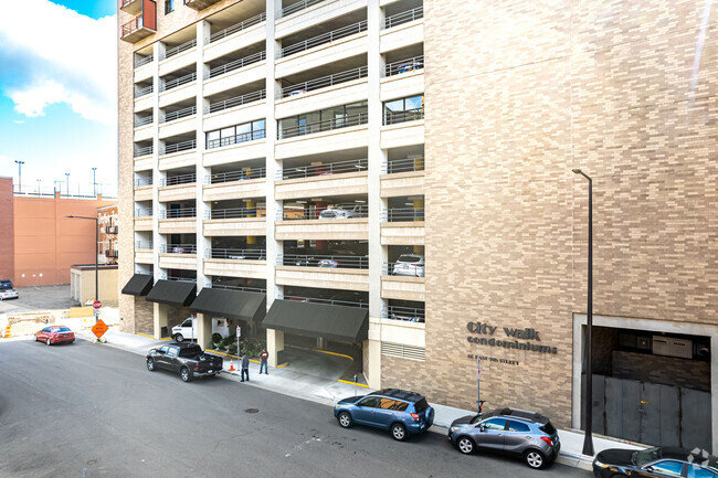
City Walk is a 25-story condominium building located in downtown St. Paul, completed in 1983. With 228 units, it offers a straightforward, utilitarian design that fits seamlessly into the vibrant urban landscape. The building provides a practical and comfortable living experience for those seeking to enjoy the conveniences of city life.
Diverse layouts with stunning city views
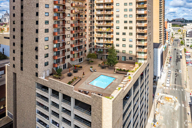
City Walk offers a variety of floor plans, including studios, and 1 to 3-bedroom layouts. Studio units range from 495 to 500 square feet, featuring 1 bathroom, with prices from approximately $105,901.5 to $133,848.75. One-bedroom units span 657 to 1,152 square feet, also with 1 bathroom, priced between $103,190 and $177,000. Two-bedroom units range from 1,085 to 1,845 square feet, offering 1 to 3 bathrooms, with prices from $168,000 to $190,000. The building also includes 3-bedroom units around 1,200 square feet with 2 bathrooms. Many units boast hardwood floors, elegant fixtures, and private balconies with breathtaking views of the St. Paul skyline. Monthly HOA fees range from $400 to $700, covering air conditioning, heating, internet, and more.
Comprehensive amenities for a convenient lifestyle
City Walk provides an array of amenities designed to enhance urban living. Residents can enjoy a heated outdoor pool, fitness center, hot tub, sauna, and a rooftop deck with panoramic views. The building also features a library, party room, and community room for social gatherings. Practical conveniences include an Amazon pick-up station, mailboxes, and secure underground parking. The building ensures safety with 24-hour security and a front desk concierge. Free laundry facilities are available on every floor, and professional management is on-site to assist residents.
Vibrant downtown St. Paul at your doorstep
Located in downtown St. Paul, City Walk offers residents access to a rich tapestry of cultural and recreational opportunities. Nearby, the Xcel Energy Center hosts concerts and sporting events, while the Ordway Center provides a venue for performing arts. For dining, options like the Saint Paul Grille and Afro Deli & Grill offer diverse culinary experiences. Grocery shopping is convenient with Lunds & Byerlys just a short walk away. Parks such as Rice Park and Mears Park provide green spaces for relaxation and community events. The neighborhood is known for its historic architecture and lively atmosphere, making it a desirable place to live.
Effortless connectivity and accessibility
City Walk is well-connected to public transportation, with the Minnesota St & 10th St bus stop just a short walk away. The building's location offers easy access to the extensive skyway system, allowing residents to navigate downtown St. Paul comfortably, even in inclement weather. For those traveling further afield, the Minneapolis-St Paul International Airport is approximately a 15-minute drive. The area is highly walkable and bike-friendly, making it convenient for residents to explore the city and its amenities.
Collateral AnalyticsCollateral Analytics
Collateral Analytics AVMs (Automated Valuation Model) employ a number of statistical approaches combined with neighborhood-specific comparable selection guarantees the most up-to-date and precise valuations.
Black Knight®Black Knight
Black Knight’s AVM (Automated Valuation Model) is a state-of-the-art online residential property valuation tool that provides a quick and accurate estimate of the value of almost any home in the U.S.
First AmericanFirst American
First American Data & Analytics’ next-generation AVM combines unrivaled data assets with a blended ensemble of valuation models to produce highly accurate, reliable valuations you can trust.
Quantarium
Current List Price
Sold Price
Area Factors
Moderate Crime
Crime Score®
5/ 10
Very Bikeable
Bike Score®
71/ 100
Walker's Paradise
Walk Score®
97/ 100
Sources: WhatIsMyCrimeRisk.com, Walk Score
Sources: WhatIsMyCrimeRisk.com, Walk Score
WhatIsMyCrimeRisk.com, Powered by CAP Index provides objective, accurate, and consistent data to help measure, compare, and mitigate crime risks. Walk Score® measures the walkability of any address. Transit Score® measures access to public transit. Bike Score® measures the bikeability of any address.
Sound Score® measures the noise level of any address. Environmental risk data is provided by First Street Foundation® and is designed to approximate risk and not intended to include all possible scenarios.
Parks in this Area
Wacouta Commons
6 min walk
Picnic Area
Trails
Playground
Mears Park
7 min walk
Picnic Area
Trails
Events
Kellogg Mall Park
7 min walk
Picnic Area
Trails
River
Rice Park
8 min walk
Picnic Area
Trails
Events
Depot Tot Lot
9 min walk
Playground
Mississippi National River and Recreation Area
13 min walk
Bike Trails
Kayak/Canoe
Hiking
Raspberry Island Regional Park
13 min walk
Summit Park
15 min walk
Trails
Multi-Purpose Field
Cathedral Hill Park
3 min drive
Multi-Purpose Field
Schools
Source:
GreatSchools:
The GreatSchools Rating helps parents compare schools within a state based on a variety of school quality indicators and provides a helpful picture of how effectively each school serves all of its students. Ratings are on a scale of 1 (below average) to 10 (above average) and can include test scores, college readiness, academic progress, advanced courses, equity, discipline and attendance data. We also advise parents to visit schools, consider other information on school performance and programs, and consider family needs as part of the school selection process.
View GreatSchools Rating Methodology
Disclaimer: Please note that this building may not be in these schools' attendance zones.
Disclaimer: Certain information contained herein is derived from information provided by parties other than Homes.com. All information provided is deemed reliable, but is not guaranteed and should be independently verified.