$1,197,867Average Value$807Average Price per Sq Ft1Home For Sale
Centrally located community popular with students, locals and tourists
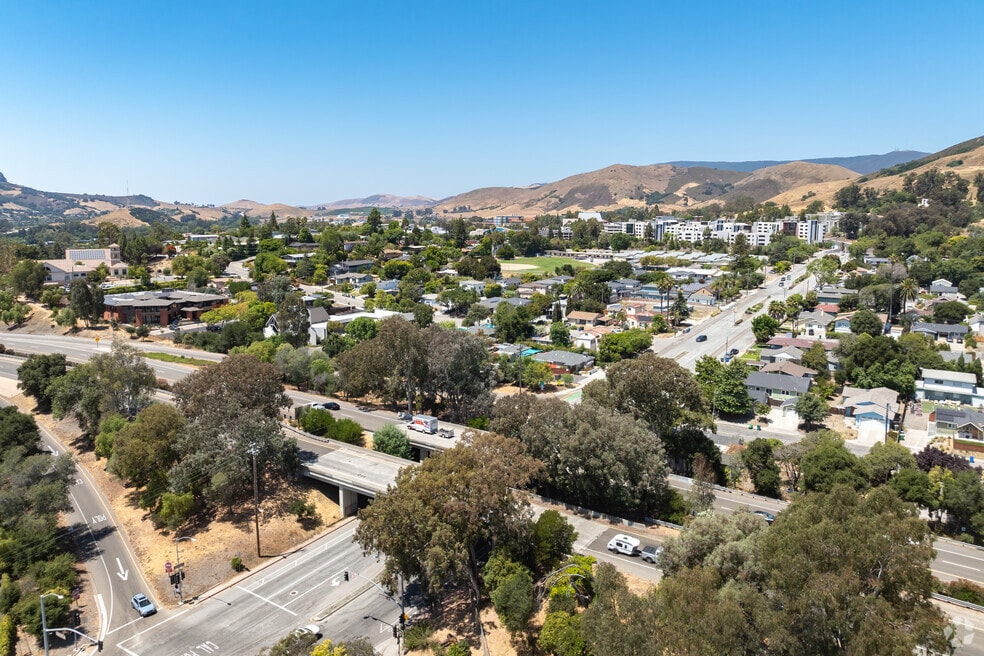
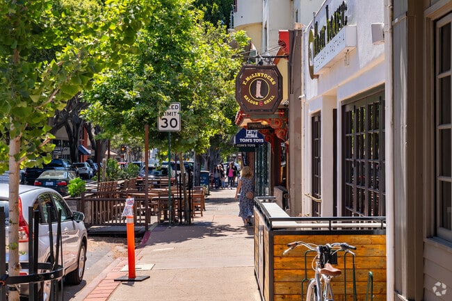
Just north of Downtown San Luis Obispo, a mile north of California Polytechnic State University (known as Cal Poly), and bordered northwest by U.S. 101, Upper Monterey is popular with locals, students and tourists. “There are pockets of college rentals, pockets that are commercial, and pockets of single-family homes," says Colleen Clarke, broker associate at Christie’s International Real Estate Group with over 25 years of experience. Residential areas north of Monterey Street are densely packed with early and mid-20th-century homes, including student housing and rentals; the neighborhood's south side is home to most of the city’s hotels. “Upper Monterey is really popular because it’s the gateway into our town," says Clarke, "and the local trolley runs from the hotels into downtown.” While the student housing and hotels can be noisy in the evenings, seasonality balances things out; when the tourists come in the summer, the college students have already gone home, and vice versa in the fall. Upscale bars and restaurants are housed within larger hotels, with a few other casual eateries dotted in between. To the east are the hiking trails on High School Hill, and the top-rated San Luis Obispo High.
A mix of rentals and owner-occupied homes
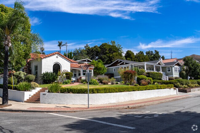
Most of the neighborhood's single-family homes are found on the west side, date between 1940 and 1970, and are either ranch-style with low-slung roofs or Spanish Revival-style with clay-tiled roofs. The south side is peppered with Craftsman bungalows from the 1920s. Two-bedroom versions of all these styles range from $800,000 to $1.2 million, while three- to-four-bedroom versions range from $1.2 million to $1.6 million. Duplexes and other multi-family homes built during the same period are found more on the north side, popular with investors for the proximity to Cal Poly, among other factors; prices for these properties range from $1.1 million to $1.7 million depending on how many units it has. Most homes here are set close together, their well-maintained lawns shaded by tall palm and cypress trees and bordered by short wooden fences or neatly trimmed hedges. Garages aren’t common, so many locals park in small driveways or along the cracked streets.
Homes on the north side are often rented out to Cal Poly students, including a few Greek life organizations. “There isn’t enough student housing on campus, so it spills over into neighboring communities,” Clarke says. “It’s advantageous if you own a rental, but not as much if it’s your own personal property.” This can bring extra traffic during Family Weekend in late October or early November when many relatives stay in hotels within Upper Monterey.
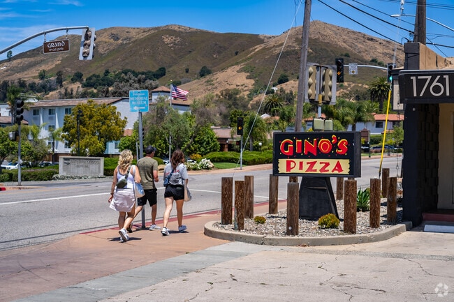
Hotel restaurants and casual eateries a mile from downtown
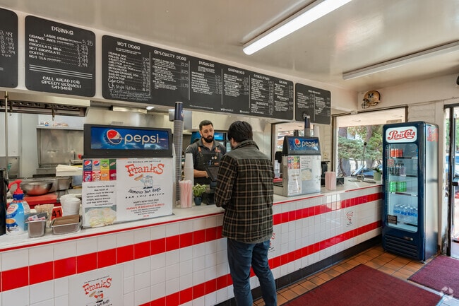
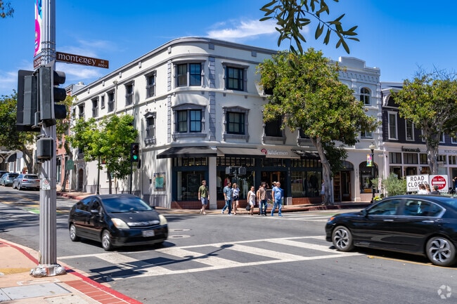
Hotels and inns line Monterey Street. One of these is Motel Inn, the world’s first motel when it opened in 1925 and now a historic landmark beside the freeway. Set in the La Quinta Inn & Suites,1865 Craft House and Kitchen serves sandwiches, salads, and steak, as well as homemade craft cocktails and happy hour specials. More nightlife options include Krobar Craft Distillery and Central Coast Brewing, which both share space in The Hub, a social club with plenty of outdoor seating and food trucks. Just off Monterey Street, Frank's Famous Hot Dogs has been a local staple since 1977, with a diner-style interior and specialties like the Double Dare Dog, a nine-inch wiener wrapped in bacon and deep fried. Within a mile is a Smart & Final Extra grocery store, as well as the locally owned restaurants and shops the line Downtown San Luis Obispo.
Annual Memorial Day Celebration at the Central Coast Veterans Memorial Museum
The Central Coast Veterans Memorial Museum is set in the heart of Upper Monterey. Established in 2002, the museum features a collection of artifacts and documentation donated by different Central Coast communities. Every year on Memorial Day, the museum hosts a remembrance ceremony honoring San Luis Obispo veterans, followed by a tri-tip barbeque lunch and exhibit talks by local historians.
A-rated schools in San Luis Obispo
Local kids can start school at Bishop’s Peak Elementary, rated A-minus by Niche. The Bishop’s Peak PTA puts on family events like family math nights and school carnivals and helps maintain the school garden, which is used as an outdoor classroom and home for the Garden Lunch Club. The A-rated Laguna Middle offers more than a dozen lunchtime clubs that meet once a week, including a Chess Club and an Edible Ecology Garden Club. At the A-rated San Luis Obispo High, located just east of the neighborhood, students can enroll in fashion, manufacturing and animal science pathways.
Parks in neighboring communities and Hiking Trails on High School High
Upper Monterey's only public green space is Ellsford Park, with a small deck overlooking San Luis Obispo Creek. Locals can head just east to hike High School Hill, whose namesake trail takes a direct route at a steep incline, with panoramic views at the peak. Santa Rosa Park is about a mile west, with a large skate park, a roller rink and a playground with several slides.
Taking the trolley into the downtown core
Upper Monterey is bordered northwest by U.S. Route 101, which leads 190 miles south to Los Angeles. On Thursdays, the Old San Luis Obispo Trolley stops along Monterey Street, taking passengers into the downtown core. Several SLO Transit bus routes stop here and travel the city, including the Cal Poly campus a mile north. Major local roads are lined with bike lanes. Nearby hospitals include Adventist Health Sierra Vista and Dignity Health French Hospital Medical Center, both about a mile away. The San Luis Obispo County Regional Airport is about 4 miles south, while the much larger Los Angeles International Airport is about 190 miles south.
GreatSchools:
The GreatSchools Rating helps parents compare schools within a state based on a variety of school quality indicators and provides a helpful picture of how effectively each school serves all of its students. Ratings are on a scale of 1 (below average) to 10 (above average) and can include test scores, college readiness, academic progress, advanced courses, equity, discipline and attendance data. We also advise parents to visit schools, consider other information on school performance and programs, and consider family needs as part of the school selection process.
View GreatSchools Rating Methodology
Are you familiar with the Upper Monterey neighborhood?
to let others know what life in this neighborhood is like.
Crime and Safety
1 - Low Crime, 10 - High Crime
Upper Monterey
US
Homicide
4
4
Sexual Assault
4
4
Assault with Weapon
4
4
Robbery
3
4
Burglary
5
4
Motor Vehicle Theft
5
4
Larceny
5
4
Crime Score
4
4
Source: WhatIsMyCrimeRisk.com
Upper Monterey Demographics and Home Trends
On average, homes in Upper Monterey, San Luis Obispo sell after 29 days on the market compared to the national average of 53 days. The median sale price for homes in Upper Monterey, San Luis Obispo over the last 12 months is $1,295,000, up 16% from the median home sale price over the previous 12 months.
Welcome to Grovehill Hideaway, a beautifully appointed 4-bedroom, 3-bathroom home offering 2,692 sq ft of living space in the highly desirable Banana Hill neighborhood. Perfectly located just minutes from downtown San Luis Obispo, this residence blends peaceful surroundings with everyday convenience.From the moment you arrive, the wide driveway and gated front patio create a warm welcome
Sound Score® measures the noise level of any address. Transit Score® measures access to public transit. Bike Score® measures the bikeability of any address.
Disclaimer: Certain information contained herein is derived from information provided by parties other than Homes.com. Our sources include: Accuweather, Public Records and Neustar. All information provided is deemed reliable, but is not guaranteed to be accurate and should be independently verified.