$163,311Average Value$150Average Price per Sq Ft1Home For Sale
North Springfield neighborhood features prominently in Black Missourian history
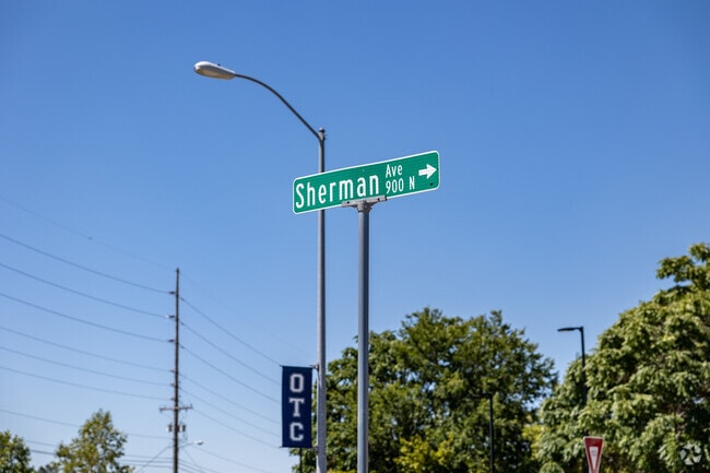
Sherman Ave is a historically Black neighborhood in North Springfield, with a popular park, well-kept historic homes and access to highly-rated public schools. Homes dating to the 1800s and a historic park root residents in the area’s rich history and provide outdoor space for sports and recreation. Residential streets lead to storied restaurants, minor-league baseball games and education at Ozarks Technical Community College, and the rest of Springfield is just under 2 miles south.
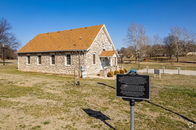
The African American Heritage trail sign in front of Timmons Hall at Silver Springs Park
The African-American Heritage Trail in Springfield has a marker in the Sherman Ave neighborhood.
1/2
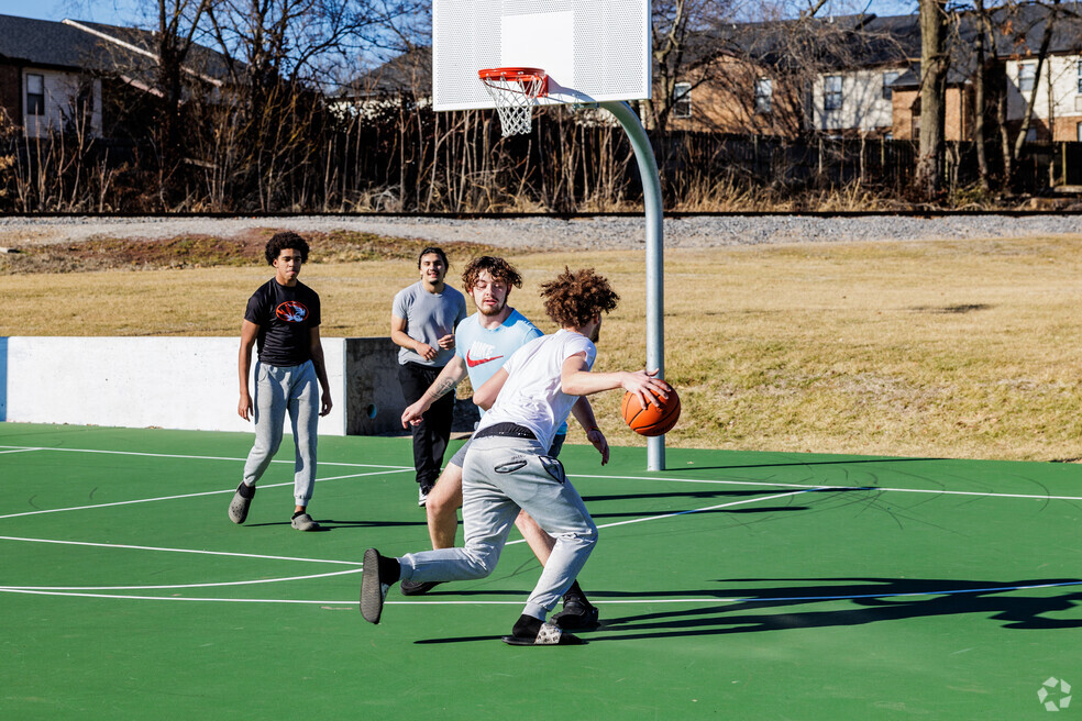
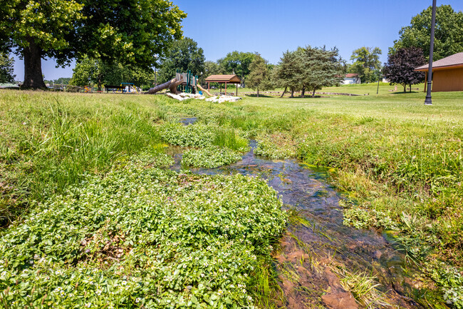
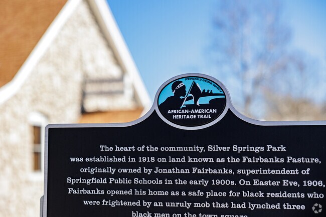
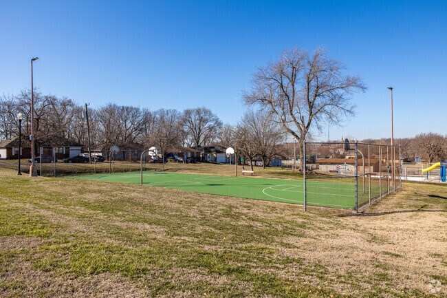
Silver Springs Park is a stop on the Springfield-Greene African American Heritage Trail
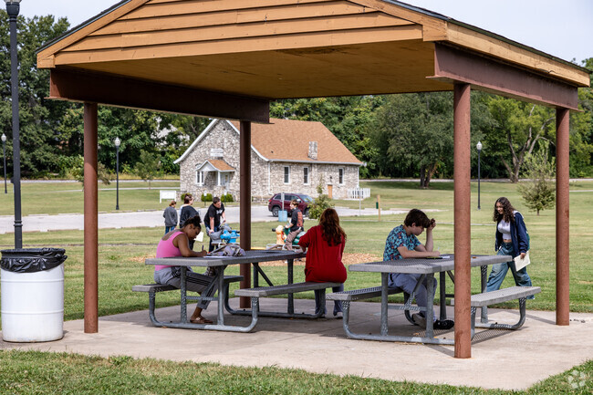
Silver Springs Park spans about 14 acres on the neighborhood's north side. “The park is kind of the anchor for the area,” says Scott Sturm, a Realtor with 22 years of local experience who works with Amax Real Estate. During segregation, Silver Springs was the sole public park available to Black residents, but now it’s the first stop of many on the Springfield-Greene African American Heritage Trail. The trail, under constructiont, will facilitate a walking tour of Black Missourian history, with 20 educational markers denoting important places and events in the midtown and downtown neighborhoods.
Also in Silver Springs Park is Timmons Hall, a former church that held services for over 80 years before becoming a community event center. In the warmer months, Silver Springs Pool and splash pad are open. Half a mile from the neighborhood is Hammons Field, home to the Springfield Cardinals, a minor-league affiliate of Major League Baseball's St. Louis Cardinals.
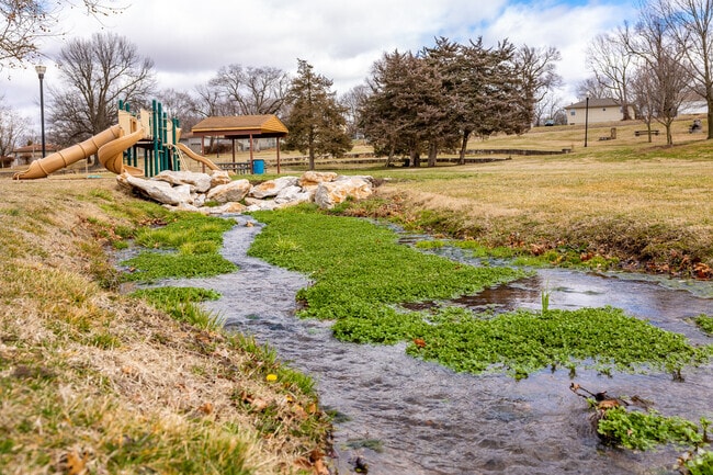
Water flows from the spring at Silver Springs Park
Basketball court at Silver Springs Park
1/2
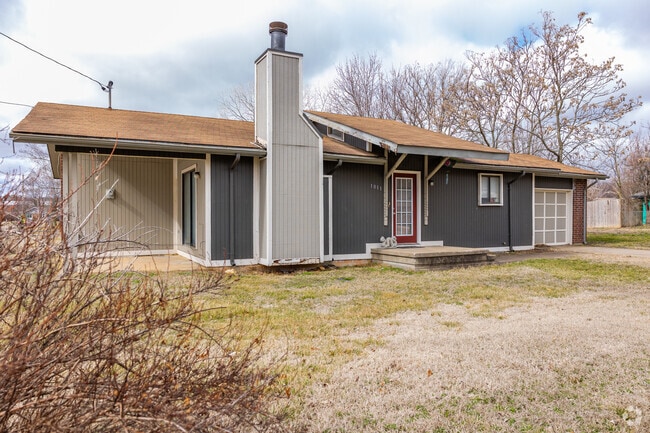
Small homes line the streets at the heart of Sherman Ave
Craftsman bungalows, cottages and ranch-style houses are common in the neighborhood. Streets such as East Scott Street have narrow sidewalks where American Sweetgum trees offer sporadic shade. Prices range from $125,000 to $400,000 for two- to five-bedroom houses. According to Sturm, affordability is a significant factor in drawing homebuyers to Springfield as a whole. “The cost of living is definitely among the lowest in the country for a city of this size,” says Sturm.
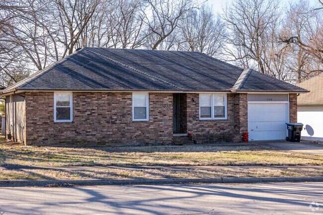
Home in Sherman Avenue neighborhood
A small brick ranch style home in the Sherman Avenue neighborhood
1/2
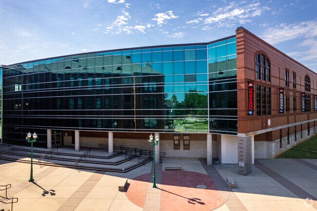
Springfield public schools get A and B grades
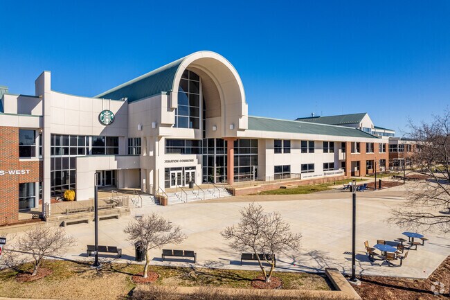
Students can attend public schools close to home. Weaver Elementary School, graded B-minus by Niche, Pipkin Middle School, graded C-plus, and Central High School, graded A-minus, are each under 2 miles from the neighbnorhood. Rated the best public high school in the Springfield area, Central High offers the Springfield Scholars program, where gifted middle schoolers pursue their strongest subjects in a high school setting. Ozarks Technical Community College offers over 40 degrees, with specialties including agriculture, automotive mechanics and aviation.
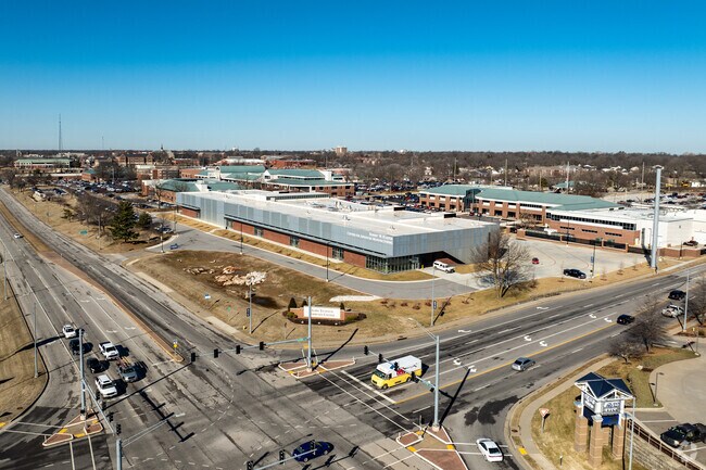
Main entrance to Ozark Technical College
Central High School underwent a major expansion and renovation in 2002.
1/2
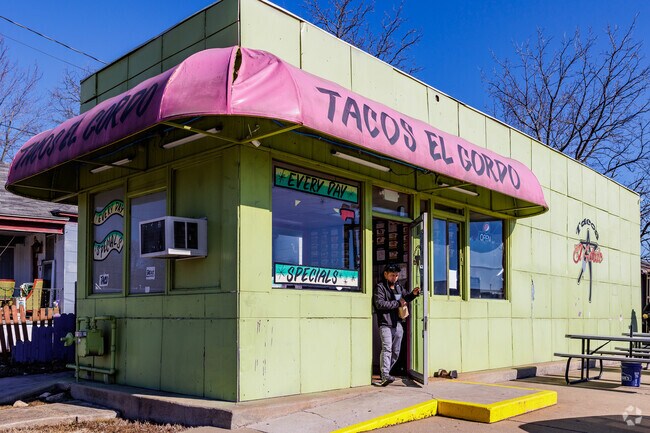
Tacos are served at the National and Division intersection
The closest supermarkets are Save A Lot, Price Cutter and Park Central Market, and the larger Walmart Neighborhood Market is 3 miles away. Tacos El Gordo is a family-run restaurant serving authentic Mexican food at the National and Division intersection. Quick meals can be found at chain restaurants, including Chipotle and Steak ‘n Shake, less than 1 mile south of Sherman Ave.
Family owned Tacos El Gordo is located on National Ave in the Sherman Ave neighborhood.
Tacos El Gordo serves up authentic Mexican flavors in the Sherman Ave neighborhood.
1/2
Festivals showcase art and music within walking distance of Sherman Ave
The neighborhood is under a mile from Springfield’s community festivals, which have 26 annual events throughout the year. One hundred artists from across the country display their work on Walnut Street during Artsfest, a 40-year-strong event held every May. Another festival, Cider Days, recently celebrated its 25th anniversary. At this festival, local artists and musicians perform while attendees enjoy fresh-made food and cider.
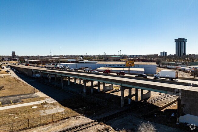
Chestnut Expressway goes around town, Springfield-Branson Airport goes out
Sherman Ave is located along the major Chestnut Expressway, which provides direct access to the rest of Springfield. Medical services are just over 1 mile away at the Cox North Hospital. Residents can bike safely on The Link, which provides a north-south route with low traffic volume and slow speed limits. For public transport, the Division bus route connects with other routes throughout the city. To leave town, residents can fly to 15 nonstop destinations from the Springfield-Branson National Airport, about 8 miles from Sherman Ave.
The Sherman Ave neighborhood is anchored by the intersection of National Ave and Chestnut Expwy.
Sherman Ave residents use Chestnut Expressway as a primary east and west travel corridor.
GreatSchools:
The GreatSchools Rating helps parents compare schools within a state based on a variety of school quality indicators and provides a helpful picture of how effectively each school serves all of its students. Ratings are on a scale of 1 (below average) to 10 (above average) and can include test scores, college readiness, academic progress, advanced courses, equity, discipline and attendance data. We also advise parents to visit schools, consider other information on school performance and programs, and consider family needs as part of the school selection process.
View GreatSchools Rating Methodology
1255 N National Avenue, Springfield--This home would be great for so many--its perfect for investors, folks wanting to downsize, first time home buyers and more! Close to 4 nearby colleges (OTC, Drury, Evangel, and Missouri State). If you love taking walks you can enjoy the Silver Springs Park right outside your door. Or, if you have kids or grandkids who love to swim, spend time at the pool in
Local Logic measures the walkability, access to public transit and bikeability of any address. CAP Index provides objective, accurate, and consistent data to help measure, compare, and mitigate crime risks.
Disclaimer: Certain information contained herein is derived from information provided by parties other than Homes.com. Our sources include: Accuweather, Public Records and Neustar. All information provided is deemed reliable, but is not guaranteed to be accurate and should be independently verified.