A historic rural community that fought for freedom
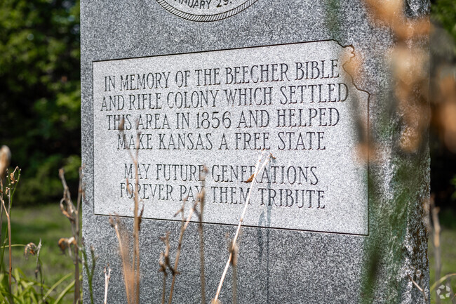
Wabaunsee is a small, unincorporated town along Kansas Highway 18 (K-18), where locals appreciate the rural countryside. “Part of what makes it special is its wide open space,” says Barb Downey, a local cattle rancher and owner of Downey Ranch, where she has lived and worked since 1988. “There’s not a lot of people. You are connected very intimately with nature, the seasons and the ecosystem.” What originally drew people to Wabaunsee was the fight against slavery during the Civil War Era, where they operated the Underground Railroad’s westernmost route. “It was settled by abolitionists so they could vote for Kansas to be a free state,” says Marcy Spaw, executive director of the Wabaunsee County Historical Society & Museum. “Reverend Henry Beecher in Connecticut gave them this charge to start a church. And for every bible he sent, he gave them a rifle because he knew they’d be fighting in the struggle for freedom.” Beecher successfully smuggled the rifles by sending them in crates labeled “Beecher’s Bibles.” The legacy of this moment lives on at a memorial along the highway and at Beecher Bible and Rifle Church, the original house of worship founded in 1857, which still holds services to this day.
Honoring the free-state settlers
The Beecher Bible and Rifle Colony Memorial sits in the middle of a long stretch of grass along K-18, honoring the town’s free-state settlers. Wabaunsee’s fight for freedom is also honored at Mount Mitchell Heritage Prairie Park, an area that served as a navigation point for the Underground Railroad. Today, people can visit the park to learn all about the park’s history while exploring the rare tallgrass prairie. “In the world, there’s about 2% of the original tallgrass prairie ecosystem left,” says Downey, “And most of it is right here in the Flint Hills of Kansas. And that’s what makes this place special. It’s un-messed with.”
Annual Old Settlers Day
Every year, the Beecher Bible and Rifle Church hosts Old Settlers Day. It starts with a church service, followed by a basket dinner and programs where people can learn about the free-state settlers and the Underground Railroad.
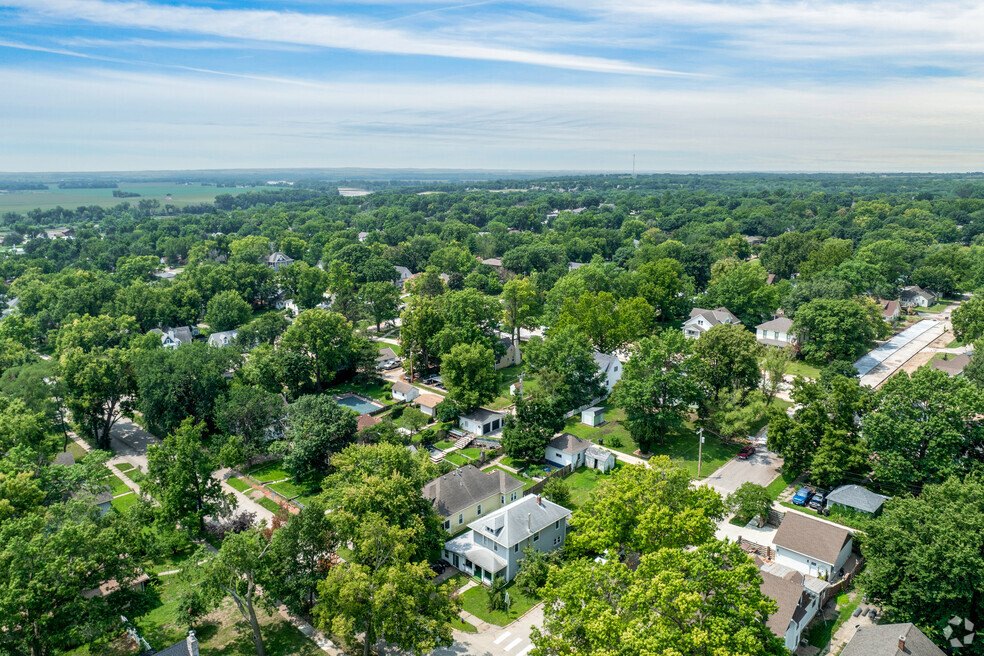
Dirt roads and homes on acres of land
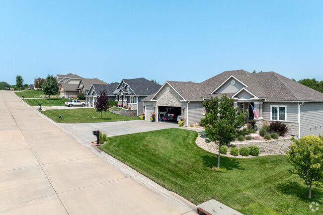
A few dozen homes are situated along Wabaunsee’s dirt roads, while others are right off K-18. The most prominent are ranch-style houses, bungalows and manufactured homes from the early- to mid-1900s. Lot sizes can range anywhere from 0.50 to 11 acres. And while many properties have wide-open yards that capture the rural countryside, some are surrounded by trees to provide more privacy. A two-to-three-bedroom home with 1,000 to 1,500 square feet of living space sells for around $150,000 to $250,000. Larger 2,000 to 2,500-square-foot homes with three to four bedrooms can range from $300,000 to $400,000.
Public schools in Wamego
Students attend schools in the city of Wamego, starting at Central Elementary, which teaches kindergarten through second grade and gets a B-minus from Niche. They’ll go on to third through fifth grade at West Elementary, which earns a B-plus. Then, they’ll head to Wamego Middle and Wamego High, each of which receives a B grade. GreatSchools rates the high school above average regarding college readiness as more than 30% of high schoolers participate in the dual enrollment program.
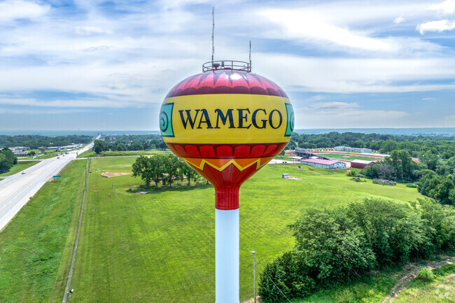
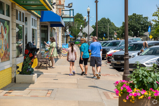
Shopping and Dining Wamego and Manhattan
K-18 can be taken 2.5 miles east to K-99, aka Road to Oz Highway. From there, it’s a 3-mile drive north to the city of Wamego. K-18 also leads west through 13 miles of farmland to Manhattan. These are the two cities where locals drive to shop and dine out. Wamego has a more hometown feel with dozens of local restaurants along Road to Oz Highway. As a nod to The Wizard of Oz, a yellow brick road winds through a narrow alley of murals and statues depicting the movie. Though the final destination isn’t Emerald City, the yellow brick road leads to Friendship House, a café known for its homestyle breakfast, lunch and dessert. Residents can also head to Wamego to shop from Gene’s Heartland Foods, a small Kansas chain. Manhattan is more commercialized with large shopping centers, where people can shop from big box retailers and dine out from a mix of national chains and local restaurants.
History of tornados
The Midwest can be a volatile region, especially during the spring months when there's a greater threat of tornadoes. Wabaunsee is no exception to these severe weather conditions. According to data from the National Oceanic and Atmospheric Administration, the town experience small tornadoes in March 2017, which caused minimal damage. There was also a more destructive EF4 tornado in May 1960, which injured 12 and caused $25 million in property damage.
GreatSchools:
The GreatSchools Rating helps parents compare schools within a state based on a variety of school quality indicators and provides a helpful picture of how effectively each school serves all of its students. Ratings are on a scale of 1 (below average) to 10 (above average) and can include test scores, college readiness, academic progress, advanced courses, equity, discipline and attendance data. We also advise parents to visit schools, consider other information on school performance and programs, and consider family needs as part of the school selection process.
View GreatSchools Rating Methodology
Are you familiar with the Wabaunsee neighborhood?
to let others know what life in this neighborhood is like.
Crime and Safety
1 - Low Crime, 10 - High Crime
Wabaunsee
US
Homicide
2
4
Sexual Assault
1
4
Assault with Weapon
2
4
Robbery
2
4
Burglary
3
4
Motor Vehicle Theft
2
4
Larceny
1
4
Crime Score
1
4
Source: WhatIsMyCrimeRisk.com
Neighborhood Facts
Number of Homes
20
Median Year Built
1946
Average Single Family Home Size Sq Ft
1,648
Below the national average
1,929
Average Townhouse Size Sq Ft
2,168
Median Lot Size Sq Ft
30,491
Distribution of Home Values
Source: Public Records
Average Home Value
Source: Public Records
Property Mix - Square Feet
This Neighborhood Has More Owners
Demographics
Total Population
131
Median Age
45
Population Density
1 person/acre
Population under 18
25.2%
On par with the national average
23.8%
Population over 65
22.1%
On par with the national average
19.1%
Finances
Median Household Income
$101,786
Above the national average
$79,601
Average Household Income
$137,490
Education and Workforce
High School Graduates
97.8%
College Graduates
45.1%
Above the national average
34.1%
Advanced Degrees
23.1%
Above the national average
13.3%
% Population in Labor Force
67.3%
Weather
Annual Precipitation
32''
Average Winter Low Temperature
18°F
Average Summer High Temperature
91°F
Annual Snowfall
10''
Area Factors
Somewhat Bikeable
Bike Score®
24/ 100
Car-Dependent
Walk Score®
0/ 100
Source: Walk Score
Source: Walk Score
Sound Score® measures the noise level of any address. Transit Score® measures access to public transit. Bike Score® measures the bikeability of any address.
Disclaimer: Certain information contained herein is derived from information provided by parties other than Homes.com. Our sources include: Accuweather, Public Records and Neustar. All information provided is deemed reliable, but is not guaranteed to be accurate and should be independently verified.