$93,612Average Value$83Average Price per Sq Ft4Homes For Sale
Growth in the aviation city of Wichita
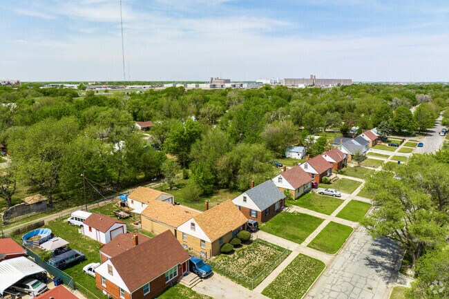
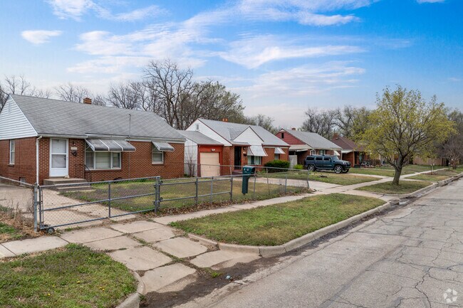
Built up during the aircraft industry boom of World War II, Wichita's Power neighborhood is known not only for its industrial areas and aircraft history but also for its memorial park and considerably affordable brick-faced family homes. The neighborhood's convenient location on the northern side of the city gives it access to all city amenities and proximity to the parks, jobs and restaurants while still allowing for low housing prices. With a location near the McConnel Air Force Base, the area is well known for its history in aviation research and has access to three airports. "The area started with the Aviation industry boom in World War II, and it's both grown and stayed the same ever since," says Jack Silvers, a realtor and resident of Wichita of 44 years.
Piatt Memorial Park is just one of many nearby parks to enjoy in Power.
The homes in Power are surrounded by tall trees.
1/2
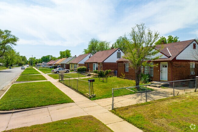
Affordable family homes in north Wichita
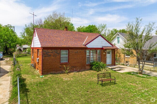
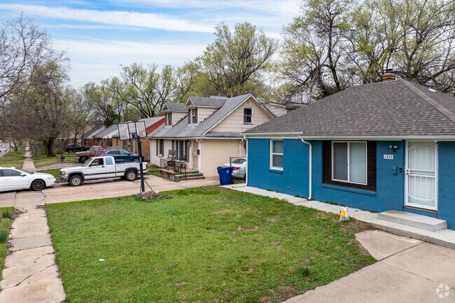
Quaint suburban blocks comprise a good portion of the residential areas in Power, with small yards hosting three to four-bedroom National-style homes. Brick and vinyl siding dot the streetscape among the primarily side-gabled homes, which sell for between $50,000 to $150,000 depending on size and condition.
Good looking blue National-style home in Power.
Single story dwellings make up most of the Power neighborhood.
1/2
Walking trails right outside of home
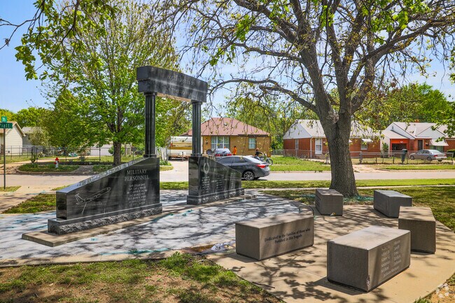
Lynette Woodard Park is a 3-acre recreational hub named after the Wichita-born 1984 Olympic basketball star. The greenspace offers residents a playground, outdoor basketball court and tennis courts and a recreation center with a fitness area. The Redbud biking and hiking path, which features trailheads right outside some homes in the neighborhood, is an 18-mile path with plenty of outdoor space. Most notable for the neighborhood is the Piatt Memorial Park, a space marking the site of a 1965 plane crash. It honors the 30 people who lost their lives.
Power has several trails and sidewalks throughout the neighborhood.
Homes in Power come in a wide variety of styles.
1/2
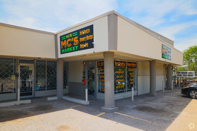
A 40-year-old neighborhood staple at Mr.Mc’s Market
Mr. MC's Market has been Power's one-stop shop for over 40 years. It carries a little of everything from fresh produce, pet food and garden tools. Walmart Neighborhood Market, Aldi and Dillons are less than 4 miles away at Sweetbriar Shopping Center. There are several fast food restaurants within a short drive, and for sit-down restaurants, locals can go to Sazón, which serves Mexican food.
Mr. MC’S Market has been Power’s one-stop shop for over 40 years.
For a sit-down restaurant in Power, head to nearby Sazón, an eatery with Mexican breakfast..
1/2
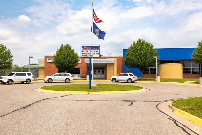
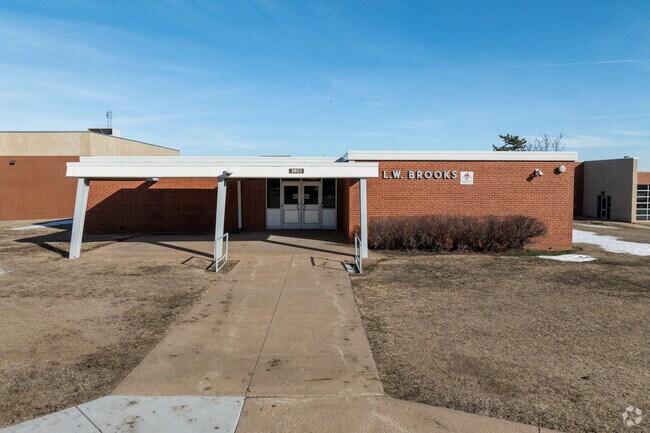
STEM and aerospace innovation through education
Mueller Aerospace and Engineering Discovery Magnet Elementary, rated C-minus on Niche, is where students begin their academic journey. Twice a week, students put on their lab coats and participate in science modules fittingly focused on aerospace, engineering and science themes. Marshall Middle School earns a C rating. High school students may attend Wichita North High School, rated a C-plus.
Mueller Aerospace and Engineering Discovery Magnet Elementary School
This is the main entry for Brooks Magnet Middle School.
1/2
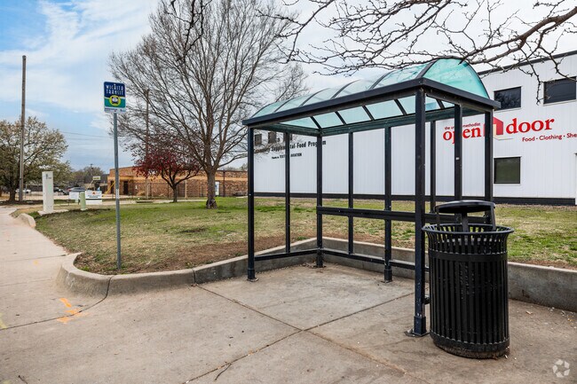
Easy travel in Wichita
Interstate 135 runs along the neighborhood's western edge, providing access to downtown Wichita as well as other states. Of the three airports surrounding Wichita, Colonel James Jabara Airport is closest. Wesley Medical Center sits just over a mile south of Power, and many bus stops run through the neighborhood and all over Wichita.
There are several public bus stops throughout Power.
Power is located closely to Wichita State University.
GreatSchools:
The GreatSchools Rating helps parents compare schools within a state based on a variety of school quality indicators and provides a helpful picture of how effectively each school serves all of its students. Ratings are on a scale of 1 (below average) to 10 (above average) and can include test scores, college readiness, academic progress, advanced courses, equity, discipline and attendance data. We also advise parents to visit schools, consider other information on school performance and programs, and consider family needs as part of the school selection process.
View GreatSchools Rating Methodology
Are you familiar with the Power neighborhood?
to let others know what life in this neighborhood is like.
Crime and Safety
1 - Low Crime, 10 - High Crime
Power
US
Homicide
7
4
Sexual Assault
7
4
Assault with Weapon
9
4
Robbery
9
4
Burglary
5
4
Motor Vehicle Theft
6
4
Larceny
6
4
Crime Score
9
4
Source: WhatIsMyCrimeRisk.com
Power Demographics and Home Trends
On average, homes in Power, Wichita sell after 43 days on the market compared to the national average of 53 days. The median sale price for homes in Power, Wichita over the last 12 months is $80,000, up 45% from the median home sale price over the previous 12 months.
This charming and well-maintained home offers four spacious bedrooms and two bathrooms, making it ideal for families or those needing extra space. The property features a large corner lot, providing ample outdoor area, complemented by a beautiful wrap-around porch perfect for relaxation and entertaining guests. The basement is full and unfinished, offering potential for customization and
This beautifully updated 3-bedroom, 1-bath home is move-in ready with modern finishes and plenty of room to grow. Step inside to find fresh updates throughout, including new countertops, freshly painted kitchen cabinets, and a stylishly tiled shower with a new vanity. Brand-new carpet adds comfort in the bedrooms, while the refinished hardwood floors bring warmth and character to the main living
Great opportunity to invest and improve! This 3-bed, 1-bath home offers plenty of potential with an unfinished basement and room to build equity through updates and repairs.
Central Park Village apartments has recently changed management, and are now being managed by 316 Rentals. We offer affordable and housing voucher friendly apartments. Most of our units are newly remodeled with fresh paint, new flooring, new appliances and fixtures.You can visit our website to schedule a showing or submit an application.
Sound Score® measures the noise level of any address. Transit Score® measures access to public transit. Bike Score® measures the bikeability of any address.
Disclaimer: Certain information contained herein is derived from information provided by parties other than Homes.com. Our sources include: Accuweather, Public Records and Neustar. All information provided is deemed reliable, but is not guaranteed to be accurate and should be independently verified.