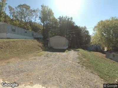
0 Byrant Rd Dunlap, TN 37327
Cagle-Fredonia Neighborhood
--
Bed
--
Bath
--
Sq Ft
122
Acres
About This Home
This home is located at 0 Byrant Rd, Dunlap, TN 37327. 0 Byrant Rd is a home located in Sequatchie County with nearby schools including Griffith Elementary School, Sequatchie County Middle School, and Sequatchie County High School.
Ownership History
Date
Name
Owned For
Owner Type
Purchase Details
Closed on
Jul 8, 2011
Sold by
Dixson George R
Bought by
Daus Mountain Tn
Purchase Details
Closed on
Jan 16, 2004
Sold by
Keith Moss K
Bought by
Dixson George R
Purchase Details
Closed on
Jun 6, 2003
Sold by
Bone Johnnie L
Bought by
Dixson George R and Dixson Ruby D
Purchase Details
Closed on
May 27, 2003
Bought by
Moss K Keith K and Moss Wife
Purchase Details
Closed on
May 26, 2003
Bought by
Moss Keith and Moss Wife
Purchase Details
Closed on
Sep 1, 1999
Sold by
Ballard George W
Bought by
Bone Johnnie L
Purchase Details
Closed on
Nov 21, 1995
Bought by
Asto Tenn Land Co Llc
Purchase Details
Closed on
Nov 20, 1995
Bought by
Asto Tenn Land Co Llc
Purchase Details
Closed on
Nov 6, 1995
Create a Home Valuation Report for This Property
The Home Valuation Report is an in-depth analysis detailing your home's value as well as a comparison with similar homes in the area
Home Values in the Area
Average Home Value in this Area
Purchase History
| Date | Buyer | Sale Price | Title Company |
|---|---|---|---|
| Daus Mountain Tn | -- | -- | |
| Dixson George R | -- | -- | |
| Dixson George R | $230,644 | -- | |
| Moss K Keith K | $230,600 | -- | |
| Moss Keith | $14,600 | -- | |
| Bone Johnnie L | $107,580 | -- | |
| Asto Tenn Land Co Llc | -- | -- | |
| Asto Tenn Land Co Llc | $1,970,300 | -- | |
| -- | $30,900 | -- |
Source: Public Records
Tax History Compared to Growth
Tax History
| Year | Tax Paid | Tax Assessment Tax Assessment Total Assessment is a certain percentage of the fair market value that is determined by local assessors to be the total taxable value of land and additions on the property. | Land | Improvement |
|---|---|---|---|---|
| 2024 | $1,017 | $55,375 | $55,375 | $0 |
| 2023 | $1,017 | $55,375 | $55,375 | $0 |
| 2022 | $916 | $37,525 | $37,525 | $0 |
| 2021 | $916 | $37,525 | $37,525 | $0 |
| 2020 | $916 | $37,525 | $37,525 | $0 |
| 2019 | $916 | $37,525 | $37,525 | $0 |
| 2018 | $916 | $37,525 | $37,525 | $0 |
| 2017 | $916 | $37,525 | $37,525 | $0 |
| 2016 | $757 | $29,475 | $29,475 | $0 |
| 2015 | $757 | $29,475 | $29,475 | $0 |
| 2014 | $757 | $29,475 | $29,475 | $0 |
Source: Public Records
Map
Nearby Homes
- 211 Rock Ave
- 0 Main St Unit RTC2808568
- 0 Main St Unit RTC2796154
- 0 Main St Unit RTC2687452
- 1046 Tatesville Rd
- 196 Hillside Dr
- 1525 Barker Rd
- 65 Deerhead Rd
- 0 Palmer Firetower Rd Unit 20250452
- 2620 Hobbstown Rd
- 121 Heavenly Hills Ln
- 39 Chestnut Oak Dr
- 34 Sr 399
- 0 Roaring Creek Rd Unit 1512039
- 0 Roaring Creek Rd Unit 1512037
- 0 Roaring Creek Rd Unit 1512032
- 0 Roaring Creek Rd Unit 1512031
- 0 Roaring Creek Rd Unit 1503916
- 243 Cullen Savage Rd
- 0 Elk Dr Unit 1508292
