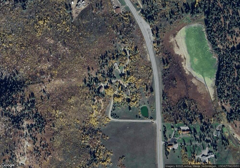
0 Flying Dr S Unit 636854 Durango, CO 81301
Estimated Value: $559,000 - $1,119,000
3
Beds
2
Baths
1,725
Sq Ft
$476/Sq Ft
Est. Value
About This Home
This home is located at 0 Flying Dr S Unit 636854, Durango, CO 81301 and is currently estimated at $821,102, approximately $476 per square foot. 0 Flying Dr S Unit 636854 is a home located in La Plata County with nearby schools including Animas Valley Elementary School, Miller Middle School, and Durango High School.
Ownership History
Date
Name
Owned For
Owner Type
Purchase Details
Closed on
Nov 16, 2012
Sold by
Whittington Wendy Leigh Schroll
Bought by
Murray Darrell J
Current Estimated Value
Home Financials for this Owner
Home Financials are based on the most recent Mortgage that was taken out on this home.
Original Mortgage
$140,000
Interest Rate
3.37%
Mortgage Type
Future Advance Clause Open End Mortgage
Purchase Details
Closed on
May 30, 2012
Sold by
Whittington Wendy Leigh Schroll
Bought by
Murray Darrell J
Home Financials for this Owner
Home Financials are based on the most recent Mortgage that was taken out on this home.
Original Mortgage
$282,000
Interest Rate
3.93%
Mortgage Type
Stand Alone Second
Purchase Details
Closed on
Mar 16, 1993
Bought by
Murray Darrell J
Create a Home Valuation Report for This Property
The Home Valuation Report is an in-depth analysis detailing your home's value as well as a comparison with similar homes in the area
Home Values in the Area
Average Home Value in this Area
Purchase History
| Date | Buyer | Sale Price | Title Company |
|---|---|---|---|
| Murray Darrell J | $175,000 | Colorado Land Title Co Llc | |
| Murray Darrell J | $352,500 | Colorado Land Title Co Llc | |
| Murray Darrell J | $134,500 | -- |
Source: Public Records
Mortgage History
| Date | Status | Borrower | Loan Amount |
|---|---|---|---|
| Closed | Murray Darrell J | $140,000 | |
| Previous Owner | Murray Darrell J | $282,000 |
Source: Public Records
Tax History Compared to Growth
Tax History
| Year | Tax Paid | Tax Assessment Tax Assessment Total Assessment is a certain percentage of the fair market value that is determined by local assessors to be the total taxable value of land and additions on the property. | Land | Improvement |
|---|---|---|---|---|
| 2025 | $1,017 | $26,180 | $13,810 | $12,370 |
| 2024 | $867 | $20,730 | $12,570 | $8,160 |
| 2023 | $867 | $23,560 | $14,330 | $9,230 |
| 2022 | $1,033 | $24,330 | $14,620 | $9,710 |
| 2021 | $1,038 | $25,030 | $15,040 | $9,990 |
| 2020 | $910 | $22,620 | $15,040 | $7,580 |
| 2019 | $872 | $22,620 | $15,040 | $7,580 |
| 2018 | $785 | $20,370 | $12,700 | $7,670 |
| 2017 | $768 | $20,370 | $12,700 | $7,670 |
| 2015 | $373 | $23,540 | $15,220 | $8,320 |
| 2014 | $373 | $21,930 | $15,560 | $6,370 |
| 2013 | -- | $21,930 | $15,560 | $6,370 |
Source: Public Records
Map
Nearby Homes
- 42574 U S 550
- 41563 N Us Hwy 550
- 41563 N U S Hwy 550
- 961 N Tamarron Dr Unit 617
- 961 N Tamarron Dr Unit 555
- 961 N Tamarron Dr Unit 633
- 298 Lakewood Dr
- 163 Peregrine Dr
- 190 Outlaw Dr Unit 3B
- 104 Outlaw Dr Unit 2A
- 516 Glacier Cliff Dr
- 444 Glacier Cliff Dr
- 448 Hermosa View Dr
- 251 Hermosa View Dr
- 490 Glacier Cliff Dr
- 80 Royal Elk Trail
- 175 Spruce Mesa Dr
- 539 Glacier Cliff Dr
- 175 E Spruce Mesa Dr
- 314 N Tamarron Dr Unit 508
- 0 Flying Dr S Unit 3 737046
- 0 Flying Dr S Unit 636855
- 0 Flying Dr S Unit 654894
- 0 Flying Dr S Unit 3 723984
- 0 Flying Dr S Unit 654896
- 0 Flying Dr S Unit 655005
- 311 Flying S Dr
- TBD Hwy 550 N
- 225 Flying S Dr
- 225 Flying Dr S
- 195 Flying S Dr
- 174 Flying S Dr
- 41563 U S 550
- 42570 & 42575 N Highway 550
- 42570 Highway 550
- 42570 Highway 550 Unit E
- 42570 Highway 550 Unit H
- 42570 Highway 550 Unit G
- 42570 Highway 550 Unit F
- 42570 Highway 550
