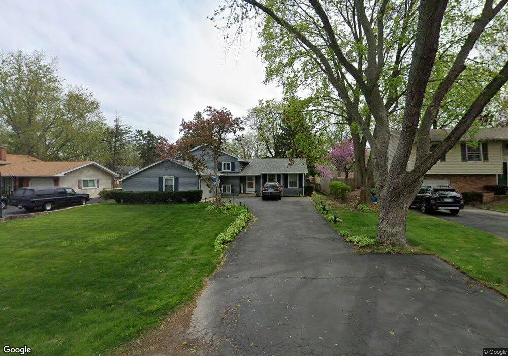
0N265 Peter Rd Winfield, IL 60190
Jewell Road NeighborhoodEstimated Value: $357,000 - $465,000
4
Beds
2
Baths
1,278
Sq Ft
$314/Sq Ft
Est. Value
About This Home
This home is located at 0N265 Peter Rd, Winfield, IL 60190 and is currently estimated at $401,847, approximately $314 per square foot. 0N265 Peter Rd is a home located in DuPage County with nearby schools including Pleasant Hill Elementary School, Monroe Middle School, and Wheaton North High School.
Ownership History
Date
Name
Owned For
Owner Type
Purchase Details
Closed on
Jun 29, 2005
Sold by
Scheffler Daniel C and Scheffler Brigid K
Bought by
Doty Gregory and Doty Jeanne
Current Estimated Value
Home Financials for this Owner
Home Financials are based on the most recent Mortgage that was taken out on this home.
Original Mortgage
$178,800
Outstanding Balance
$93,517
Interest Rate
5.69%
Mortgage Type
Fannie Mae Freddie Mac
Estimated Equity
$308,330
Purchase Details
Closed on
Jan 24, 2003
Sold by
Dever Shirley J and Shirley J Dever Trust
Bought by
Scheffler Daniel C and Scheffler Brigid K
Home Financials for this Owner
Home Financials are based on the most recent Mortgage that was taken out on this home.
Original Mortgage
$165,000
Interest Rate
5.95%
Purchase Details
Closed on
Oct 15, 1998
Sold by
Dever Shirley J
Bought by
Dever Shirley J
Create a Home Valuation Report for This Property
The Home Valuation Report is an in-depth analysis detailing your home's value as well as a comparison with similar homes in the area
Home Values in the Area
Average Home Value in this Area
Purchase History
| Date | Buyer | Sale Price | Title Company |
|---|---|---|---|
| Doty Gregory | $279,000 | -- | |
| Scheffler Daniel C | $247,500 | -- | |
| Dever Shirley J | -- | -- |
Source: Public Records
Mortgage History
| Date | Status | Borrower | Loan Amount |
|---|---|---|---|
| Open | Doty Gregory | $178,800 | |
| Previous Owner | Scheffler Daniel C | $165,000 |
Source: Public Records
Tax History
| Year | Tax Paid | Tax Assessment Tax Assessment Total Assessment is a certain percentage of the fair market value that is determined by local assessors to be the total taxable value of land and additions on the property. | Land | Improvement |
|---|---|---|---|---|
| 2024 | $7,393 | $116,854 | $23,282 | $93,572 |
| 2023 | $7,048 | $107,560 | $21,430 | $86,130 |
| 2022 | $6,875 | $101,650 | $20,250 | $81,400 |
| 2021 | $6,512 | $99,240 | $19,770 | $79,470 |
| 2020 | $6,464 | $98,320 | $19,590 | $78,730 |
| 2019 | $6,331 | $95,720 | $19,070 | $76,650 |
| 2018 | $5,792 | $87,640 | $17,970 | $69,670 |
| 2017 | $5,690 | $84,410 | $17,310 | $67,100 |
| 2016 | $5,642 | $81,040 | $16,620 | $64,420 |
| 2015 | $5,610 | $77,320 | $15,860 | $61,460 |
| 2014 | $6,311 | $84,790 | $15,890 | $68,900 |
| 2013 | $6,102 | $85,050 | $15,940 | $69,110 |
Source: Public Records
Map
Nearby Homes
- n 071 Stanley St
- 0N049 Page St
- 26W548 Prairie Ave
- 26W181 Grand Ave
- 0S064 Calvin Ct
- 27W073 Jewell Rd
- 0N655 Courtney Ln
- 27W266 Oakwood St
- 27W145 Cooley Ave
- 27W180 Cooley Ave
- 1N020 Prairie Path Ln
- 27W225 Ash Ct
- 27W210 Providence Ln Unit 1
- 27W439 Chartwell Dr
- 0S348 East St
- 0N700 Concord Ln
- 107 N Pierce Ave
- 27W300 Melrose Ln
- 0S340 Forest St
- 0N018 Windermere Rd Unit 301
- 0N255 Peter Rd
- 0N273 Peter Rd
- 0N281 Peter Rd
- 0N274 Peter Rd
- 0N245 Peter Rd
- 0N246 Stanley St
- 0N236 Stanley St
- 0N252 Stanley St
- 0N228 Stanley St
- 0N266 Peter Rd
- 0N301 Peter Rd
- 0N282 Peter Rd
- 0N260 Stanley St
- 0N256 Peter Rd
- 0N231 Peter Rd
- 0N304 Peter Rd
- 0N311 Peter Rd
- 26W336 Jewell Rd
- 26W350 Jewell Rd
- 26W304 Stanley St
Your Personal Tour Guide
Ask me questions while you tour the home.