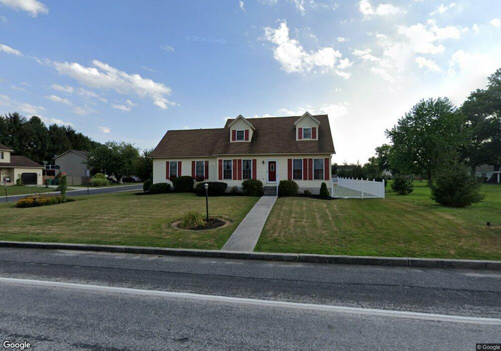
1 Ash Dr Unit 33 Littlestown, PA 17340
Estimated Value: $295,000 - $391,000
3
Beds
2
Baths
1,600
Sq Ft
$211/Sq Ft
Est. Value
About This Home
This home is located at 1 Ash Dr Unit 33, Littlestown, PA 17340 and is currently estimated at $338,244, approximately $211 per square foot. 1 Ash Dr Unit 33 is a home located in Adams County with nearby schools including Rolling Acres El School, Maple Avenue Middle School, and Littlestown Senior High School.
Ownership History
Date
Name
Owned For
Owner Type
Purchase Details
Closed on
Sep 27, 2010
Sold by
Sponseller Jeffrey A and Noel Michele L
Bought by
Sponseller Jeffrey A
Current Estimated Value
Home Financials for this Owner
Home Financials are based on the most recent Mortgage that was taken out on this home.
Original Mortgage
$98,500
Interest Rate
4.37%
Mortgage Type
New Conventional
Create a Home Valuation Report for This Property
The Home Valuation Report is an in-depth analysis detailing your home's value as well as a comparison with similar homes in the area
Home Values in the Area
Average Home Value in this Area
Purchase History
| Date | Buyer | Sale Price | Title Company |
|---|---|---|---|
| Sponseller Jeffrey A | -- | -- |
Source: Public Records
Mortgage History
| Date | Status | Borrower | Loan Amount |
|---|---|---|---|
| Closed | Sponseller Jeffrey A | $98,500 |
Source: Public Records
Tax History Compared to Growth
Tax History
| Year | Tax Paid | Tax Assessment Tax Assessment Total Assessment is a certain percentage of the fair market value that is determined by local assessors to be the total taxable value of land and additions on the property. | Land | Improvement |
|---|---|---|---|---|
| 2025 | $5,133 | $208,600 | $26,700 | $181,900 |
| 2024 | $4,279 | $208,600 | $26,700 | $181,900 |
| 2023 | $4,152 | $208,600 | $26,700 | $181,900 |
| 2022 | $4,021 | $208,600 | $26,700 | $181,900 |
| 2021 | $3,890 | $208,600 | $26,700 | $181,900 |
| 2020 | $4,080 | $208,600 | $26,700 | $181,900 |
| 2019 | $4,339 | $208,600 | $26,700 | $181,900 |
| 2018 | $3,689 | $208,600 | $26,700 | $181,900 |
| 2017 | $3,586 | $208,600 | $26,700 | $181,900 |
| 2016 | -- | $208,600 | $26,700 | $181,900 |
| 2015 | -- | $208,600 | $26,700 | $181,900 |
| 2014 | -- | $208,600 | $26,700 | $181,900 |
Source: Public Records
Map
Nearby Homes
- 67 Cedarfield Dr
- 28 Bonniefield Cir Unit 25
- 138 Cedarfield Dr Unit 71
- 1 Hickory Ave
- 27 Maple St
- 8 Maple St
- 48 Cannon Ln Unit 105
- 13 N Pine St
- 25 Harvest Dr
- 780 White Hall Rd
- 860 Bon Ox Rd
- 464 Locust Ln
- 549 Grant Dr Unit 549
- 3801 Baltimore Pike
- 871 Sherman Dr Unit 871
- 2746 Baltimore Pike
- 948 Heritage Dr Unit 948
- 0 Littlestown Rd
- 4900 Hanover Rd
- 70 Sells Station Rd
- 3 Ash Dr Unit 32
- 2 Ash Dr Unit 34
- 1 S Bonniefield Dr Unit 70
- 4 Ash Dr Unit 35
- 5 Ash Dr
- 2 S Bonniefield Dr Unit 65
- 6 Ash Dr Unit 36
- 84 Maple St
- 46 Bonniefield Cir Unit 71
- 44 Bonniefield Cir Unit 72
- 7 Ash Dr Unit 30
- 8 Ash Dr Unit 37
- 4 S Bonniefield Dr Unit 64
- 8 Cedarfield Dr Unit 100
- 42 Bonniefield Cir Unit 73
- 10 Cedarfield Dr Unit 99
- Cedarfield Dr
- Cedarfield Dr
- Cedarfield Dr
- 10 Ash Dr Unit 38