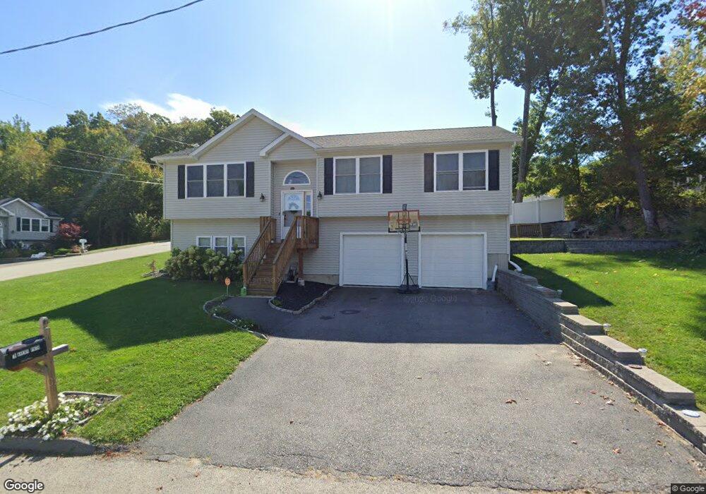
1 Avery Path Worcester, MA 01603
Webster Square NeighborhoodEstimated Value: $513,234 - $584,000
3
Beds
2
Baths
1,334
Sq Ft
$411/Sq Ft
Est. Value
About This Home
This home is located at 1 Avery Path, Worcester, MA 01603 and is currently estimated at $547,809, approximately $410 per square foot. 1 Avery Path is a home with nearby schools including Gates Lane, Jacob Hiatt Magnet School, and Chandler Magnet.
Ownership History
Date
Name
Owned For
Owner Type
Purchase Details
Closed on
Aug 27, 2020
Sold by
Hackenson Eric M
Bought by
Hackenson Eric M and Hackenson Bethany L
Current Estimated Value
Home Financials for this Owner
Home Financials are based on the most recent Mortgage that was taken out on this home.
Original Mortgage
$214,500
Outstanding Balance
$148,650
Interest Rate
2.9%
Mortgage Type
New Conventional
Estimated Equity
$399,159
Purchase Details
Closed on
May 30, 2013
Sold by
Avery Inv Props Llc
Bought by
Hackenson Eric M
Home Financials for this Owner
Home Financials are based on the most recent Mortgage that was taken out on this home.
Original Mortgage
$241,300
Interest Rate
3.45%
Mortgage Type
New Conventional
Purchase Details
Closed on
Aug 12, 2005
Sold by
Bruinsma Karen L and Stone Karen L
Bought by
Avery Invest Prop Llc
Create a Home Valuation Report for This Property
The Home Valuation Report is an in-depth analysis detailing your home's value as well as a comparison with similar homes in the area
Home Values in the Area
Average Home Value in this Area
Purchase History
| Date | Buyer | Sale Price | Title Company |
|---|---|---|---|
| Hackenson Eric M | -- | None Available | |
| Hackenson Eric M | $254,000 | -- | |
| Avery Invest Prop Llc | $235,000 | -- | |
| Avery Invest Prop Llc | $235,000 | -- |
Source: Public Records
Mortgage History
| Date | Status | Borrower | Loan Amount |
|---|---|---|---|
| Open | Hackenson Eric M | $214,500 | |
| Previous Owner | Hackenson Eric M | $241,300 | |
| Previous Owner | Avery Invest Prop Llc | $40,000 |
Source: Public Records
Tax History
| Year | Tax Paid | Tax Assessment Tax Assessment Total Assessment is a certain percentage of the fair market value that is determined by local assessors to be the total taxable value of land and additions on the property. | Land | Improvement |
|---|---|---|---|---|
| 2025 | $6,286 | $476,600 | $97,600 | $379,000 |
| 2024 | $6,075 | $441,800 | $97,600 | $344,200 |
| 2023 | $6,018 | $419,700 | $84,800 | $334,900 |
| 2022 | $5,226 | $343,600 | $67,900 | $275,700 |
| 2021 | $5,304 | $325,800 | $54,300 | $271,500 |
| 2020 | $5,015 | $295,000 | $53,900 | $241,100 |
| 2019 | $4,876 | $270,900 | $47,000 | $223,900 |
| 2018 | $4,886 | $258,400 | $47,000 | $211,400 |
| 2017 | $4,649 | $241,900 | $47,000 | $194,900 |
| 2016 | $4,751 | $230,500 | $33,200 | $197,300 |
| 2015 | $4,626 | $230,500 | $33,200 | $197,300 |
| 2014 | $4,504 | $230,500 | $33,200 | $197,300 |
Source: Public Records
Map
Nearby Homes
- 57 1st St
- 25 Wyola Dr
- 31 B Gates Rd Unit 22R
- 34 Scandinavia Ave
- 128 Wildwood Ave
- 5 Swan Ave
- 34 Rosslare Dr Unit 108
- 22 Outlook Dr
- 23B Timrod Dr
- 11 Timrod Dr
- 26 Sylvan St
- 6 Ludington Rd
- 76 Parsons Hill Dr Unit A
- 2 Montague St
- 23 Lakewood St
- 32 Goddard Memorial Dr
- 114 Lovell St
- 415 Mill St
- 13 Merchant St
- 55 Grandview Ave
Your Personal Tour Guide
Ask me questions while you tour the home.