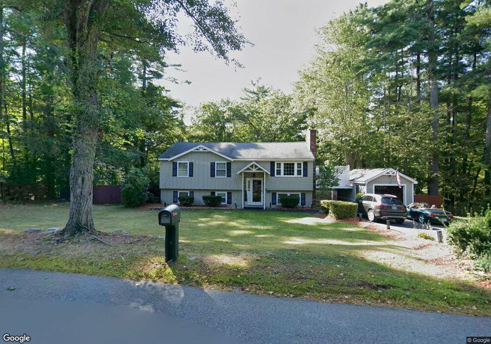
1 Bancroft St Pepperell, MA 01463
Estimated Value: $470,000 - $544,000
3
Beds
1
Bath
1,268
Sq Ft
$409/Sq Ft
Est. Value
About This Home
This home is located at 1 Bancroft St, Pepperell, MA 01463 and is currently estimated at $518,990, approximately $409 per square foot. 1 Bancroft St is a home located in Middlesex County with nearby schools including North Middlesex Regional High School, Pepperell Christian Academy, and Maple Dene & Moppet School.
Ownership History
Date
Name
Owned For
Owner Type
Purchase Details
Closed on
Mar 20, 2000
Sold by
Fallon Madeline V
Bought by
Maskalenko Thomas P and Maskalenko Kristin M
Current Estimated Value
Purchase Details
Closed on
Jan 19, 1990
Sold by
Frank Eugene S
Bought by
Fallon Madeline
Create a Home Valuation Report for This Property
The Home Valuation Report is an in-depth analysis detailing your home's value as well as a comparison with similar homes in the area
Home Values in the Area
Average Home Value in this Area
Purchase History
| Date | Buyer | Sale Price | Title Company |
|---|---|---|---|
| Maskalenko Thomas P | $156,500 | -- | |
| Fallon Madeline | $136,000 | -- |
Source: Public Records
Mortgage History
| Date | Status | Borrower | Loan Amount |
|---|---|---|---|
| Open | Fallon Madeline | $70,000 |
Source: Public Records
Tax History
| Year | Tax Paid | Tax Assessment Tax Assessment Total Assessment is a certain percentage of the fair market value that is determined by local assessors to be the total taxable value of land and additions on the property. | Land | Improvement |
|---|---|---|---|---|
| 2025 | $6,642 | $454,000 | $196,900 | $257,100 |
| 2024 | $6,056 | $422,000 | $180,900 | $241,100 |
| 2023 | $5,844 | $386,000 | $152,900 | $233,100 |
| 2022 | $5,479 | $319,500 | $128,700 | $190,800 |
| 2021 | $5,374 | $299,900 | $112,700 | $187,200 |
| 2020 | $5,092 | $299,900 | $112,700 | $187,200 |
| 2019 | $4,771 | $287,600 | $112,700 | $174,900 |
| 2018 | $4,404 | $268,700 | $112,700 | $156,000 |
| 2017 | $3,806 | $239,500 | $104,700 | $134,800 |
| 2016 | $3,656 | $221,200 | $104,700 | $116,500 |
| 2015 | $3,528 | $221,200 | $104,700 | $116,500 |
| 2014 | $3,423 | $215,800 | $104,700 | $111,100 |
Source: Public Records
Map
Nearby Homes
- 120 Townsend St Unit 1
- 120 Townsend St Unit 2
- 96 Townsend St
- 90 Townsend St
- 39 Mount Lebanon St
- 2 Blueberry Hill Rd
- 21 Magnolia Ln
- 143 Heald St
- 18 Maple St Unit 14
- 13 Birch Dr
- 53 Throne Hill Rd
- 142 River Rd
- 2 Everett Dr
- 38 River Rd Unit 11
- 69 Main St Unit 71
- 26 Bluebird Ln
- 11 Maplewood Dr
- 44 Nod Rd
- 18 Beech St
- 113-115 Main St
- 2 Bancroft St
- 3 Bancroft St
- 6 Bancroft St
- 142 Townsend St
- 5 Bancroft St
- 131 Townsend St
- 8 Bancroft St
- 133 Townsend St
- 129 Townsend St
- 7 Bancroft St
- 135 Townsend St
- 140 Townsend St
- 150 Townsend St
- 127 Townsend St
- 138 Townsend St
- 137 Townsend St
- 125 Townsend St
- 121 Townsend St
- 9 Bancroft St
- 139 Townsend St
Your Personal Tour Guide
Ask me questions while you tour the home.