1 Brooks Rd Mauldin, SC 29662
Estimated Value: $299,158 - $315,000
3
Beds
2
Baths
2,176
Sq Ft
$140/Sq Ft
Est. Value
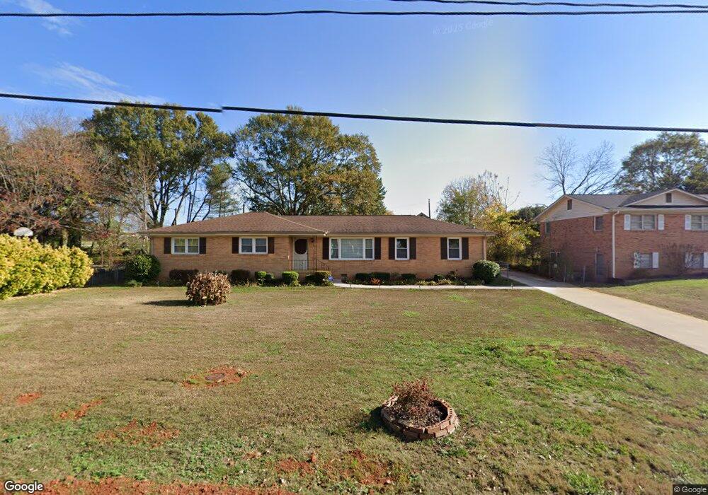
About This Home
This home is located at 1 Brooks Rd, Mauldin, SC 29662 and is currently estimated at $305,290, approximately $140 per square foot. 1 Brooks Rd is a home located in Greenville County with nearby schools including Greenbrier Elementary School, Hillcrest Middle School, and Mauldin High School.
Ownership History
Date
Name
Owned For
Owner Type
Purchase Details
Closed on
Oct 31, 2023
Sold by
Whiteside Aliza
Bought by
Whiteside Aliza and Thompson Carol D
Current Estimated Value
Purchase Details
Closed on
Feb 28, 2022
Sold by
Thompson Willie C
Bought by
Whiteside Aliza
Home Financials for this Owner
Home Financials are based on the most recent Mortgage that was taken out on this home.
Original Mortgage
$176,000
Interest Rate
3.69%
Mortgage Type
New Conventional
Create a Home Valuation Report for This Property
The Home Valuation Report is an in-depth analysis detailing your home's value as well as a comparison with similar homes in the area
Home Values in the Area
Average Home Value in this Area
Purchase History
| Date | Buyer | Sale Price | Title Company |
|---|---|---|---|
| Whiteside Aliza | -- | None Listed On Document | |
| Whiteside Aliza | $220,000 | None Listed On Document |
Source: Public Records
Mortgage History
| Date | Status | Borrower | Loan Amount |
|---|---|---|---|
| Previous Owner | Whiteside Aliza | $176,000 |
Source: Public Records
Tax History
| Year | Tax Paid | Tax Assessment Tax Assessment Total Assessment is a certain percentage of the fair market value that is determined by local assessors to be the total taxable value of land and additions on the property. | Land | Improvement |
|---|---|---|---|---|
| 2025 | $1,426 | $9,610 | $1,620 | $7,990 |
| 2024 | $1,426 | $8,360 | $1,400 | $6,960 |
| 2023 | $1,344 | $12,530 | $2,100 | $10,430 |
| 2022 | $728 | $6,170 | $700 | $5,470 |
| 2021 | $729 | $6,170 | $700 | $5,470 |
| 2020 | $639 | $5,400 | $700 | $4,700 |
| 2019 | $640 | $5,400 | $700 | $4,700 |
| 2018 | $638 | $5,400 | $700 | $4,700 |
| 2017 | $638 | $5,400 | $700 | $4,700 |
| 2016 | $950 | $135,100 | $17,500 | $117,600 |
| 2015 | $950 | $135,100 | $17,500 | $117,600 |
| 2014 | $1,070 | $153,380 | $20,500 | $132,880 |
Source: Public Records
Map
Nearby Homes
- 427 Circle Dr
- 8 Chelseabrook Ct
- 501 Wynstone Place
- 113 Carlton Dr
- 104 Baldwin Cir
- 0 Greenbriar Dr
- 311 Birchwood Ln
- 116 Canyon Ct
- 30 Kennebec Ln
- 116 Baldwin Cir
- 712 Brooks Rd
- 207 Nantallah Trail
- 222 Horse Tack Trail
- 206 Boothbay Ct
- 530 Huntingdale Place
- 103 Ridan Rd
- 242 Santorini Way
- 254 Santorini Way
- 104 Fawn Ridge Way
- 105 Poplar Springs Dr
Your Personal Tour Guide
Ask me questions while you tour the home.