Estimated Value: $562,000 - $651,000
4
Beds
2
Baths
2,025
Sq Ft
$300/Sq Ft
Est. Value
About This Home
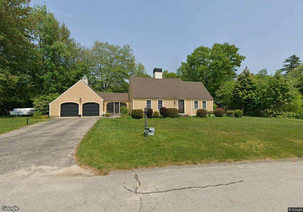
This home is located at 1 Concord Way, Dover, NH 03820 and is currently estimated at $606,571, approximately $299 per square foot. 1 Concord Way is a home located in Strafford County with nearby schools including Woodman Park School, Dover Middle School, and Dover Senior High School.
Ownership History
Date
Name
Owned For
Owner Type
Purchase Details
Closed on
May 28, 2004
Sold by
Momm Edward W
Bought by
Hanson Matthew A and Hanson Kimberly A
Current Estimated Value
Home Financials for this Owner
Home Financials are based on the most recent Mortgage that was taken out on this home.
Original Mortgage
$270,000
Interest Rate
5.88%
Mortgage Type
Purchase Money Mortgage
Purchase Details
Closed on
Aug 21, 2000
Sold by
Morrissette Daniel E and Morrissette Lauren A
Bought by
Momm Edward W
Home Financials for this Owner
Home Financials are based on the most recent Mortgage that was taken out on this home.
Original Mortgage
$178,000
Interest Rate
8.13%
Mortgage Type
Purchase Money Mortgage
Purchase Details
Closed on
May 31, 1996
Sold by
Pimpis Frank E and Pimpis Beverly D
Bought by
Morrissette Daniel E and Morrissette Lauren A
Create a Home Valuation Report for This Property
The Home Valuation Report is an in-depth analysis detailing your home's value as well as a comparison with similar homes in the area
Home Values in the Area
Average Home Value in this Area
Purchase History
| Date | Buyer | Sale Price | Title Company |
|---|---|---|---|
| Hanson Matthew A | $337,500 | -- | |
| Momm Edward W | $222,500 | -- | |
| Morrissette Daniel E | $140,000 | -- |
Source: Public Records
Mortgage History
| Date | Status | Borrower | Loan Amount |
|---|---|---|---|
| Open | Morrissette Daniel E | $253,700 | |
| Closed | Morrissette Daniel E | $53,000 | |
| Closed | Morrissette Daniel E | $270,000 | |
| Previous Owner | Morrissette Daniel E | $178,000 |
Source: Public Records
Tax History Compared to Growth
Tax History
| Year | Tax Paid | Tax Assessment Tax Assessment Total Assessment is a certain percentage of the fair market value that is determined by local assessors to be the total taxable value of land and additions on the property. | Land | Improvement |
|---|---|---|---|---|
| 2024 | $10,259 | $564,600 | $156,600 | $408,000 |
| 2023 | $9,788 | $523,400 | $165,300 | $358,100 |
| 2022 | $9,511 | $479,400 | $156,600 | $322,800 |
| 2021 | $9,090 | $418,900 | $130,500 | $288,400 |
| 2020 | $8,794 | $353,900 | $117,500 | $236,400 |
| 2019 | $8,796 | $349,200 | $117,500 | $231,700 |
| 2018 | $8,538 | $342,600 | $117,500 | $225,100 |
| 2017 | $8,128 | $314,200 | $95,700 | $218,500 |
| 2016 | $7,267 | $276,400 | $85,100 | $191,300 |
| 2015 | $7,230 | $271,700 | $85,100 | $186,600 |
| 2014 | $7,067 | $271,700 | $85,100 | $186,600 |
| 2011 | $6,054 | $241,000 | $68,800 | $172,200 |
Source: Public Records
Map
Nearby Homes
- 134 Emerald Ln
- 7 Fancy Hill
- 5 Prospect St
- 5 Cedarbrook Dr
- 80 Glenwood Ave
- 5 Charlotte Dr
- 12 Zeland Dr
- 0 4th St Unit 2
- 98 Silver St
- 63 Sixth St
- 54 Cielo Dr
- 73 Rutland St
- 0 Nute Rd Unit 19B 5060365
- 0 Indian Brook Rd Unit C
- 0 Hemlock Rd Unit 5059998
- 26 Lenox Dr Unit D
- 23 Lenox Dr Unit A
- 32 Lenox Dr Unit D
- 29 Lenox Dr Unit B
- 16 Lenox Dr Unit C
- 15 Westwood Cir
- 11 Westwood Cir
- 6 Westwood Cir
- 9 Westwood Cir
- 3 Concord Way
- 10 Westwood Cir
- 17 Westwood Cir
- 6 Concord Way
- 4 Westwood Cir
- 7 Westwood Cir
- 12 Westwood Cir
- 4 Concord Way
- 5 Concord Way
- 14 Westwood Cir
- 2 Westwood Cir
- 5 Westwood Cir
- 21 Westwood Cir
- 7 Concord Way
- 16 Westwood Cir
- 23 Westwood Cir