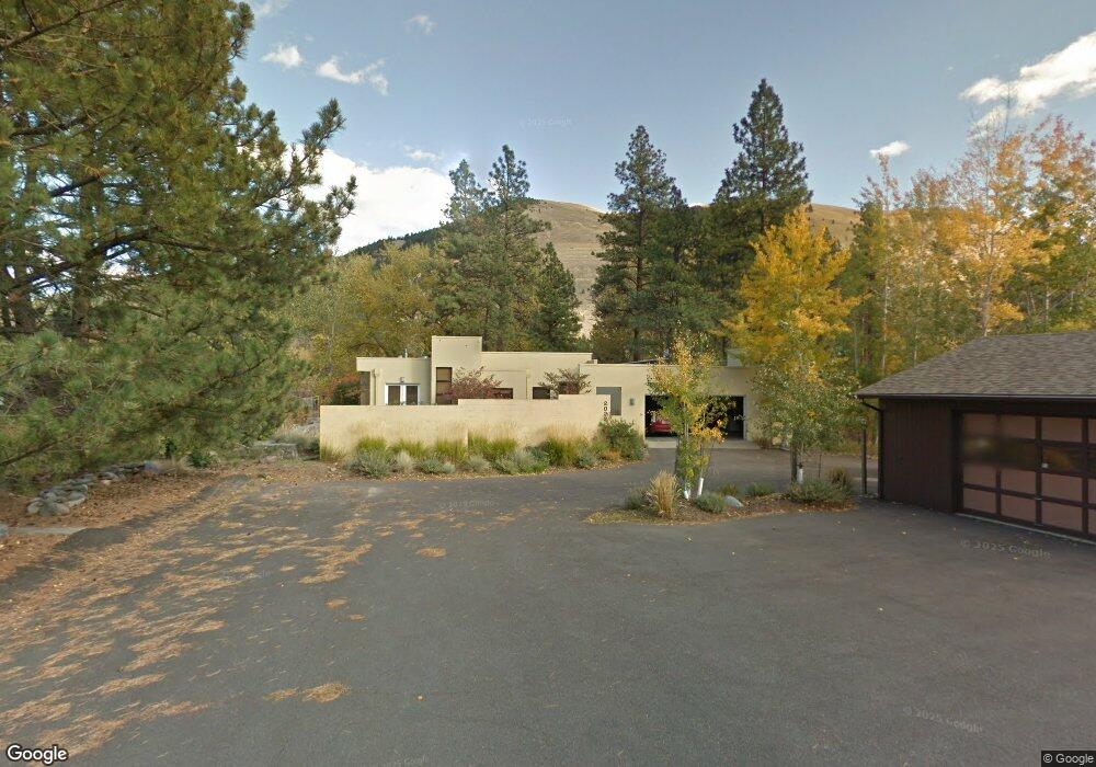
1 Dunn Ln Missoula, MT 59802
Lower Rattlesnake NeighborhoodEstimated Value: $679,000 - $866,000
3
Beds
1
Bath
497
Sq Ft
$1,555/Sq Ft
Est. Value
About This Home
This home is located at 1 Dunn Ln, Missoula, MT 59802 and is currently estimated at $772,922, approximately $1,555 per square foot. 1 Dunn Ln is a home located in Missoula County with nearby schools including Rattlesnake Elementary School, Washington Middle School, and Hellgate High School.
Ownership History
Date
Name
Owned For
Owner Type
Purchase Details
Closed on
Jun 12, 2018
Sold by
The Nancy H Brown Revocable Trust
Bought by
Flore Michael and The Nancy H Brown Family Trust
Current Estimated Value
Purchase Details
Closed on
Feb 2, 2012
Sold by
Brown Nancy H
Bought by
The Nancy H Brown Revocable Trust
Purchase Details
Closed on
Apr 12, 2007
Sold by
Craig Willa J and Risi George F
Bought by
Brown Nancy H
Home Financials for this Owner
Home Financials are based on the most recent Mortgage that was taken out on this home.
Original Mortgage
$320,000
Interest Rate
6.25%
Mortgage Type
Unknown
Purchase Details
Closed on
Sep 29, 2006
Sold by
Buness David J and Buness Fay M
Bought by
Risi George F and Craig Willa J
Home Financials for this Owner
Home Financials are based on the most recent Mortgage that was taken out on this home.
Original Mortgage
$502,923
Interest Rate
6.53%
Mortgage Type
Purchase Money Mortgage
Create a Home Valuation Report for This Property
The Home Valuation Report is an in-depth analysis detailing your home's value as well as a comparison with similar homes in the area
Home Values in the Area
Average Home Value in this Area
Purchase History
| Date | Buyer | Sale Price | Title Company |
|---|---|---|---|
| Flore Michael | -- | None Available | |
| The Nancy H Brown Revocable Trust | -- | None Available | |
| Brown Nancy H | -- | It | |
| Risi George F | -- | First American Title Co |
Source: Public Records
Mortgage History
| Date | Status | Borrower | Loan Amount |
|---|---|---|---|
| Previous Owner | Brown Nancy H | $320,000 | |
| Previous Owner | Risi George F | $502,923 |
Source: Public Records
Tax History Compared to Growth
Tax History
| Year | Tax Paid | Tax Assessment Tax Assessment Total Assessment is a certain percentage of the fair market value that is determined by local assessors to be the total taxable value of land and additions on the property. | Land | Improvement |
|---|---|---|---|---|
| 2025 | $7,306 | $904,800 | $627,933 | $276,867 |
| 2024 | $6,975 | $573,200 | $375,610 | $197,590 |
| 2023 | $6,759 | $573,200 | $375,610 | $197,590 |
| 2022 | $7,611 | $560,500 | $382,925 | $177,575 |
| 2021 | $6,808 | $560,500 | $0 | $0 |
| 2020 | $6,537 | $497,000 | $0 | $0 |
| 2019 | $6,515 | $497,000 | $0 | $0 |
| 2018 | $6,455 | $478,799 | $0 | $0 |
| 2017 | $6,347 | $478,799 | $0 | $0 |
| 2016 | $4,833 | $380,013 | $0 | $0 |
| 2015 | $4,473 | $380,013 | $0 | $0 |
| 2014 | $3,865 | $184,651 | $0 | $0 |
Source: Public Records
Map
Nearby Homes
- 2201 Greenough Ct W
- 2215 Raymond Ave
- 1811 Elison Ln
- 1227 Basecamp Dr Unit A
- 1250 Basecamp Dr Unit C
- 1250 Basecamp Dr Unit F
- 2411 Raymond Ave
- 1132 Jackson St
- 2606 Sycamore St
- 521 Arbor Dr
- 838 Locust St
- 1300 Dickinson St
- 1015 Poplar St
- 1116 Vine St
- 1110 Vine St
- 111 N 2nd St W
- 416 E Pine St
- 1306 Lily Ct
- 1025 Grand Ave Unit 4
- 632 N 5th St W Unit C
- 531 Evan Kelly Rd
- 2022 Greenough Dr W
- 2024 Greenough Dr W
- 1950 Alvina Dr
- 529 Evan Kelly Rd
- 1960 Alvina Dr
- 1970 Alvina Dr
- 535 Evan Kelly Rd
- 2012 Greenough Dr W
- 16 Charis Ln
- 532 Evan Kelly Rd
- 17 Charis Ln
- 524 Evan Kelly Rd
- 1920 Alvina Dr
- 600 City Dr
- 600 City Dr
- 1 Charis Ln
- 2020 W Greenough Dr
- 501 Evan Kelly Rd
- 15 Charis Ln