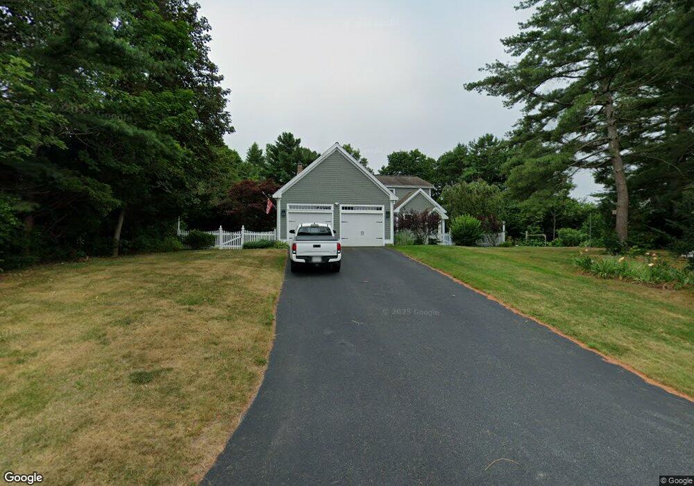
1 Elgin Rd Pocasset, MA 02559
Pocasset NeighborhoodEstimated Value: $1,021,050 - $1,159,000
3
Beds
3
Baths
2,142
Sq Ft
$507/Sq Ft
Est. Value
About This Home
This home is located at 1 Elgin Rd, Pocasset, MA 02559 and is currently estimated at $1,085,263, approximately $506 per square foot. 1 Elgin Rd is a home located in Barnstable County with nearby schools including Bourne High School, Cadence Academy Preschool - Bourne, and Heritage Christian Academy.
Ownership History
Date
Name
Owned For
Owner Type
Purchase Details
Closed on
Apr 2, 2018
Sold by
Priestley Robert R and Priestley Dorothy J
Bought by
Priestley Ft and Priestley
Current Estimated Value
Purchase Details
Closed on
Jul 15, 2005
Sold by
Cork Carl L and Cork Diane T
Bought by
Priestley Dorothy J and Priestley Robert R
Home Financials for this Owner
Home Financials are based on the most recent Mortgage that was taken out on this home.
Original Mortgage
$350,000
Interest Rate
5.67%
Mortgage Type
Purchase Money Mortgage
Purchase Details
Closed on
Mar 1, 2001
Sold by
Good Bldrs Inc
Bought by
Cork Carl L and Cork Diane T
Create a Home Valuation Report for This Property
The Home Valuation Report is an in-depth analysis detailing your home's value as well as a comparison with similar homes in the area
Home Values in the Area
Average Home Value in this Area
Purchase History
| Date | Buyer | Sale Price | Title Company |
|---|---|---|---|
| Priestley Ft | -- | -- | |
| Priestley Ft | -- | -- | |
| Priestley Dorothy J | $740,000 | -- | |
| Priestley Dorothy J | $740,000 | -- | |
| Cork Carl L | $419,500 | -- | |
| Good Bldrs Inc | $95,400 | -- | |
| Good Bldrs Inc | $95,400 | -- |
Source: Public Records
Mortgage History
| Date | Status | Borrower | Loan Amount |
|---|---|---|---|
| Previous Owner | Good Bldrs Inc | $322,523 | |
| Previous Owner | Priestley Dorothy J | $350,000 | |
| Previous Owner | Good Bldrs Inc | $50,000 |
Source: Public Records
Tax History Compared to Growth
Tax History
| Year | Tax Paid | Tax Assessment Tax Assessment Total Assessment is a certain percentage of the fair market value that is determined by local assessors to be the total taxable value of land and additions on the property. | Land | Improvement |
|---|---|---|---|---|
| 2025 | $7,811 | $1,000,100 | $500,000 | $500,100 |
| 2024 | $7,898 | $984,800 | $476,200 | $508,600 |
| 2023 | $7,050 | $800,200 | $344,800 | $455,400 |
| 2022 | $7,026 | $696,300 | $330,600 | $365,700 |
| 2021 | $6,825 | $633,700 | $300,800 | $332,900 |
| 2020 | $6,660 | $620,100 | $298,000 | $322,100 |
| 2019 | $6,363 | $605,400 | $298,000 | $307,400 |
| 2018 | $6,044 | $573,400 | $283,800 | $289,600 |
| 2017 | $5,915 | $574,300 | $281,100 | $293,200 |
| 2016 | $5,758 | $566,700 | $281,100 | $285,600 |
| 2015 | $5,707 | $566,700 | $281,100 | $285,600 |
Source: Public Records
Map
Nearby Homes
- 22 Nairn Rd
- 48 Red Brook Harbor Rd
- 3 Red Brook Pond Dr
- 1094 County Rd
- 171 Bellavista Dr
- 940 County Rd
- 254 Barlows Landing Rd
- 34 Kenwood Rd
- 45 Kenwood Rd
- 940 County Rd
- 709 County Rd
- 70 Wings Neck Rd
- 7 4th Ave
- 1234 Route 28a
- 174 Barlows Landing Rd
- 1234 Route 28a
- 15 1st St
- 24 Richmond Rd
- 10 Squeteague Harbor Rd
- 75 Winsor Rd
- 1035 Shore Rd
- 1044 Shore Rd
- 9 Cedar Point Dr
- 5 Cedar Point Dr
- 15 Cedar Point Dr
- 1043 Shore Rd
- 178-180 Scraggy Neck Rd
- 1121 County Rd
- 1029 Shore Rd
- 1027 Shore Rd
- 19 Cedar Point Dr
- 32 Elgin Rd
- 5 Elgin Rd
- 1025 Shore Rd
- 10 Cedar Point Dr
- 6 Cedar Point Dr
- 14 Cedar Point Dr
- 1051 Shore Rd
- 4 Nairn Rd
- 20 Cedar Point Dr