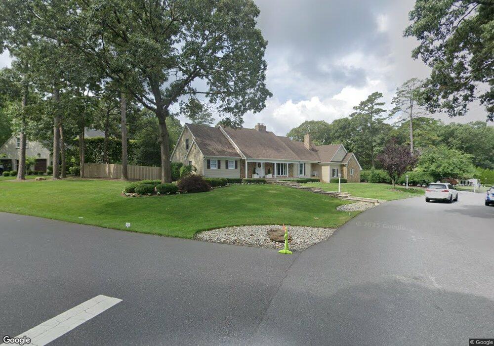
1 Fischer Rd Linwood, NJ 08221
Estimated Value: $735,888 - $895,000
--
Bed
--
Bath
3,599
Sq Ft
$229/Sq Ft
Est. Value
About This Home
This home is located at 1 Fischer Rd, Linwood, NJ 08221 and is currently estimated at $824,629, approximately $229 per square foot. 1 Fischer Rd is a home located in Atlantic County with nearby schools including Seaview Elementary School, Belhaven Middle School, and Mainland Regional High School.
Ownership History
Date
Name
Owned For
Owner Type
Purchase Details
Closed on
Jun 24, 2020
Sold by
Janansky Edward G
Bought by
Janansky Edward G and Janansky Marcee H
Current Estimated Value
Home Financials for this Owner
Home Financials are based on the most recent Mortgage that was taken out on this home.
Original Mortgage
$333,000
Interest Rate
3.1%
Mortgage Type
New Conventional
Create a Home Valuation Report for This Property
The Home Valuation Report is an in-depth analysis detailing your home's value as well as a comparison with similar homes in the area
Home Values in the Area
Average Home Value in this Area
Purchase History
| Date | Buyer | Sale Price | Title Company |
|---|---|---|---|
| Janansky Edward G | -- | Surety Title Company |
Source: Public Records
Mortgage History
| Date | Status | Borrower | Loan Amount |
|---|---|---|---|
| Closed | Janansky Edward G | $333,000 |
Source: Public Records
Tax History Compared to Growth
Tax History
| Year | Tax Paid | Tax Assessment Tax Assessment Total Assessment is a certain percentage of the fair market value that is determined by local assessors to be the total taxable value of land and additions on the property. | Land | Improvement |
|---|---|---|---|---|
| 2025 | $17,934 | $470,100 | $150,000 | $320,100 |
| 2024 | $17,934 | $470,100 | $150,000 | $320,100 |
| 2023 | $17,102 | $470,100 | $150,000 | $320,100 |
| 2022 | $17,102 | $470,100 | $150,000 | $320,100 |
| 2021 | $16,952 | $470,100 | $150,000 | $320,100 |
| 2020 | $19,889 | $559,300 | $239,200 | $320,100 |
| 2019 | $19,464 | $559,300 | $239,200 | $320,100 |
| 2018 | $19,027 | $559,300 | $239,200 | $320,100 |
| 2017 | $17,684 | $530,400 | $239,200 | $291,200 |
| 2016 | $17,089 | $530,400 | $239,200 | $291,200 |
| 2015 | $17,105 | $530,400 | $239,200 | $291,200 |
| 2014 | $16,514 | $532,700 | $239,200 | $293,500 |
Source: Public Records
Map
Nearby Homes
- 1 Mill Ln
- 5 Mill Ln
- 12 Fischer Rd
- 2221 Burroughs Ave
- 14 Wexford Ln
- 608 Revere Ave
- 622 Central Ave
- 2 Lake Dr
- 550 Central Ave Unit M3
- 550 Central Ave Unit B1
- 550 Central Ave Unit 4
- 550 Central Ave Unit G-16 Constitution Ct
- 550 Central Ave Unit E-14
- 550 Central Ave Unit I-7
- 550 G-16 Central Ave
- 11 Dani Dr
- 1119 Nugent Terrace
- Temple Drive
- 413 W Oakcrest Ave
- 2 Sandy Ct