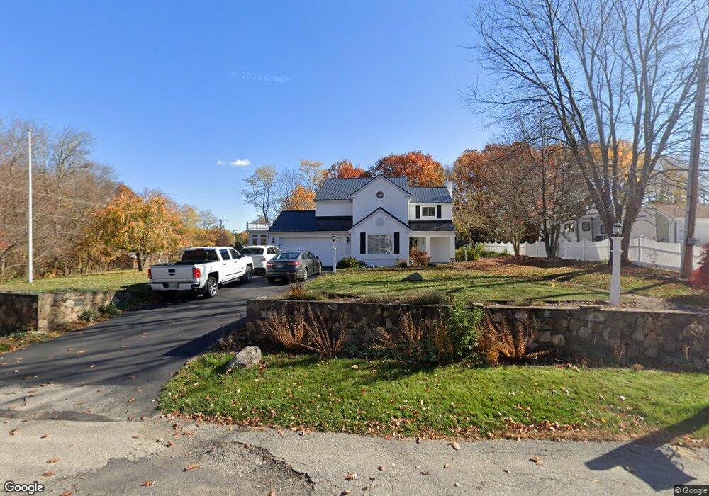
1 Francis Dr Seabrook, NH 03874
Estimated Value: $665,000 - $750,018
3
Beds
3
Baths
2,245
Sq Ft
$321/Sq Ft
Est. Value
About This Home
This home is located at 1 Francis Dr, Seabrook, NH 03874 and is currently estimated at $720,005, approximately $320 per square foot. 1 Francis Dr is a home located in Rockingham County with nearby schools including Seabrook Elementary School, Seabrook Middle School, and Winnacunnet High School.
Ownership History
Date
Name
Owned For
Owner Type
Purchase Details
Closed on
Dec 24, 2024
Sold by
Small Bruce J
Bought by
Bruce J Small Ret and Small
Current Estimated Value
Purchase Details
Closed on
Oct 31, 1995
Bought by
Small Bruce and Small Beverly
Create a Home Valuation Report for This Property
The Home Valuation Report is an in-depth analysis detailing your home's value as well as a comparison with similar homes in the area
Home Values in the Area
Average Home Value in this Area
Purchase History
| Date | Buyer | Sale Price | Title Company |
|---|---|---|---|
| Bruce J Small Ret | -- | None Available | |
| Bruce J Small Ret | -- | None Available | |
| Small Bruce | $47,000 | -- |
Source: Public Records
Mortgage History
| Date | Status | Borrower | Loan Amount |
|---|---|---|---|
| Previous Owner | Small Bruce | $135,000 | |
| Previous Owner | Small Bruce | $364,000 |
Source: Public Records
Tax History Compared to Growth
Tax History
| Year | Tax Paid | Tax Assessment Tax Assessment Total Assessment is a certain percentage of the fair market value that is determined by local assessors to be the total taxable value of land and additions on the property. | Land | Improvement |
|---|---|---|---|---|
| 2024 | $8,467 | $722,400 | $257,200 | $465,200 |
| 2023 | $8,464 | $560,900 | $219,900 | $341,000 |
| 2022 | $7,590 | $572,800 | $219,900 | $352,900 |
| 2021 | $7,579 | $552,000 | $199,100 | $352,900 |
| 2020 | $6,600 | $413,300 | $158,700 | $254,600 |
| 2019 | $6,495 | $412,400 | $158,700 | $253,700 |
| 2018 | $4 | $398,600 | $144,900 | $253,700 |
| 2017 | $4 | $380,700 | $127,000 | $253,700 |
| 2016 | $5,631 | $380,700 | $127,000 | $253,700 |
| 2015 | $5,027 | $339,900 | $118,700 | $221,200 |
| 2014 | $5,190 | $339,900 | $118,700 | $221,200 |
| 2013 | $5,190 | $339,900 | $118,700 | $221,200 |
Source: Public Records
Map
Nearby Homes
- 462 New Zealand Rd
- 22 Maple Ridge Rd
- 147 Weare Rd
- 51 Locust St
- 253 Amesbury Rd
- 17 Riley Rd
- 195 Amesbury Rd
- 21 Woodman Rd
- 95 Lillian Ave
- 27 Stacey Ave
- 1 Brown Ave Unit 3-80
- 3 Brown Ave Unit 75
- 57 Clinton St
- 25 Whittier Meadows Dr
- 3 Glenwood St
- 100 Congress St
- 96 Folly Mill Rd
- 63 Drinkwater Rd
- 2 Locke Hill Ln
- 152 Amesbury Rd