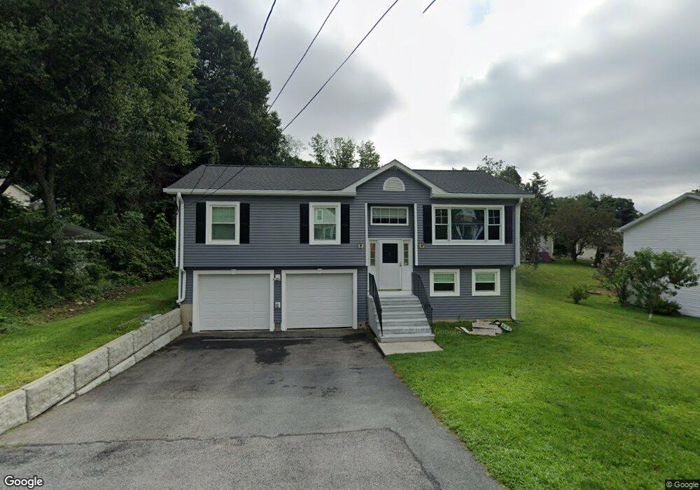
1 Knapp Ave Worcester, MA 01605
Forest Grove NeighborhoodEstimated Value: $429,000 - $492,000
4
Beds
2
Baths
2,000
Sq Ft
$234/Sq Ft
Est. Value
About This Home
This home is located at 1 Knapp Ave, Worcester, MA 01605 and is currently estimated at $468,914, approximately $234 per square foot. 1 Knapp Ave is a home located in Worcester County with nearby schools including Nelson Place Elementary School, Chandler Magnet, and Jacob Hiatt Magnet School.
Create a Home Valuation Report for This Property
The Home Valuation Report is an in-depth analysis detailing your home's value as well as a comparison with similar homes in the area
Home Values in the Area
Average Home Value in this Area
Tax History
| Year | Tax Paid | Tax Assessment Tax Assessment Total Assessment is a certain percentage of the fair market value that is determined by local assessors to be the total taxable value of land and additions on the property. | Land | Improvement |
|---|---|---|---|---|
| 2025 | $4,359 | $330,500 | $119,100 | $211,400 |
| 2024 | $4,213 | $306,400 | $119,100 | $187,300 |
| 2023 | $4,030 | $281,000 | $103,600 | $177,400 |
| 2022 | $3,691 | $242,700 | $82,800 | $159,900 |
| 2021 | $3,494 | $214,600 | $66,300 | $148,300 |
| 2020 | $3,358 | $197,500 | $66,200 | $131,300 |
| 2019 | $3,236 | $179,800 | $59,800 | $120,000 |
| 2018 | $3,249 | $171,800 | $59,800 | $112,000 |
| 2017 | $3,260 | $169,600 | $59,800 | $109,800 |
| 2016 | $3,205 | $155,500 | $44,800 | $110,700 |
| 2015 | $3,121 | $155,500 | $44,800 | $110,700 |
| 2014 | $3,038 | $155,500 | $44,800 | $110,700 |
Source: Public Records
Map
Nearby Homes
- 61 Barry Rd
- 97 Parkton Ave
- 46 Barry Rd
- 12 Tattan Farm Rd
- 667 Grove St
- 3 Old English Rd
- 0 Grove St
- 11 Holden St
- 770 Salisbury St Unit 333
- 82 Holden St
- 158 Chester St
- 493 Salisbury St
- 577 Grove St
- 4004 Brompton Cir
- 9 Dennison Rd
- 32 Aylesbury Rd
- 33 Aylesbury Rd
- 40 Westwood Dr
- 10 Salisbury Hill Blvd Unit 75
- 8 Old Colony Rd