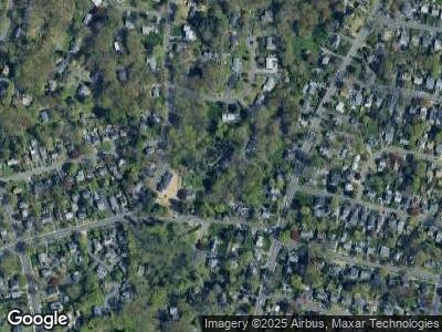
1 Lane Rd Norwalk, CT 06851
Cranbury NeighborhoodEstimated Value: $1,013,000 - $1,140,000
3
Beds
4
Baths
2,568
Sq Ft
$418/Sq Ft
Est. Value
About This Home
This home is located at 1 Lane Rd, Norwalk, CT 06851 and is currently estimated at $1,074,279, approximately $418 per square foot. 1 Lane Rd is a home located in Fairfield County with nearby schools including Cranbury Elementary School, West Rocks Middle School, and Norwalk High School.
Ownership History
Date
Name
Owned For
Owner Type
Purchase Details
Closed on
Jun 3, 2024
Sold by
Even Francine R
Bought by
Brouard Roger
Current Estimated Value
Purchase Details
Closed on
Dec 21, 2000
Sold by
Greene Sean W and Greene Anne B
Bought by
Even Francine R
Purchase Details
Closed on
Oct 15, 1999
Sold by
Connelly John J
Bought by
Greene Sean W and Greene Anne B
Purchase Details
Closed on
Jun 19, 1997
Sold by
Mazza David P and Taylor Mccall-Mazza N
Bought by
Connelly John J
Purchase Details
Closed on
Jun 3, 1994
Sold by
Berg Robert and Berg Dwanna
Bought by
Mazza David and Mccall Mazza N Taylor
Create a Home Valuation Report for This Property
The Home Valuation Report is an in-depth analysis detailing your home's value as well as a comparison with similar homes in the area
Home Values in the Area
Average Home Value in this Area
Purchase History
| Date | Buyer | Sale Price | Title Company |
|---|---|---|---|
| Brouard Roger | -- | None Available | |
| Brouard Roger | -- | None Available | |
| Brouard Roger | -- | None Available | |
| Even Francine R | $590,000 | -- | |
| Greene Sean W | $509,900 | -- | |
| Connelly John J | $440,000 | -- | |
| Mazza David | $340,000 | -- | |
| Even Francine R | $590,000 | -- | |
| Greene Sean W | $509,900 | -- | |
| Connelly John J | $440,000 | -- | |
| Mazza David | $340,000 | -- |
Source: Public Records
Mortgage History
| Date | Status | Borrower | Loan Amount |
|---|---|---|---|
| Open | Brouard Roger | $280,000 | |
| Previous Owner | Mazza David | $112,000 |
Source: Public Records
Tax History Compared to Growth
Tax History
| Year | Tax Paid | Tax Assessment Tax Assessment Total Assessment is a certain percentage of the fair market value that is determined by local assessors to be the total taxable value of land and additions on the property. | Land | Improvement |
|---|---|---|---|---|
| 2024 | $15,845 | $671,670 | $271,360 | $400,310 |
| 2023 | $13,791 | $548,100 | $218,500 | $329,600 |
| 2022 | $13,534 | $548,100 | $218,500 | $329,600 |
| 2021 | $13,182 | $548,100 | $218,500 | $329,600 |
| 2020 | $13,175 | $548,100 | $218,500 | $329,600 |
| 2019 | $12,806 | $548,100 | $218,500 | $329,600 |
| 2018 | $13,676 | $512,940 | $226,370 | $286,570 |
| 2017 | $13,206 | $512,940 | $226,370 | $286,570 |
| 2016 | $13,080 | $512,940 | $226,370 | $286,570 |
| 2015 | $13,044 | $512,940 | $226,370 | $286,570 |
| 2014 | $12,875 | $512,940 | $226,370 | $286,570 |
Source: Public Records
Map
Nearby Homes
- 10 4 Winds Dr
- 301 Westport Rd
- 189 Westport Rd
- 181 Westport Rd
- 58 Washington Post Dr
- 125 W Meadow Rd
- 81 Grumman Hill Rd
- 6 Downe Ln
- 9 High Ridge Rd
- 9 Bobwhite Dr
- 10 Wilton Hunt Rd
- 46 Grumman Hill Rd
- 30 Wilton Hunt Rd
- 2 Grouse Path
- 44 Village Ct Unit 44
- 48 Village Ct
- 4A Newtown Turnpike
- 70 Bayne St
- 133 Chestnut Hill Rd
- 4 Newtown Turnpike
- 1 Lane Rd
- 6 Farm House Ln
- 329 Chestnut Hill Rd
- 329 Chestnut Hill Rd Unit 4
- 329 Chestnut Hill Rd Unit 9
- 329 Chestnut Hill Rd Unit 3
- 329 Chestnut Hill Rd Unit 5
- 329 Chestnut Hill Rd Unit 7
- 329 Chestnut Hill Rd Unit 6
- 329 Chestnut Hill Rd Unit 2
- 4 Farm House Ln
- 367 Chestnut Hill Rd
- 2 Farm House Ln
- 373 Chestnut Hill Rd
- 335 Chestnut Hill Rd Unit 3
- 335 Chestnut Hill Rd Unit 4
- 335 Chestnut Hill Rd Unit 7
- 335 Chestnut Hill Rd
- 335 Chestnut Hill Rd Unit 6
- 335 Chestnut Hill Rd Unit 2
