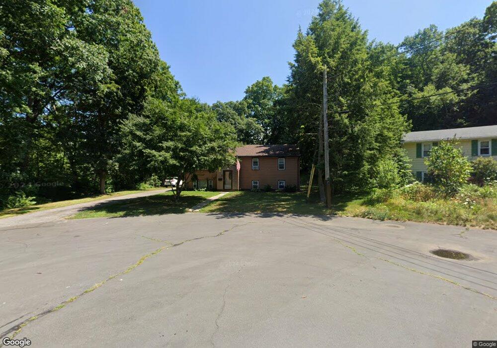
1 Maclean Dr Framingham, MA 01701
Nobscot NeighborhoodEstimated Value: $638,000 - $690,000
4
Beds
2
Baths
1,991
Sq Ft
$334/Sq Ft
Est. Value
About This Home
This home is located at 1 Maclean Dr, Framingham, MA 01701 and is currently estimated at $663,999, approximately $333 per square foot. 1 Maclean Dr is a home located in Middlesex County with nearby schools including Framingham High School, Summit Montessori School, and Saint Bridget School.
Ownership History
Date
Name
Owned For
Owner Type
Purchase Details
Closed on
Jul 29, 2010
Sold by
Mary K Carter Ft and Williams
Bought by
Quinn Michael and Quinn Bonnie
Current Estimated Value
Home Financials for this Owner
Home Financials are based on the most recent Mortgage that was taken out on this home.
Original Mortgage
$313,500
Outstanding Balance
$209,754
Interest Rate
4.78%
Mortgage Type
Purchase Money Mortgage
Estimated Equity
$454,245
Purchase Details
Closed on
Feb 12, 2009
Sold by
Carter Mary K
Bought by
Mary K Carter Ft and Williams
Create a Home Valuation Report for This Property
The Home Valuation Report is an in-depth analysis detailing your home's value as well as a comparison with similar homes in the area
Home Values in the Area
Average Home Value in this Area
Purchase History
| Date | Buyer | Sale Price | Title Company |
|---|---|---|---|
| Quinn Michael | $330,000 | -- | |
| Mary K Carter Ft | -- | -- |
Source: Public Records
Mortgage History
| Date | Status | Borrower | Loan Amount |
|---|---|---|---|
| Open | Quinn Michael | $313,500 |
Source: Public Records
Tax History Compared to Growth
Tax History
| Year | Tax Paid | Tax Assessment Tax Assessment Total Assessment is a certain percentage of the fair market value that is determined by local assessors to be the total taxable value of land and additions on the property. | Land | Improvement |
|---|---|---|---|---|
| 2025 | $6,894 | $577,400 | $271,200 | $306,200 |
| 2024 | $6,249 | $501,500 | $242,200 | $259,300 |
| 2023 | $5,925 | $452,600 | $216,200 | $236,400 |
| 2022 | $5,583 | $406,300 | $196,100 | $210,200 |
| 2021 | $5,565 | $396,100 | $188,500 | $207,600 |
| 2020 | $5,466 | $364,900 | $171,300 | $193,600 |
| 2019 | $5,412 | $351,900 | $171,300 | $180,600 |
| 2018 | $5,348 | $327,700 | $164,900 | $162,800 |
| 2017 | $5,242 | $313,700 | $160,100 | $153,600 |
| 2016 | $5,247 | $301,900 | $160,100 | $141,800 |
| 2015 | $5,310 | $298,000 | $160,700 | $137,300 |
Source: Public Records
Map
Nearby Homes