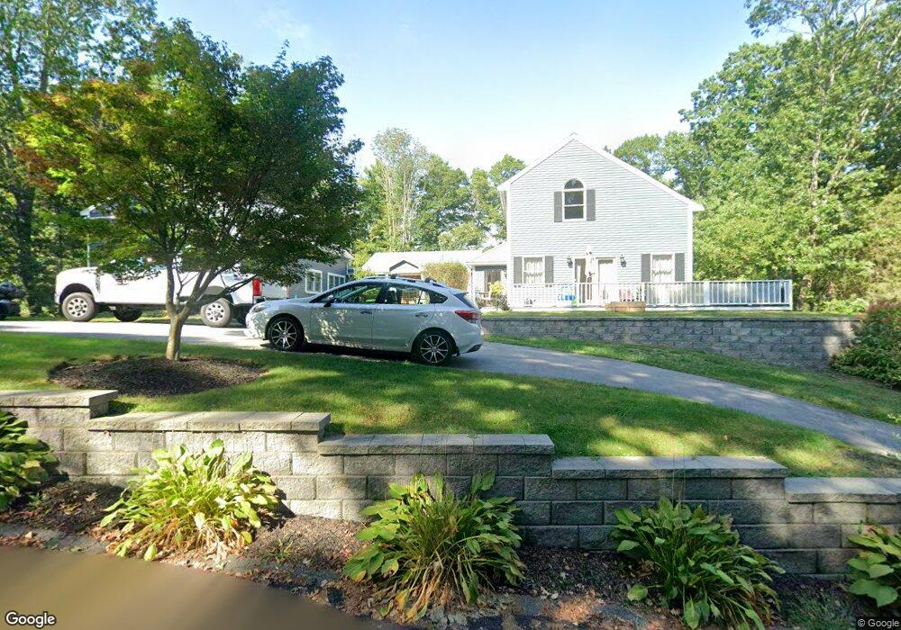
1 Mathieu Hill Rd Gloucester, MA 01930
West Gloucester NeighborhoodEstimated Value: $765,000 - $1,008,000
3
Beds
3
Baths
3,471
Sq Ft
$255/Sq Ft
Est. Value
About This Home
This home is located at 1 Mathieu Hill Rd, Gloucester, MA 01930 and is currently estimated at $885,180, approximately $255 per square foot. 1 Mathieu Hill Rd is a home located in Essex County with nearby schools including West Parish, Ralph B O'maley Middle School, and Gloucester High School.
Ownership History
Date
Name
Owned For
Owner Type
Purchase Details
Closed on
Sep 24, 2018
Sold by
Mathieu Barbara J and Maxham Melanie
Bought by
Lane Gary H
Current Estimated Value
Home Financials for this Owner
Home Financials are based on the most recent Mortgage that was taken out on this home.
Original Mortgage
$432,000
Outstanding Balance
$378,243
Interest Rate
4.88%
Mortgage Type
New Conventional
Estimated Equity
$506,937
Purchase Details
Closed on
Sep 1, 1985
Bought by
Mathieu Michael P and Mathieu Barbara
Create a Home Valuation Report for This Property
The Home Valuation Report is an in-depth analysis detailing your home's value as well as a comparison with similar homes in the area
Home Values in the Area
Average Home Value in this Area
Purchase History
| Date | Buyer | Sale Price | Title Company |
|---|---|---|---|
| Lane Gary H | $480,000 | -- | |
| Mathieu Michael P | $115,000 | -- |
Source: Public Records
Mortgage History
| Date | Status | Borrower | Loan Amount |
|---|---|---|---|
| Open | Lane Gary H | $432,000 |
Source: Public Records
Tax History
| Year | Tax Paid | Tax Assessment Tax Assessment Total Assessment is a certain percentage of the fair market value that is determined by local assessors to be the total taxable value of land and additions on the property. | Land | Improvement |
|---|---|---|---|---|
| 2025 | $8,776 | $902,900 | $224,600 | $678,300 |
| 2024 | $8,681 | $892,200 | $213,900 | $678,300 |
| 2023 | $9,306 | $878,800 | $190,900 | $687,900 |
| 2022 | $8,408 | $716,800 | $166,100 | $550,700 |
| 2021 | $7,755 | $623,400 | $151,100 | $472,300 |
| 2020 | $7,351 | $596,200 | $151,100 | $445,100 |
| 2019 | $6,837 | $538,800 | $151,100 | $387,700 |
| 2018 | $6,380 | $493,400 | $151,100 | $342,300 |
| 2017 | $7,388 | $560,100 | $143,800 | $416,300 |
| 2016 | $7,050 | $518,000 | $150,000 | $368,000 |
| 2015 | $7,020 | $514,300 | $150,000 | $364,300 |
Source: Public Records
Map
Nearby Homes
- 587 Essex Ave
- 7 Leaman Dr
- 15 Lufkin Point Rd
- 368 Essex Ave
- 162 Main St
- 145 Main St Unit 1
- 145 Main St Unit 4
- 90 Southern Ave Unit 90
- 5 Samoset Rd Unit B
- 34 & 34R Pickering St
- 85 Martin St
- 167 Atlantic St
- 178 Atlantic St
- 5 Lepage Ln
- 24 Cobblestone Ln Unit 603
- 3 Hardy Ln
- 4 Tara Rd
- 145 Essex Ave Unit 402
- 226 Atlantic St
- 13 Honeysuckle Rd
Your Personal Tour Guide
Ask me questions while you tour the home.