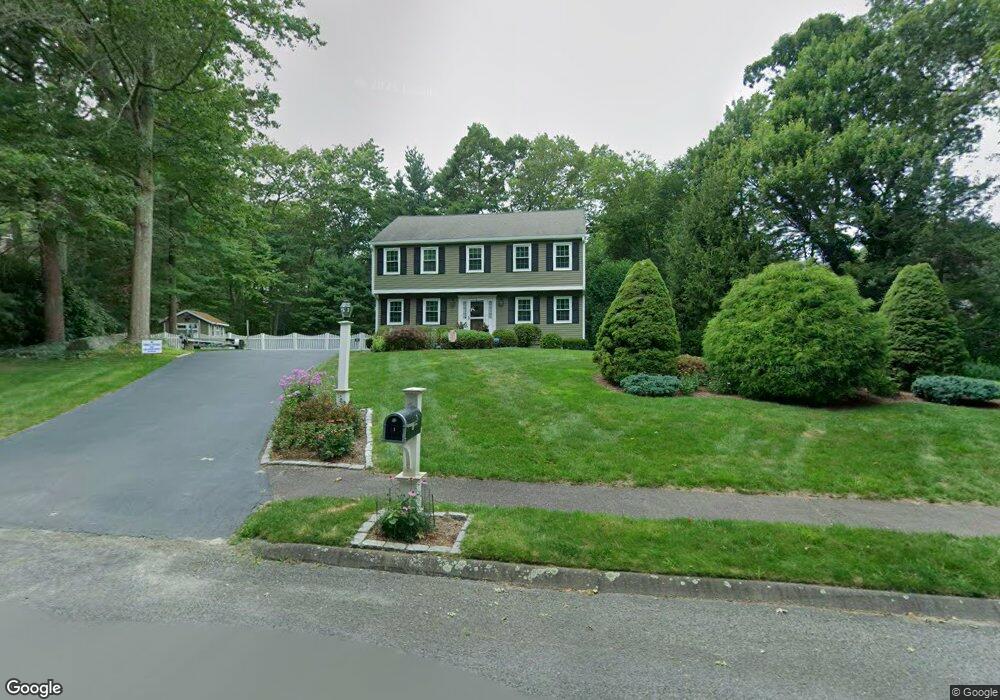
1 Megans Way Mansfield, MA 02048
Estimated Value: $720,000 - $829,000
3
Beds
3
Baths
1,893
Sq Ft
$407/Sq Ft
Est. Value
About This Home
This home is located at 1 Megans Way, Mansfield, MA 02048 and is currently estimated at $770,108, approximately $406 per square foot. 1 Megans Way is a home located in Bristol County with nearby schools including Everett W. Robinson Elementary School, Jordan/Jackson Elementary School, and Harold L. Qualters Middle School.
Ownership History
Date
Name
Owned For
Owner Type
Purchase Details
Closed on
Apr 30, 1996
Sold by
Cassaw Daniel H and Darlene Cassaw M
Bought by
Moore Charles S and Moore Suzanne M
Current Estimated Value
Purchase Details
Closed on
Nov 30, 1992
Sold by
East Coast Dev Ltd
Bought by
Cassaw Daniel H and Darlene S Cassaw M
Create a Home Valuation Report for This Property
The Home Valuation Report is an in-depth analysis detailing your home's value as well as a comparison with similar homes in the area
Home Values in the Area
Average Home Value in this Area
Purchase History
| Date | Buyer | Sale Price | Title Company |
|---|---|---|---|
| Moore Charles S | $191,500 | -- | |
| Cassaw Daniel H | $170,700 | -- |
Source: Public Records
Mortgage History
| Date | Status | Borrower | Loan Amount |
|---|---|---|---|
| Open | Cassaw Daniel H | $200,000 | |
| Closed | Cassaw Daniel H | $49,000 |
Source: Public Records
Tax History Compared to Growth
Tax History
| Year | Tax Paid | Tax Assessment Tax Assessment Total Assessment is a certain percentage of the fair market value that is determined by local assessors to be the total taxable value of land and additions on the property. | Land | Improvement |
|---|---|---|---|---|
| 2025 | $8,217 | $623,900 | $279,400 | $344,500 |
| 2024 | $8,150 | $603,700 | $291,500 | $312,200 |
| 2023 | $7,948 | $564,100 | $291,500 | $272,600 |
| 2022 | $7,682 | $506,400 | $269,800 | $236,600 |
| 2021 | $3,752 | $477,000 | $225,000 | $252,000 |
| 2020 | $2,973 | $470,300 | $225,000 | $245,300 |
| 2019 | $6,662 | $437,700 | $187,400 | $250,300 |
| 2018 | $6,609 | $424,500 | $178,700 | $245,800 |
| 2017 | $6,197 | $412,600 | $173,600 | $239,000 |
| 2016 | $5,951 | $386,200 | $165,300 | $220,900 |
| 2015 | $5,813 | $375,000 | $165,300 | $209,700 |
Source: Public Records
Map
Nearby Homes
- 47 Old Farm Rd
- 17 Peters Way
- 150 Gilbert St
- 36 Cranberry Rd
- 6 Colts Way
- 4 Buckskin Dr
- 11 Landry Ave
- 115 Westfield Dr
- 10 Sleepy Hollow Cir
- 451R Gilbert St
- 176 Elm St
- 57 Vine St
- 116 George St
- 2 Oak St Unit 2D
- 2 Oak St Unit 2A
- 2 Oak St Unit 2C
- 2 Oak St Unit 2B
- 6 Cedar Creek Dr
- 15 Old Wood Rd
- 37 Oakleaf Dr