Estimated Value: $448,000 - $601,000
4
Beds
2
Baths
1,747
Sq Ft
$305/Sq Ft
Est. Value
About This Home
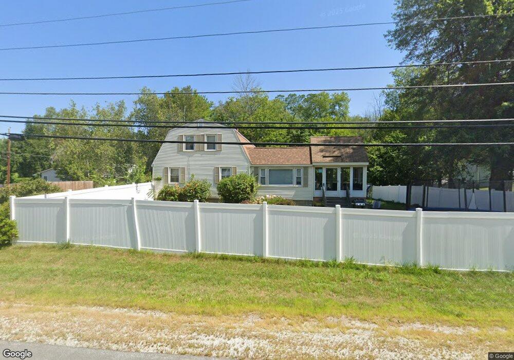
This home is located at 1 Paul Ave, Derry, NH 03038 and is currently estimated at $533,389, approximately $305 per square foot. 1 Paul Ave is a home located in Rockingham County with nearby schools including Ernest P. Barka Elementary School, Gilbert H. Hood Middle School, and Pinkerton Academy.
Ownership History
Date
Name
Owned For
Owner Type
Purchase Details
Closed on
Jun 29, 2001
Sold by
Nguyen Kim
Bought by
Ronaghan Ernie and Ronaghan Barbara
Current Estimated Value
Home Financials for this Owner
Home Financials are based on the most recent Mortgage that was taken out on this home.
Original Mortgage
$157,250
Outstanding Balance
$60,600
Interest Rate
7.14%
Estimated Equity
$472,789
Purchase Details
Closed on
Jul 6, 1998
Sold by
Parkin George P
Bought by
Nguyen Kim
Home Financials for this Owner
Home Financials are based on the most recent Mortgage that was taken out on this home.
Original Mortgage
$80,000
Interest Rate
7.04%
Create a Home Valuation Report for This Property
The Home Valuation Report is an in-depth analysis detailing your home's value as well as a comparison with similar homes in the area
Home Values in the Area
Average Home Value in this Area
Purchase History
| Date | Buyer | Sale Price | Title Company |
|---|---|---|---|
| Ronaghan Ernie | $185,000 | -- | |
| Nguyen Kim | $108,500 | -- |
Source: Public Records
Mortgage History
| Date | Status | Borrower | Loan Amount |
|---|---|---|---|
| Open | Nguyen Kim | $157,250 | |
| Previous Owner | Nguyen Kim | $80,000 |
Source: Public Records
Tax History Compared to Growth
Tax History
| Year | Tax Paid | Tax Assessment Tax Assessment Total Assessment is a certain percentage of the fair market value that is determined by local assessors to be the total taxable value of land and additions on the property. | Land | Improvement |
|---|---|---|---|---|
| 2024 | $9,145 | $489,300 | $203,300 | $286,000 |
| 2023 | $8,231 | $398,000 | $172,700 | $225,300 |
| 2022 | $7,578 | $398,000 | $172,700 | $225,300 |
| 2021 | $7,156 | $289,000 | $130,800 | $158,200 |
| 2020 | $7,034 | $289,000 | $130,800 | $158,200 |
| 2019 | $6,684 | $255,900 | $99,000 | $156,900 |
| 2018 | $6,661 | $255,900 | $99,000 | $156,900 |
| 2017 | $6,095 | $211,200 | $89,500 | $121,700 |
| 2016 | $5,715 | $211,200 | $89,500 | $121,700 |
| 2015 | $5,720 | $195,700 | $89,500 | $106,200 |
| 2014 | $5,757 | $195,700 | $89,500 | $106,200 |
| 2013 | $5,656 | $179,600 | $82,000 | $97,600 |
Source: Public Records
Map
Nearby Homes
- 80 Bypass 28
- 27 Cove Dr
- 7 Gena Ave
- 6 Hilda Ave
- 9 Dattillo Rd
- 8 Mark Ave
- 4 Viza Ave
- 52 Daniel Rd
- 50 Daniel Rd
- 54 Daniel Rd
- 1 Barkland Dr
- 70 English Range Rd
- 80.5 English Range Rd
- 5 Tsienneto Rd Unit 10
- 5 Tsienneto Rd Unit 127
- 5 Tsienneto Rd Unit 170
- 5 Tsienneto Rd Unit 41
- 5 Tsienneto Rd Unit 151
- 8 Ledgewood Dr
- 4 Ledgewood Dr