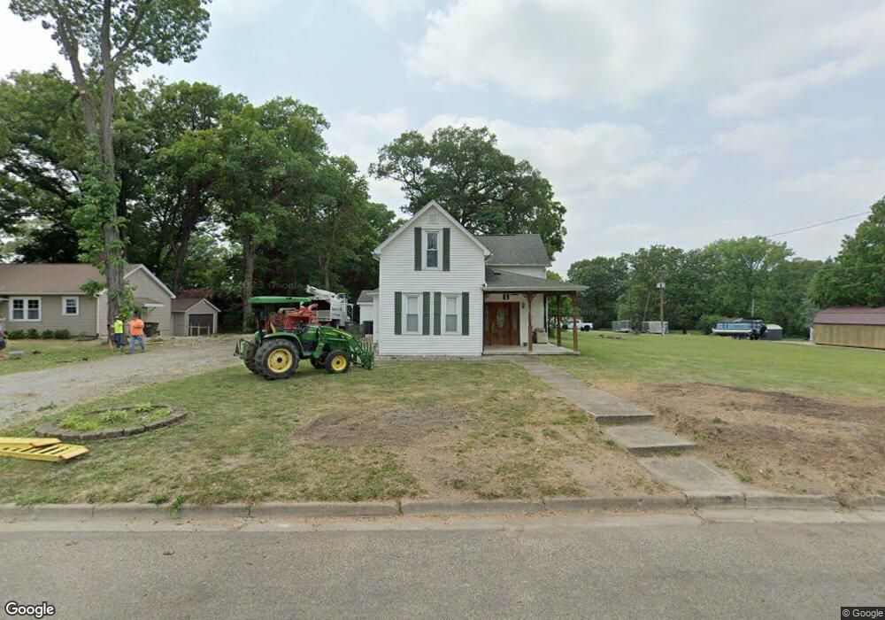
1 S Stewart St Danville, IL 61832
Estimated Value: $50,000 - $85,000
--
Bed
--
Bath
--
Sq Ft
0.76
Acres
About This Home
This home is located at 1 S Stewart St, Danville, IL 61832 and is currently estimated at $72,011. 1 S Stewart St is a home located in Vermilion County with nearby schools including Southwest Elementary School, South View Upper Elementary School, and North Ridge Middle School.
Ownership History
Date
Name
Owned For
Owner Type
Purchase Details
Closed on
Apr 12, 2024
Sold by
Vaughn Richard Alan and Ashley Klynn
Bought by
Vaughn Properties Llc-Series Dt Properties
Current Estimated Value
Purchase Details
Closed on
Aug 22, 2019
Sold by
Vaughn Richard Alan
Bought by
Vaughn Richard Alan and Vaughn Ashley
Home Financials for this Owner
Home Financials are based on the most recent Mortgage that was taken out on this home.
Original Mortgage
$69,000
Interest Rate
3.5%
Mortgage Type
New Conventional
Create a Home Valuation Report for This Property
The Home Valuation Report is an in-depth analysis detailing your home's value as well as a comparison with similar homes in the area
Home Values in the Area
Average Home Value in this Area
Purchase History
| Date | Buyer | Sale Price | Title Company |
|---|---|---|---|
| Vaughn Properties Llc-Series Dt Properties | -- | None Listed On Document | |
| Vaughn Richard Alan | -- | -- |
Source: Public Records
Mortgage History
| Date | Status | Borrower | Loan Amount |
|---|---|---|---|
| Previous Owner | Vaughn Richard Alan | $69,000 |
Source: Public Records
Tax History Compared to Growth
Tax History
| Year | Tax Paid | Tax Assessment Tax Assessment Total Assessment is a certain percentage of the fair market value that is determined by local assessors to be the total taxable value of land and additions on the property. | Land | Improvement |
|---|---|---|---|---|
| 2024 | $1,652 | $18,272 | $2,032 | $16,240 |
| 2023 | $1,652 | $15,692 | $1,745 | $13,947 |
| 2022 | $840 | $13,894 | $1,545 | $12,349 |
| 2021 | $753 | $12,865 | $1,431 | $11,434 |
| 2020 | $710 | $12,430 | $1,383 | $11,047 |
| 2019 | $724 | $12,430 | $1,383 | $11,047 |
| 2018 | $699 | $12,368 | $1,376 | $10,992 |
| 2015 | $637 | $10,985 | $1,222 | $9,763 |
| 2014 | $637 | $10,985 | $1,222 | $9,763 |
| 2013 | $637 | $10,985 | $1,222 | $9,763 |
Source: Public Records
Map
Nearby Homes
- 213 W 1st St
- 302 S Stewart St
- 111 E Bridge St
- 210 W 7th St
- 423 Mallard Point Dr
- 913 Forrest St
- 0 Wayside Dr
- 511 E 3rd St
- 44 Warrington Ave
- 305 Bensyl Ave
- 318 Oak St
- 123 N Gilbert St
- 305 Park St
- 408 Elizabeth St
- 324 Oak St
- 405 Chandler St
- 402 N Franklin St
- 207 W Seminary St
- 409 Chandler St
- 112 E 2nd St