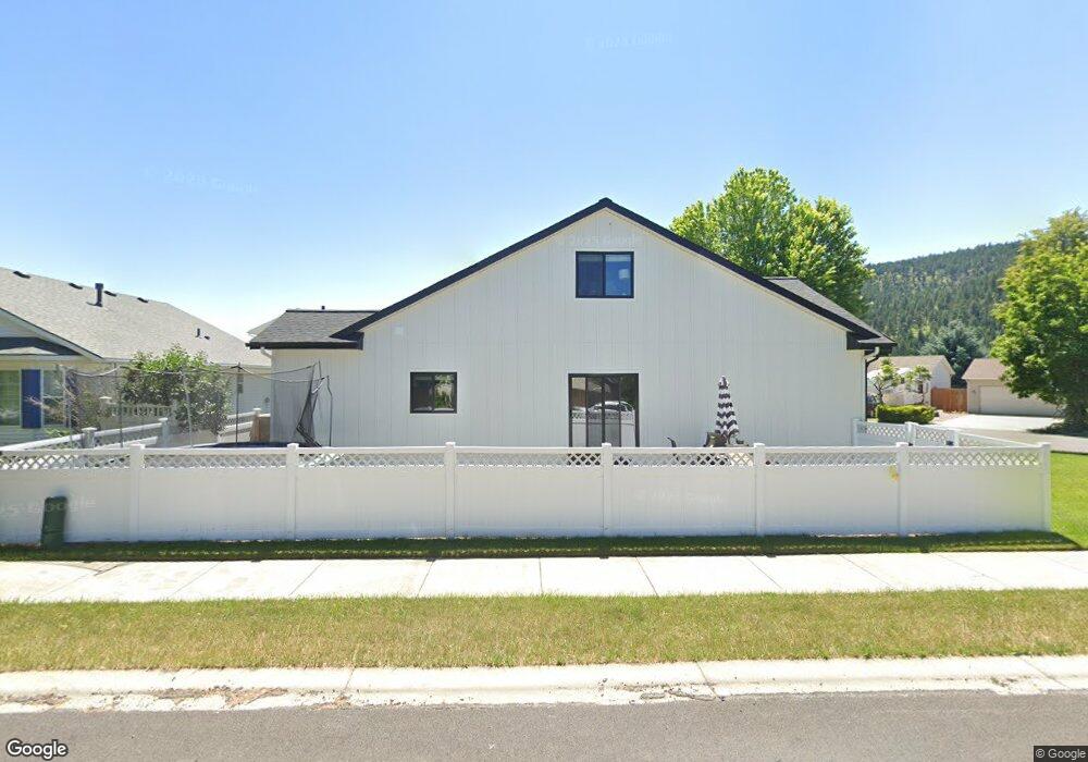
10 Austin St Kalispell, MT 59901
Estimated Value: $495,000 - $522,000
4
Beds
2
Baths
1,860
Sq Ft
$274/Sq Ft
Est. Value
About This Home
This home is located at 10 Austin St, Kalispell, MT 59901 and is currently estimated at $509,450, approximately $273 per square foot. 10 Austin St is a home located in Flathead County with nearby schools including Lillian Peterson School, Kalispell Middle School, and Flathead High School.
Ownership History
Date
Name
Owned For
Owner Type
Purchase Details
Closed on
Dec 13, 2011
Sold by
Ayers Rena B
Bought by
Groshong Ryan W and Groshong Sarah J
Current Estimated Value
Home Financials for this Owner
Home Financials are based on the most recent Mortgage that was taken out on this home.
Original Mortgage
$29,264
Outstanding Balance
$19,951
Interest Rate
3.94%
Mortgage Type
Unknown
Estimated Equity
$489,499
Purchase Details
Closed on
Jun 25, 2006
Sold by
Snell Jerry M and Shell April M
Bought by
Ayres Rena B
Create a Home Valuation Report for This Property
The Home Valuation Report is an in-depth analysis detailing your home's value as well as a comparison with similar homes in the area
Purchase History
| Date | Buyer | Sale Price | Title Company |
|---|---|---|---|
| Groshong Ryan W | -- | Insured Titles | |
| Ayres Rena B | -- | Flathead County Title Compan |
Source: Public Records
Mortgage History
| Date | Status | Borrower | Loan Amount |
|---|---|---|---|
| Open | Groshong Ryan W | $29,264 | |
| Open | Groshong Ryan W | $133,214 |
Source: Public Records
Tax History
| Year | Tax Paid | Tax Assessment Tax Assessment Total Assessment is a certain percentage of the fair market value that is determined by local assessors to be the total taxable value of land and additions on the property. | Land | Improvement |
|---|---|---|---|---|
| 2025 | $2,796 | $526,300 | $0 | $0 |
| 2024 | $3,121 | $400,700 | $0 | $0 |
| 2023 | $3,565 | $400,700 | $0 | $0 |
| 2022 | $3,430 | $289,200 | $0 | $0 |
| 2021 | $3,112 | $289,200 | $0 | $0 |
| 2020 | $3,121 | $246,400 | $0 | $0 |
| 2019 | $3,126 | $246,400 | $0 | $0 |
| 2018 | $2,607 | $190,380 | $0 | $0 |
| 2017 | $2,613 | $190,380 | $0 | $0 |
| 2016 | $2,379 | $188,900 | $0 | $0 |
| 2015 | $2,377 | $188,900 | $0 | $0 |
| 2014 | $2,406 | $115,805 | $0 | $0 |
Source: Public Records
Map
Nearby Homes
- 1906 Bluestone Dr
- 135 Rimrock Ct
- 1996/1998 Greatview
- 2035 Teal Dr
- 2224 Pintail Ct
- 1971 Bluestone Dr
- 605 Valley View Dr
- 8 Primrose Ct
- 2208 Ruddy Duck Dr
- 1483 & 1485 Western Dr
- 1418 6th Ave W
- 1517 5th Ave W
- 2303 Kismet Ct
- 1313 7th Ave W
- 1308 7th Ave W
- 2253 Canvasback Ct
- 1467 Destiny Ln
- 2318 Kismet Ct
- 1354 Destiny Ln
- 865 9th St W
Your Personal Tour Guide
Ask me questions while you tour the home.