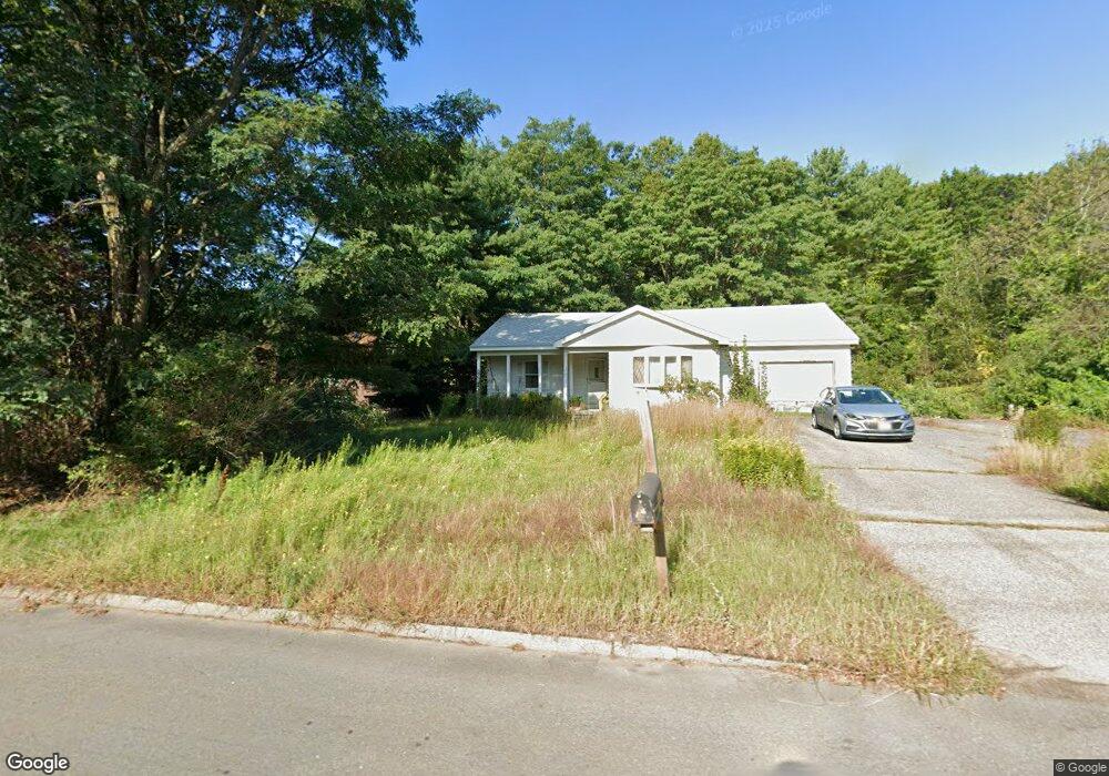
10 Cornwall Ln Unit U5 Nashua, NH 03063
Northwest Nashua NeighborhoodEstimated Value: $385,118 - $418,000
3
Beds
1
Bath
1,223
Sq Ft
$329/Sq Ft
Est. Value
About This Home
This home is located at 10 Cornwall Ln Unit U5, Nashua, NH 03063 and is currently estimated at $401,780, approximately $328 per square foot. 10 Cornwall Ln Unit U5 is a home located in Hillsborough County with nearby schools including Birch Hill Elementary School, Elm Street Middle School, and Nashua High School North.
Ownership History
Date
Name
Owned For
Owner Type
Purchase Details
Closed on
Oct 1, 1999
Sold by
Collinge Troy D
Bought by
Kedder Valerie A
Current Estimated Value
Home Financials for this Owner
Home Financials are based on the most recent Mortgage that was taken out on this home.
Original Mortgage
$111,900
Interest Rate
7.85%
Create a Home Valuation Report for This Property
The Home Valuation Report is an in-depth analysis detailing your home's value as well as a comparison with similar homes in the area
Home Values in the Area
Average Home Value in this Area
Purchase History
| Date | Buyer | Sale Price | Title Company |
|---|---|---|---|
| Kedder Valerie A | $139,900 | -- |
Source: Public Records
Mortgage History
| Date | Status | Borrower | Loan Amount |
|---|---|---|---|
| Open | Kedder Valerie A | $76,000 | |
| Closed | Kedder Valerie A | $111,900 |
Source: Public Records
Tax History
| Year | Tax Paid | Tax Assessment Tax Assessment Total Assessment is a certain percentage of the fair market value that is determined by local assessors to be the total taxable value of land and additions on the property. | Land | Improvement |
|---|---|---|---|---|
| 2025 | $6,562 | $389,900 | $0 | $389,900 |
| 2024 | $6,199 | $389,900 | $0 | $389,900 |
| 2023 | $5,093 | $279,400 | $0 | $279,400 |
| 2022 | $5,049 | $279,400 | $0 | $279,400 |
| 2021 | $5,464 | $235,300 | $0 | $235,300 |
| 2020 | $5,370 | $237,500 | $0 | $237,500 |
| 2019 | $5,168 | $237,500 | $0 | $237,500 |
| 2018 | $5,037 | $237,500 | $0 | $237,500 |
| 2017 | $4,126 | $160,000 | $0 | $160,000 |
| 2016 | $4,011 | $160,000 | $0 | $160,000 |
| 2015 | $3,925 | $160,000 | $0 | $160,000 |
| 2014 | $3,848 | $160,000 | $0 | $160,000 |
Source: Public Records
Map
Nearby Homes
- 10 Hampton Dr
- 25 Pelham St
- 13 Cider Ln
- 8 Fitzpatrick Cir Unit U79
- 18 Kanata Dr
- 14 Beaver St
- 5 Lowther Place Unit U6
- 111 Coburn Ave Unit 187
- 668 W Hollis St
- 5 Ivy Ln Unit U131
- 77 Dunbarton Dr
- 734 W Hollis St
- 189 Coburn Woods
- 293 Pine Hill Rd
- 30 Spring Cove Rd Unit U112
- 23 Spring Cove Rd Unit U152
- 8 Althea Ln Unit U26
- 47 Dogwood Dr Unit U202
- 12 Heather Ct Unit U39
- 4 Lee Ann St
- 8 Cornwall Ln Unit U6
- 9 Cornwall Ln Unit U4
- 6 Cornwall Ln Unit U7
- 7 Cornwall Ln Unit U3
- 5 Cornwall Ln Unit U2
- 479 Broad St
- 5 Cardinal Cir
- 7 Brittany Way Unit U8
- 7 Brittany Way Unit 8
- 3 Cornwall Ln Unit U1
- 16 Grimsby Ln Unit U14
- 4 Cardinal Cir
- 469 Broad St
- 3 Cardinal Cir
- 11 Grimsby Ln Unit U13
- 2 Cardinal Cir
- 4 Brittany Way Unit U39
- 3 Gloucester Ln Unit U29
- 472 Broad St
- 474 Broad St
Your Personal Tour Guide
Ask me questions while you tour the home.