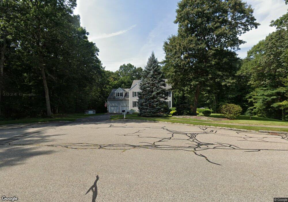
10 Cypress Ln Franklin, MA 02038
Wadsworth NeighborhoodEstimated Value: $917,269 - $1,044,000
4
Beds
3
Baths
2,511
Sq Ft
$394/Sq Ft
Est. Value
About This Home
This home is located at 10 Cypress Ln, Franklin, MA 02038 and is currently estimated at $990,567, approximately $394 per square foot. 10 Cypress Ln is a home located in Norfolk County with nearby schools including Jefferson Elementary School, Remington Middle School, and Franklin High School.
Ownership History
Date
Name
Owned For
Owner Type
Purchase Details
Closed on
Jul 22, 2020
Sold by
Dolan Frederick J and Dolan Marybeth M
Bought by
Dolan Rt
Current Estimated Value
Purchase Details
Closed on
Jan 12, 2006
Sold by
Kesaris Brenda and Kesaris John A
Bought by
Dolan Frederick J and Dolan Marybeth M
Home Financials for this Owner
Home Financials are based on the most recent Mortgage that was taken out on this home.
Original Mortgage
$286,400
Interest Rate
6.28%
Mortgage Type
Purchase Money Mortgage
Purchase Details
Closed on
Oct 15, 1999
Sold by
Mendes Dev Co Inc
Bought by
Kesaris John A and Kesaris Brenda
Create a Home Valuation Report for This Property
The Home Valuation Report is an in-depth analysis detailing your home's value as well as a comparison with similar homes in the area
Home Values in the Area
Average Home Value in this Area
Purchase History
| Date | Buyer | Sale Price | Title Company |
|---|---|---|---|
| Dolan Rt | -- | None Available | |
| Dolan Frederick J | $596,000 | -- | |
| Kesaris John A | $358,025 | -- |
Source: Public Records
Mortgage History
| Date | Status | Borrower | Loan Amount |
|---|---|---|---|
| Previous Owner | Kesaris John A | $240,000 | |
| Previous Owner | Dolan Frederick J | $286,400 | |
| Previous Owner | Dolan Frederick J | $250,000 | |
| Previous Owner | Kesaris John A | $45,500 | |
| Previous Owner | Kesaris John A | $245,000 |
Source: Public Records
Tax History Compared to Growth
Tax History
| Year | Tax Paid | Tax Assessment Tax Assessment Total Assessment is a certain percentage of the fair market value that is determined by local assessors to be the total taxable value of land and additions on the property. | Land | Improvement |
|---|---|---|---|---|
| 2025 | $9,331 | $803,000 | $363,400 | $439,600 |
| 2024 | $9,555 | $810,400 | $363,400 | $447,000 |
| 2023 | $9,065 | $720,600 | $347,300 | $373,300 |
| 2022 | $8,413 | $598,800 | $269,200 | $329,600 |
| 2021 | $8,421 | $574,800 | $259,700 | $315,100 |
| 2020 | $8,158 | $562,200 | $262,300 | $299,900 |
| 2019 | $7,934 | $541,200 | $241,300 | $299,900 |
| 2018 | $7,672 | $523,700 | $254,400 | $269,300 |
| 2017 | $7,751 | $531,600 | $262,300 | $269,300 |
| 2016 | $7,365 | $507,900 | $241,600 | $266,300 |
| 2015 | $7,194 | $484,800 | $218,500 | $266,300 |
| 2014 | $6,884 | $476,400 | $210,100 | $266,300 |
Source: Public Records
Map
Nearby Homes
- 2 Duhamel Way
- 352 Lake St
- 1250 Pulaski Blvd
- 8 Bubbling Brook Rd
- 124 Lake St
- 851 Washington St
- 65 Palmetto Dr Unit 65
- 0 Prospect St
- 21 Palmetto Dr Unit 21
- 24 Palmetto Dr Unit 24
- 9 Pebble Cir Unit 9
- 29 Squire Ln
- 2095 West St
- 1 Clover Dr
- 66 Newland Ave
- 17 Susan Ln
- 340 Wrentham Rd
- 17 Stanford Rd
- 89 Lakeview Ave
- 26 Iris Ln
- 14 Cypress Ln
- 11 Cypress Ln
- 3 Hamel Ct
- 14 Hamel Ct
- 20 Townline Rd
- 22 Townline Rd
- 18 Cypress Ln
- 53 Highridge Rd
- 16 Auburn Rd
- 45 Highridge Rd Unit 23
- 19 Townline Rd
- 34 Cypress Ln
- 18 Townline Rd
- 43 Highridge Rd
- 45 Highridge Rd
- 47 Highridge Rd
- 43 Highridge Rd
- 22 Cypress Ln
- 17 Townline Rd
- 49 Highridge Rd