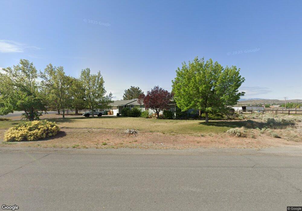
10 E Sky Ranch Blvd Sparks, NV 89441
Sky Ranch NeighborhoodEstimated Value: $595,241 - $686,000
3
Beds
2
Baths
1,512
Sq Ft
$432/Sq Ft
Est. Value
About This Home
This home is located at 10 E Sky Ranch Blvd, Sparks, NV 89441 and is currently estimated at $653,560, approximately $432 per square foot. 10 E Sky Ranch Blvd is a home located in Washoe County with nearby schools including Spanish Springs Elementary School, Yvonne Shaw Middle School, and Spanish Springs High School.
Ownership History
Date
Name
Owned For
Owner Type
Purchase Details
Closed on
Nov 22, 1993
Sold by
Barreto Daniel J and Sertic Kelli J
Bought by
Miller John H and Miller Ginger S
Current Estimated Value
Home Financials for this Owner
Home Financials are based on the most recent Mortgage that was taken out on this home.
Original Mortgage
$122,500
Interest Rate
3.87%
Create a Home Valuation Report for This Property
The Home Valuation Report is an in-depth analysis detailing your home's value as well as a comparison with similar homes in the area
Home Values in the Area
Average Home Value in this Area
Purchase History
| Date | Buyer | Sale Price | Title Company |
|---|---|---|---|
| Miller John H | $160,000 | Western Title Company Inc |
Source: Public Records
Mortgage History
| Date | Status | Borrower | Loan Amount |
|---|---|---|---|
| Closed | Miller John H | $122,500 |
Source: Public Records
Tax History
| Year | Tax Paid | Tax Assessment Tax Assessment Total Assessment is a certain percentage of the fair market value that is determined by local assessors to be the total taxable value of land and additions on the property. | Land | Improvement |
|---|---|---|---|---|
| 2026 | $1,671 | $88,876 | $42,028 | $46,848 |
| 2025 | $2,165 | $93,662 | $45,313 | $48,349 |
| 2024 | $2,165 | $94,327 | $44,541 | $49,786 |
| 2023 | $2,102 | $93,108 | $45,717 | $47,391 |
| 2022 | $2,041 | $75,750 | $36,125 | $39,625 |
| 2021 | $1,982 | $69,510 | $29,400 | $40,110 |
| 2020 | $1,922 | $67,785 | $27,599 | $40,186 |
| 2019 | $1,866 | $70,422 | $30,797 | $39,625 |
| 2018 | $1,812 | $58,293 | $19,000 | $39,293 |
| 2017 | $1,759 | $55,127 | $15,251 | $39,876 |
| 2016 | $1,715 | $57,141 | $15,950 | $41,191 |
| 2015 | $1,711 | $54,289 | $12,973 | $41,316 |
| 2014 | $1,661 | $53,895 | $12,973 | $40,922 |
| 2013 | -- | $49,775 | $8,930 | $40,845 |
Source: Public Records
Map
Nearby Homes
- 85 E Sky Ranch Blvd
- 480 Aswan St
- 450 Brayfield St
- 60 Rosetta Stone Ct
- 282 Arlis Place
- 284 Arlis Place
- 355 Hyacinth St
- 281 Saintsbury Ct
- 2428 W Nehalem Dr
- 1976 Amazonite Dr
- 1982 Amazonite Dr
- 2104 Roaring Fork Ct
- 2139 Roaring Fork Ct
- 7972 Zorite Dr
- 260 Virgil Dr
- 2131 Musselshell Ct
- 2248 Musselshell Dr
- 1981 Lanstar Dr
- 30 N Patterson Place
- 8061 Calabaza Ct
- 20 E Sky Ranch Blvd
- 410 Rockwell Blvd
- 25 E Sky Ranch Blvd
- 35 E Sky Ranch Blvd
- 30 E Sky Ranch Blvd
- 15 E Sky Ranch Blvd
- 420 Rockwell Blvd
- 45 E Sky Ranch Blvd
- 415 Rockwell Blvd
- 40 E Sky Ranch Blvd
- 55 E Sky Ranch Blvd
- 25 Leo Dr
- 50 E Sky Ranch Blvd
- 10 W Sky Ranch Blvd
- 65 E Sky Ranch Blvd
- 35 Leo Dr
- 15 W Sky Ranch Blvd
- 430 Rockwell Blvd
- 25 Palm Springs Ct
- 30 Mclemore Ct
Your Personal Tour Guide
Ask me questions while you tour the home.