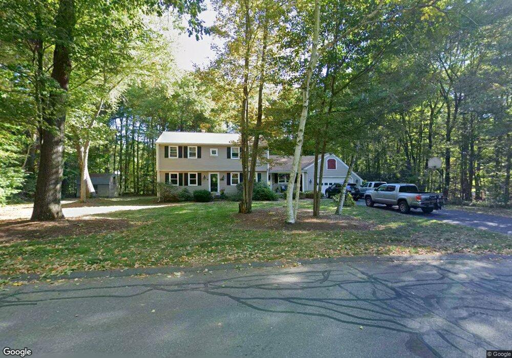
10 Edward Ave Southampton, MA 01073
Estimated Value: $546,818 - $670,000
4
Beds
2
Baths
2,088
Sq Ft
$279/Sq Ft
Est. Value
About This Home
This home is located at 10 Edward Ave, Southampton, MA 01073 and is currently estimated at $582,455, approximately $278 per square foot. 10 Edward Ave is a home located in Hampshire County with nearby schools including William E Norris School, Hilltown Cooperative Charter Public School, and Calvary Baptist Christian School.
Ownership History
Date
Name
Owned For
Owner Type
Purchase Details
Closed on
Jun 26, 1998
Sold by
Robicheau Edmond J
Bought by
Reardon Patricia M and Reardon Peter W
Current Estimated Value
Purchase Details
Closed on
Sep 12, 1997
Sold by
Merchant James M and Merchant Linda A
Bought by
Robicheau Ii Edmond J
Create a Home Valuation Report for This Property
The Home Valuation Report is an in-depth analysis detailing your home's value as well as a comparison with similar homes in the area
Home Values in the Area
Average Home Value in this Area
Purchase History
| Date | Buyer | Sale Price | Title Company |
|---|---|---|---|
| Reardon Patricia M | $187,000 | -- | |
| Robicheau Ii Edmond J | $183,000 | -- |
Source: Public Records
Mortgage History
| Date | Status | Borrower | Loan Amount |
|---|---|---|---|
| Open | Robicheau Ii Edmond J | $35,000 | |
| Open | Robicheau Ii Edmond J | $182,500 |
Source: Public Records
Tax History Compared to Growth
Tax History
| Year | Tax Paid | Tax Assessment Tax Assessment Total Assessment is a certain percentage of the fair market value that is determined by local assessors to be the total taxable value of land and additions on the property. | Land | Improvement |
|---|---|---|---|---|
| 2025 | $6,042 | $426,400 | $116,400 | $310,000 |
| 2024 | $5,877 | $412,400 | $116,400 | $296,000 |
| 2023 | $5,483 | $382,600 | $116,400 | $266,200 |
| 2022 | $5,294 | $351,300 | $116,000 | $235,300 |
| 2021 | $4,885 | $305,900 | $106,900 | $199,000 |
| 2020 | $3,368 | $310,700 | $106,900 | $203,800 |
| 2019 | $4,800 | $294,300 | $106,900 | $187,400 |
| 2018 | $4,528 | $270,800 | $95,700 | $175,100 |
| 2017 | $4,419 | $270,800 | $95,700 | $175,100 |
| 2015 | $4,129 | $262,800 | $86,900 | $175,900 |
Source: Public Records
Map
Nearby Homes
- 0 Glendale Rd
- 72 Glendale Rd
- 12 Kingsberry Ln
- 10 Golden Cir
- 12 Golden Cir
- 31 Lead Mine Rd
- 38 College Hwy
- 29 Rattle Hill Rd
- 36 Torrey St
- 6 Nicols Way Unit 6
- 18 Nicols Way Unit 18
- 12 Nicols Way Unit 12
- 75 Lead Mine Rd
- M143 &152 Glendale St
- 2 Little St
- 385 Main St
- 262 Loudville Rd
- 41 South St Unit 11
- 33 Howard Ave
- 125 Park St