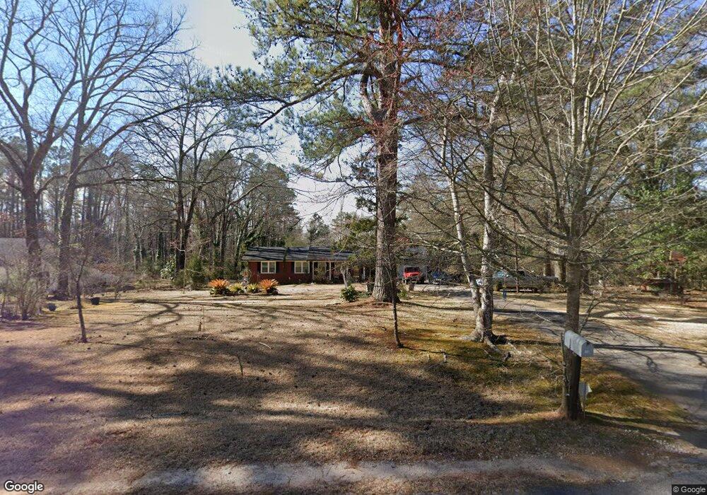
10 Fern Rd Unit I Stockbridge, GA 30281
Estimated Value: $221,312 - $257,000
3
Beds
2
Baths
1,496
Sq Ft
$158/Sq Ft
Est. Value
About This Home
This home is located at 10 Fern Rd Unit I, Stockbridge, GA 30281 and is currently estimated at $236,828, approximately $158 per square foot. 10 Fern Rd Unit I is a home located in Henry County with nearby schools including Woodland Elementary School, Woodland Middle School, and Woodland High School.
Ownership History
Date
Name
Owned For
Owner Type
Purchase Details
Closed on
Jun 13, 2002
Sold by
Hud
Bought by
Harris Stanley M and Harris Coleen R
Current Estimated Value
Home Financials for this Owner
Home Financials are based on the most recent Mortgage that was taken out on this home.
Original Mortgage
$103,000
Outstanding Balance
$43,427
Interest Rate
6.77%
Mortgage Type
New Conventional
Estimated Equity
$193,401
Purchase Details
Closed on
Apr 30, 1999
Sold by
Chambers Essie
Bought by
Pain Joseph M and Pain Cindy L
Home Financials for this Owner
Home Financials are based on the most recent Mortgage that was taken out on this home.
Original Mortgage
$89,550
Interest Rate
7%
Mortgage Type
FHA
Create a Home Valuation Report for This Property
The Home Valuation Report is an in-depth analysis detailing your home's value as well as a comparison with similar homes in the area
Home Values in the Area
Average Home Value in this Area
Purchase History
| Date | Buyer | Sale Price | Title Company |
|---|---|---|---|
| Harris Stanley M | -- | -- | |
| Pain Joseph M | $90,000 | -- |
Source: Public Records
Mortgage History
| Date | Status | Borrower | Loan Amount |
|---|---|---|---|
| Open | Harris Stanley M | $103,000 | |
| Previous Owner | Pain Joseph M | $89,550 |
Source: Public Records
Tax History Compared to Growth
Tax History
| Year | Tax Paid | Tax Assessment Tax Assessment Total Assessment is a certain percentage of the fair market value that is determined by local assessors to be the total taxable value of land and additions on the property. | Land | Improvement |
|---|---|---|---|---|
| 2025 | $2,314 | $86,080 | $14,000 | $72,080 |
| 2024 | $2,314 | $82,320 | $14,000 | $68,320 |
| 2023 | $1,769 | $80,960 | $12,000 | $68,960 |
| 2022 | $2,049 | $71,440 | $10,000 | $61,440 |
| 2021 | $1,655 | $54,760 | $10,000 | $44,760 |
| 2020 | $1,494 | $47,960 | $8,000 | $39,960 |
| 2019 | $1,371 | $42,760 | $8,000 | $34,760 |
| 2018 | $1,273 | $39,200 | $8,000 | $31,200 |
| 2016 | $1,035 | $33,000 | $8,000 | $25,000 |
| 2015 | $683 | $23,560 | $6,000 | $17,560 |
| 2014 | $648 | $22,560 | $6,000 | $16,560 |
Source: Public Records
Map
Nearby Homes
- 95 Fern Ct
- 65 Wynfield Dr
- 830 Anna Kathryn Dr
- 811 Anna Kathryn Dr
- 831 Anna Kathryn Dr
- 813 Anna Kathryn Dr
- 805 Anna Kathryn Dr
- 825 Anna Kathryn Dr
- 809 Anna Kathryn Dr
- 807 Anna Kathryn Dr
- 829 Anna Kathryn Dr
- 176 Swan Lake Dr
- 0 Freeman Dr Unit 128 10480940
- 0 Freeman #128 Dr
- 1527 Old Conyers Rd Unit 4
- 0 Flakes Rd Unit 24
- 125 Johnsons Walk Unit 2
- 293 Ironwood Dr
- 719 Erin Dr
- 110 Wildwood Dr
- 20 Fern Rd
- 20 Fern Rd
- 1926 Old Conyers Rd
- 0 Fern Cir Unit 7299931
- 5 Fern Rd
- 15 Fern Cir
- 15 Fern Rd
- 5 Fern Cir
- 1894 Old Conyers Rd
- 30 Fern Rd
- 1956 Old Conyers Rd
- 25 Fern Rd
- 25 Fern Cir
- 35 Fern Rd
- 1909 Old Conyers Rd
- 1937 Old Conyers Rd
- 60 Fern Rd
- 1957 Old Conyers Rd Unit 1
- 1982 Old Conyers Rd
- 1887 Old Conyers Rd