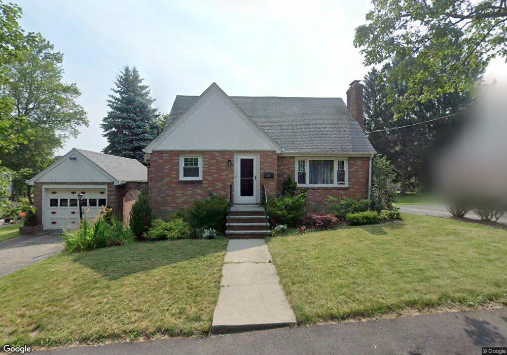
10 Frederick St Quincy, MA 02169
Estimated Value: $488,000 - $585,893
3
Beds
1
Bath
1,216
Sq Ft
$437/Sq Ft
Est. Value
About This Home
This home is located at 10 Frederick St, Quincy, MA 02169 and is currently estimated at $531,473, approximately $437 per square foot. 10 Frederick St is a home located in Norfolk County with nearby schools including South West Middle School, Lincoln-Hancock Community School, and Quincy High School.
Ownership History
Date
Name
Owned For
Owner Type
Purchase Details
Closed on
Jul 12, 2013
Sold by
Jurusz Anne M Est
Bought by
Longhurst John L
Current Estimated Value
Home Financials for this Owner
Home Financials are based on the most recent Mortgage that was taken out on this home.
Original Mortgage
$220,875
Outstanding Balance
$159,996
Interest Rate
3.83%
Mortgage Type
New Conventional
Estimated Equity
$371,477
Create a Home Valuation Report for This Property
The Home Valuation Report is an in-depth analysis detailing your home's value as well as a comparison with similar homes in the area
Purchase History
| Date | Buyer | Sale Price | Title Company |
|---|---|---|---|
| Longhurst John L | $232,500 | -- | |
| Longhurst John L | $232,500 | -- |
Source: Public Records
Mortgage History
| Date | Status | Borrower | Loan Amount |
|---|---|---|---|
| Open | Longhurst John L | $220,875 | |
| Closed | Longhurst John L | $220,875 |
Source: Public Records
Tax History
| Year | Tax Paid | Tax Assessment Tax Assessment Total Assessment is a certain percentage of the fair market value that is determined by local assessors to be the total taxable value of land and additions on the property. | Land | Improvement |
|---|---|---|---|---|
| 2025 | $6,282 | $544,800 | $289,600 | $255,200 |
| 2024 | $5,960 | $528,800 | $275,800 | $253,000 |
| 2023 | $5,559 | $499,500 | $262,700 | $236,800 |
| 2022 | $5,199 | $434,000 | $210,100 | $223,900 |
| 2021 | $5,172 | $426,000 | $210,100 | $215,900 |
| 2020 | $5,156 | $414,800 | $210,100 | $204,700 |
| 2019 | $4,829 | $384,800 | $204,000 | $180,800 |
| 2018 | $4,833 | $362,300 | $188,900 | $173,400 |
| 2017 | $4,646 | $327,900 | $179,900 | $148,000 |
| 2016 | $4,347 | $302,700 | $163,500 | $139,200 |
| 2015 | $4,205 | $288,000 | $154,300 | $133,700 |
| 2014 | $3,957 | $266,300 | $154,300 | $112,000 |
Source: Public Records
Map
Nearby Homes
- 211 West St Unit 11B
- 510 Willard St
- 459 Willard St Unit 303
- 9 Westford St
- 25 McDonald St
- 211 Copeland St
- 87 Village Dr
- 39 Cross St
- 40 Cross St Unit 1
- 132 Centre St
- 51 Branch St Unit 2
- 51 Branch St Unit 3
- 230 Willard St Unit 102
- 12 Nelson St
- 21 Arthur St
- 91 Garfield St
- 21 Totman St Unit 205
- 21 Totman St Unit 404
- 21 Totman St Unit 309
- 21 Totman St Unit 409
- 16 Frederick St
- 4 Frederick St
- 15 Helene St
- 9 Helene St
- 9 Frederick St
- 3 Frederick St
- 23 Helene St
- 22 Frederick St
- 15 Frederick St
- 5 Helene St
- 110 Bunker Hill Ln
- 14 Helene St
- 114 Bunker Hill Ln
- 124 Bunker Hill Ln
- 22 Helene St
- 106 Bunker Hill Ln
- 8 Helene St
- 136 Bunker Hill Ln
- 571 Willard St Unit 2
- 571 Willard St
Your Personal Tour Guide
Ask me questions while you tour the home.