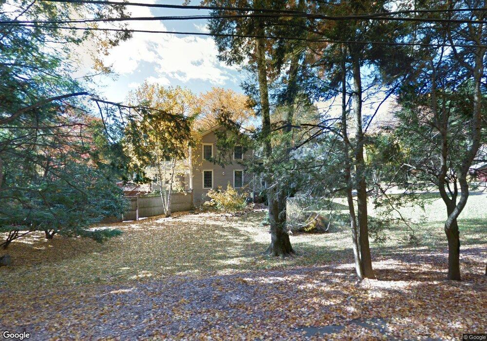
10 High Meadow Rd Weston, CT 06883
Estimated Value: $1,497,000 - $1,658,478
4
Beds
5
Baths
3,362
Sq Ft
$469/Sq Ft
Est. Value
About This Home
This home is located at 10 High Meadow Rd, Weston, CT 06883 and is currently estimated at $1,578,370, approximately $469 per square foot. 10 High Meadow Rd is a home located in Fairfield County with nearby schools including Hurlbutt Elementary School, Weston Intermediate School, and Weston Middle School.
Ownership History
Date
Name
Owned For
Owner Type
Purchase Details
Closed on
Jul 10, 2019
Sold by
Dibartholomeo Lori
Bought by
Berg Rebecca and Solano Javier
Current Estimated Value
Home Financials for this Owner
Home Financials are based on the most recent Mortgage that was taken out on this home.
Original Mortgage
$820,000
Outstanding Balance
$719,571
Interest Rate
3.9%
Mortgage Type
Purchase Money Mortgage
Estimated Equity
$858,799
Purchase Details
Closed on
Mar 11, 2010
Sold by
Dibartholomeo Thomas J
Bought by
Dibartholomeo Lori E
Purchase Details
Closed on
Mar 8, 2010
Sold by
Dibartholomeo Lori E
Bought by
Dibartholomeo Lori E and Dibartholomeo Thomas J
Purchase Details
Closed on
May 1, 1997
Sold by
Pandelos Michael and Pandelos Antje
Bought by
Dibartholomeo Thomas and Dibartholomeo Lori
Create a Home Valuation Report for This Property
The Home Valuation Report is an in-depth analysis detailing your home's value as well as a comparison with similar homes in the area
Home Values in the Area
Average Home Value in this Area
Purchase History
| Date | Buyer | Sale Price | Title Company |
|---|---|---|---|
| Berg Rebecca | $1,025,000 | -- | |
| Dibartholomeo Lori E | -- | -- | |
| Dibartholomeo Lori E | -- | -- | |
| Dibartholomeo Thomas | $485,000 | -- |
Source: Public Records
Mortgage History
| Date | Status | Borrower | Loan Amount |
|---|---|---|---|
| Open | Berg Rebecca | $820,000 | |
| Previous Owner | Dibartholomeo Thomas | $100,000 | |
| Previous Owner | Dibartholomeo Thomas | $845,000 |
Source: Public Records
Tax History Compared to Growth
Tax History
| Year | Tax Paid | Tax Assessment Tax Assessment Total Assessment is a certain percentage of the fair market value that is determined by local assessors to be the total taxable value of land and additions on the property. | Land | Improvement |
|---|---|---|---|---|
| 2025 | $18,413 | $770,420 | $235,900 | $534,520 |
| 2024 | $18,082 | $770,420 | $235,900 | $534,520 |
| 2023 | $17,686 | $534,970 | $235,900 | $299,070 |
| 2022 | $17,638 | $534,970 | $235,900 | $299,070 |
| 2021 | $17,611 | $534,970 | $235,900 | $299,070 |
| 2020 | $17,317 | $534,970 | $235,900 | $299,070 |
| 2019 | $17,317 | $534,970 | $235,900 | $299,070 |
| 2018 | $17,032 | $579,500 | $262,500 | $317,000 |
| 2017 | $16,753 | $579,500 | $262,500 | $317,000 |
| 2016 | $16,551 | $579,500 | $262,500 | $317,000 |
| 2015 | $16,614 | $579,500 | $262,500 | $317,000 |
| 2014 | $16,365 | $579,500 | $262,500 | $317,000 |
Source: Public Records
Map
Nearby Homes
- 17 Huckleberry Ln
- 31 Riverfield Dr
- 4 Good Hill Rd
- 31 White Birch Rd
- 1 Greenlea Ln
- 32 Kettle Creek Rd
- 9 Greenbrier Rd
- 14 Northfield Dr
- 136 Lyons Plain Rd
- 30 Cavalry Rd
- 56 Charcoal Hill Rd
- 40 Hermit Ln
- 145 Lyons Plain Rd
- 24 Nordholm Dr
- 81 Norfield Rd
- 4A Newtown Turnpike
- 24 Warnock Dr
- 87 Red Coat Rd
- 21 Warnock Dr
- 25 Hermit Ln
- 7 High Meadow Rd
- 11 High Meadow Rd
- 24 Coley Dr
- 18 High Meadow Rd
- 38 Coley Dr
- 28 Lyons Plain Rd
- 15 High Meadow Rd
- 18 Lyons Plain Rd
- 25 Coley Dr
- 19 Lyons Plain Rd
- 0 Lyons Plain Rd
- 16 Coley Dr
- 19 Coley Dr
- 1 Arrowhead Way
- 13 Lyons Plain Rd
- 38 Lyons Plain Rd
- 00 Arrowhead Way
- 3 North Ave
- 3 North Ave
- 17 Coley Dr