Estimated Value: $623,000 - $705,015
4
Beds
3
Baths
1,946
Sq Ft
$344/Sq Ft
Est. Value
About This Home
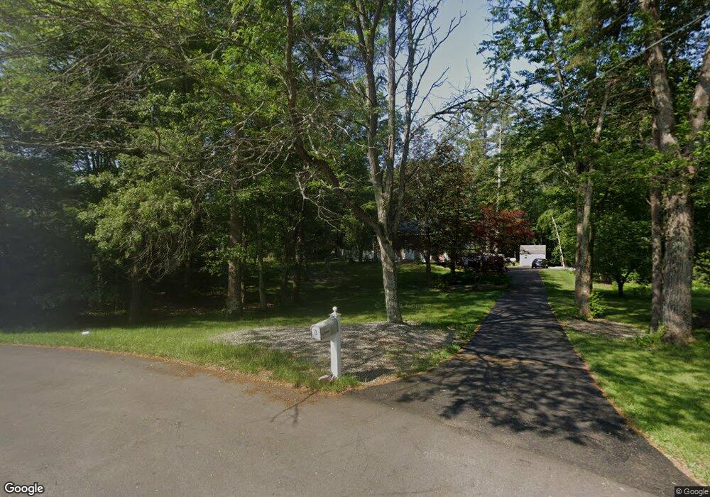
This home is located at 10 Independence Ave, Derry, NH 03038 and is currently estimated at $669,504, approximately $344 per square foot. 10 Independence Ave is a home located in Rockingham County with nearby schools including South Range Elementary School, West Running Brook Middle School, and Pinkerton Academy.
Ownership History
Date
Name
Owned For
Owner Type
Purchase Details
Closed on
Nov 19, 2010
Sold by
Rbs Citizens Bank Na
Bought by
Francis Matthew P
Current Estimated Value
Home Financials for this Owner
Home Financials are based on the most recent Mortgage that was taken out on this home.
Original Mortgage
$180,400
Outstanding Balance
$119,207
Interest Rate
4.3%
Mortgage Type
Purchase Money Mortgage
Estimated Equity
$550,297
Purchase Details
Closed on
May 12, 2009
Sold by
Oconnell James P
Bought by
Rbs Citizens Bank Na
Create a Home Valuation Report for This Property
The Home Valuation Report is an in-depth analysis detailing your home's value as well as a comparison with similar homes in the area
Home Values in the Area
Average Home Value in this Area
Purchase History
| Date | Buyer | Sale Price | Title Company |
|---|---|---|---|
| Francis Matthew P | $225,500 | -- | |
| Rbs Citizens Bank Na | $188,300 | -- |
Source: Public Records
Mortgage History
| Date | Status | Borrower | Loan Amount |
|---|---|---|---|
| Open | Rbs Citizens Bank Na | $180,400 |
Source: Public Records
Tax History
| Year | Tax Paid | Tax Assessment Tax Assessment Total Assessment is a certain percentage of the fair market value that is determined by local assessors to be the total taxable value of land and additions on the property. | Land | Improvement |
|---|---|---|---|---|
| 2024 | $10,581 | $566,145 | $209,745 | $356,400 |
| 2023 | $9,449 | $456,924 | $178,324 | $278,600 |
| 2022 | $8,700 | $456,924 | $178,324 | $278,600 |
| 2021 | $8,187 | $330,642 | $136,442 | $194,200 |
| 2020 | $8,048 | $330,642 | $136,442 | $194,200 |
| 2019 | $7,614 | $291,500 | $95,900 | $195,600 |
| 2018 | $7,918 | $291,490 | $95,890 | $195,600 |
| 2017 | $7,678 | $266,053 | $86,153 | $179,900 |
| 2016 | $7,199 | $266,053 | $86,153 | $179,900 |
| 2015 | $6,967 | $238,353 | $86,153 | $152,200 |
| 2014 | $7,012 | $238,353 | $86,153 | $152,200 |
| 2013 | $7,056 | $224,084 | $81,384 | $142,700 |
Source: Public Records
Map
Nearby Homes
- 5 Hidden Valley Rd
- 16 Towne Dr
- 41 Derryfield Rd
- 44 Sheffield Way Unit 6B
- 2 Mulberry St
- 6 Michael Ave
- 42 Kendall Pond Rd
- 106 N Lowell Rd
- 8 Blueberry Rd Unit U: R
- 5 Elise Ave Unit Lot 94
- 30 Kendall Pond Rd Unit 77
- 30 Kendall Pond Rd Unit 87
- 68 Fordway Extension
- 14 Reed St
- 4 Norman Dr Unit L
- 65 Fordway Extension
- 12 Elise Ave Unit 6
- 14 Elise Ave Unit 7
- 16 Elise Ave Unit Lot 8
- 5 Craven Terrace
- 12 Independence Ave
- 8 Independence Ave
- 7 Independence Ave
- 5 Independence Ave
- 6 Independence Ave
- 3 Independence Ave
- 4 Independence Ave
- 1 Independence Ave
- 2 Independence Ave
- 150 Fordway Extension
- 15 Beacon Hill Rd
- 13 Beacon Hill Rd
- 17 Beacon Hill Rd
- 152 Fordway Extension
- 19 Beacon Hill Rd
- 11 Beacon Hill Rd
- 21 Beacon Hill Rd
- 29 Beacon Hill Rd
- 23 Beacon Hill Rd
- 158 Fordway Extension
Your Personal Tour Guide
Ask me questions while you tour the home.