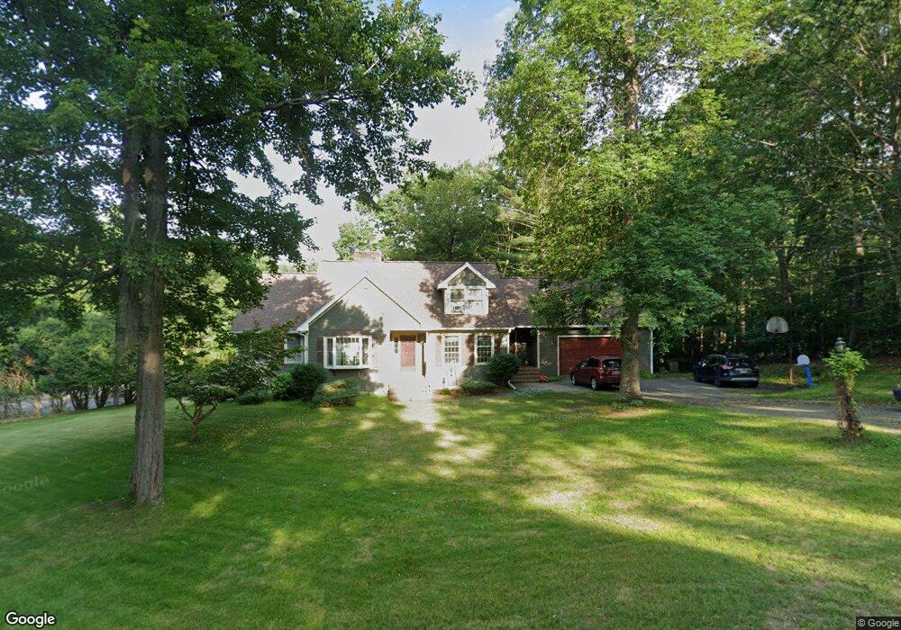
10 Independence Dr Salem, NH 03079
Arlington Pond NeighborhoodEstimated Value: $817,000 - $842,000
4
Beds
4
Baths
2,764
Sq Ft
$302/Sq Ft
Est. Value
About This Home
This home is located at 10 Independence Dr, Salem, NH 03079 and is currently estimated at $834,173, approximately $301 per square foot. 10 Independence Dr is a home located in Rockingham County with nearby schools including North Salem Elementary School, Woodbury School, and Salem High School.
Ownership History
Date
Name
Owned For
Owner Type
Purchase Details
Closed on
Mar 29, 2023
Sold by
Silloway Roger D and Silloway Tracy V
Bought by
Silloway Ft
Current Estimated Value
Purchase Details
Closed on
Oct 19, 2001
Sold by
Mckechnie Robert J and Mckechnie Barbara A
Bought by
Silloway Roger D and Silloway Tracy
Home Financials for this Owner
Home Financials are based on the most recent Mortgage that was taken out on this home.
Original Mortgage
$239,900
Interest Rate
6.92%
Create a Home Valuation Report for This Property
The Home Valuation Report is an in-depth analysis detailing your home's value as well as a comparison with similar homes in the area
Home Values in the Area
Average Home Value in this Area
Purchase History
| Date | Buyer | Sale Price | Title Company |
|---|---|---|---|
| Silloway Ft | -- | None Available | |
| Silloway Roger D | $369,900 | -- |
Source: Public Records
Mortgage History
| Date | Status | Borrower | Loan Amount |
|---|---|---|---|
| Previous Owner | Silloway Roger D | $199,000 | |
| Previous Owner | Silloway Roger D | $239,900 |
Source: Public Records
Tax History Compared to Growth
Tax History
| Year | Tax Paid | Tax Assessment Tax Assessment Total Assessment is a certain percentage of the fair market value that is determined by local assessors to be the total taxable value of land and additions on the property. | Land | Improvement |
|---|---|---|---|---|
| 2024 | $11,688 | $664,100 | $248,300 | $415,800 |
| 2023 | $11,263 | $664,100 | $248,300 | $415,800 |
| 2022 | $10,659 | $664,100 | $248,300 | $415,800 |
| 2021 | $10,612 | $664,100 | $248,300 | $415,800 |
| 2020 | $9,836 | $446,700 | $177,400 | $269,300 |
| 2019 | $9,818 | $446,700 | $177,400 | $269,300 |
| 2018 | $9,653 | $446,700 | $177,400 | $269,300 |
| 2017 | $9,309 | $446,700 | $177,400 | $269,300 |
| 2016 | $9,126 | $446,700 | $177,400 | $269,300 |
| 2015 | $8,239 | $385,200 | $173,100 | $212,100 |
| 2014 | $8,008 | $385,200 | $173,100 | $212,100 |
| 2013 | $7,881 | $385,200 | $173,100 | $212,100 |
Source: Public Records
Map
Nearby Homes
- 8 Independence Dr
- 9 Independence Dr
- 2 Tilton Terrace
- 11 Independence Dr
- 7 Independence Dr
- 12 Independence Dr
- 6 Independence Dr
- 13 Independence Dr
- 5 Independence Dr
- 15 Independence Dr
- 16 Independence Dr
- 3 Tilton Terrace
- 17 Independence Dr
- 3 Independence Dr
- 334 N Main St
- 7 Tilton Terrace
- 5 Tilton Terrace
- 328 N Main St
- 18 Independence Dr
- 36 Norwood Rd