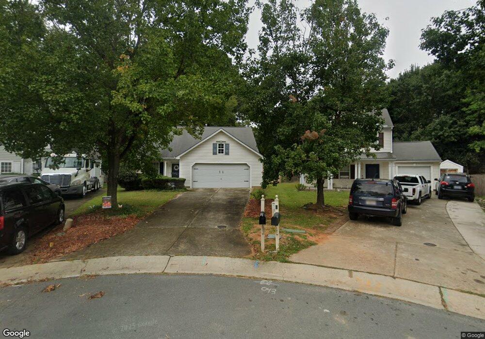
10 Kitty Hawk Ct Durham, NC 27703
Eastern Durham NeighborhoodEstimated Value: $289,000 - $313,000
3
Beds
2
Baths
1,171
Sq Ft
$261/Sq Ft
Est. Value
About This Home
This home is located at 10 Kitty Hawk Ct, Durham, NC 27703 and is currently estimated at $305,558, approximately $260 per square foot. 10 Kitty Hawk Ct is a home located in Durham County with nearby schools including Bethesda Elementary School, John W Neal Middle School, and Southern School of Energy & Sustainability.
Ownership History
Date
Name
Owned For
Owner Type
Purchase Details
Closed on
Dec 19, 2007
Sold by
Dowd Christopher J and Dowd Jessica E
Bought by
Hembrick Donna
Current Estimated Value
Home Financials for this Owner
Home Financials are based on the most recent Mortgage that was taken out on this home.
Original Mortgage
$135,000
Outstanding Balance
$85,095
Interest Rate
6.22%
Mortgage Type
Purchase Money Mortgage
Estimated Equity
$220,463
Purchase Details
Closed on
Dec 10, 2002
Sold by
Anderson Homes Inc
Bought by
Dowd Christopher J and Dowd Jessica E
Home Financials for this Owner
Home Financials are based on the most recent Mortgage that was taken out on this home.
Original Mortgage
$119,704
Interest Rate
5.92%
Mortgage Type
FHA
Create a Home Valuation Report for This Property
The Home Valuation Report is an in-depth analysis detailing your home's value as well as a comparison with similar homes in the area
Home Values in the Area
Average Home Value in this Area
Purchase History
| Date | Buyer | Sale Price | Title Company |
|---|---|---|---|
| Hembrick Donna | $135,000 | None Available | |
| Dowd Christopher J | $121,000 | -- |
Source: Public Records
Mortgage History
| Date | Status | Borrower | Loan Amount |
|---|---|---|---|
| Open | Hembrick Donna | $135,000 | |
| Previous Owner | Dowd Christopher J | $119,704 |
Source: Public Records
Tax History Compared to Growth
Tax History
| Year | Tax Paid | Tax Assessment Tax Assessment Total Assessment is a certain percentage of the fair market value that is determined by local assessors to be the total taxable value of land and additions on the property. | Land | Improvement |
|---|---|---|---|---|
| 2025 | $2,838 | $286,337 | $84,000 | $202,337 |
| 2024 | $2,251 | $161,399 | $44,887 | $116,512 |
| 2023 | $2,114 | $161,399 | $44,887 | $116,512 |
| 2022 | $2,066 | $161,399 | $44,887 | $116,512 |
| 2021 | $2,056 | $161,399 | $44,887 | $116,512 |
| 2020 | $2,008 | $161,399 | $44,887 | $116,512 |
| 2019 | $2,008 | $161,399 | $44,887 | $116,512 |
| 2018 | $1,783 | $131,470 | $26,932 | $104,538 |
| 2017 | $1,770 | $131,470 | $26,932 | $104,538 |
| 2016 | $1,711 | $131,470 | $26,932 | $104,538 |
| 2015 | $1,803 | $130,216 | $36,563 | $93,653 |
| 2014 | $1,803 | $130,216 | $36,563 | $93,653 |
Source: Public Records
Map
Nearby Homes
- 802 Lynn Rd
- 806 Lindley Dr
- 3323 Nantuckett Ave
- 3330 Nantuckett Ave
- 1218 Kendall Dr
- 806 Kendall Dr
- 3533 Gibson Rd
- 2934 Carolyn Dr
- 335 Pleasant Dr
- 428 Walton St
- 519 Pleasant Dr
- 308 Lynn Rd
- 3503 Grimes Ave
- 1006 Spacious Skies Ln
- 1015 Sora Way
- 1030 Thoughtful Spot Ln
- 2072 Tanners Mill Dr
- 613 Midway Ave
- 2036 October Dr
- 102 Harvest Oaks Ln Unit 38
- 8 Kitty Hawk Ct
- 11 Kitty Hawk Ct
- 6 Kitty Hawk Ct
- 9 Kitty Hawk Ct
- 3100 Gibson Rd
- 7 Kitty Hawk Ct
- 902 Stennis Way
- 904 Stennis Way
- 906 Stennis Way
- 5 Kitty Hawk Ct
- 1002 Stennis Way
- 1004 Stennis Way
- 3007 Forrestal Dr
- 3009 Forrestal Dr
- 1006 Stennis Way
- 817 Lynn Rd
- 3005 Forrestal Dr
- 822 Lynn Rd
- 903 Stennis Way
- 901 Stennis Way