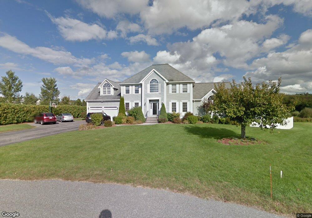
10 Lenox Cir Andover, MA 01810
Haggetts NeighborhoodEstimated Value: $1,289,000 - $1,434,000
4
Beds
3
Baths
3,332
Sq Ft
$411/Sq Ft
Est. Value
About This Home
This home is located at 10 Lenox Cir, Andover, MA 01810 and is currently estimated at $1,368,936, approximately $410 per square foot. 10 Lenox Cir is a home located in Essex County with nearby schools including Henry C. Sanborn Elementary School, Wood Hill Middle School, and Andover High School.
Ownership History
Date
Name
Owned For
Owner Type
Purchase Details
Closed on
Dec 14, 2016
Sold by
Lem John B and Lem Laura
Bought by
Lem Ft and Lem
Current Estimated Value
Purchase Details
Closed on
Oct 9, 1996
Sold by
Bradford Glen Inc
Bought by
Lem John B
Home Financials for this Owner
Home Financials are based on the most recent Mortgage that was taken out on this home.
Original Mortgage
$350,000
Interest Rate
8.06%
Mortgage Type
Purchase Money Mortgage
Create a Home Valuation Report for This Property
The Home Valuation Report is an in-depth analysis detailing your home's value as well as a comparison with similar homes in the area
Home Values in the Area
Average Home Value in this Area
Purchase History
| Date | Buyer | Sale Price | Title Company |
|---|---|---|---|
| Lem Ft | -- | -- | |
| Lem Ft | -- | -- | |
| Lem John B | $425,300 | -- | |
| Lem John B | $425,300 | -- |
Source: Public Records
Mortgage History
| Date | Status | Borrower | Loan Amount |
|---|---|---|---|
| Previous Owner | Lem John B | $250,000 | |
| Previous Owner | Lem John B | $100,000 | |
| Previous Owner | Lem John B | $350,000 | |
| Previous Owner | Lem John B | $350,000 |
Source: Public Records
Tax History Compared to Growth
Tax History
| Year | Tax Paid | Tax Assessment Tax Assessment Total Assessment is a certain percentage of the fair market value that is determined by local assessors to be the total taxable value of land and additions on the property. | Land | Improvement |
|---|---|---|---|---|
| 2024 | $15,509 | $1,204,100 | $498,900 | $705,200 |
| 2023 | $14,588 | $1,067,900 | $426,500 | $641,400 |
| 2022 | $14,012 | $959,700 | $384,400 | $575,300 |
| 2021 | $13,489 | $882,200 | $349,700 | $532,500 |
| 2020 | $13,126 | $874,500 | $349,700 | $524,800 |
| 2019 | $12,947 | $847,900 | $330,000 | $517,900 |
| 2018 | $12,523 | $800,700 | $320,600 | $480,100 |
| 2017 | $12,051 | $793,900 | $314,500 | $479,400 |
| 2016 | $12,059 | $813,700 | $330,900 | $482,800 |
| 2015 | $11,819 | $789,500 | $330,900 | $458,600 |
Source: Public Records
Map
Nearby Homes
- 58 Blanchard St
- 69 Blanchard St
- 22 Haggetts Pond Rd
- 14 Regis Rd
- 14 Geneva Rd
- 15 Geneva Rd
- 4 Hazelwood Cir
- 97 Kendall Rd
- 1170 Livingston St
- 399 North St
- 18 Dale St Unit 4G
- 101 Barry Dr
- 177 Apache Way Unit 177
- 20 Sophie Ruth Way
- 18 Bryan Ln Unit 18
- 13 Berkeley
- 1117 Emerald Ct
- 1224 Emerald Ct
- 43 Patrick Rd
- 995 North St
- 12 Lenox Cir
- 8 Lenox Cir
- 14 Lenox Cir
- 6 Lenox Cir
- 11 Lenox Cir
- 9 Lenox Cir
- 4 Lenox Cir
- 7 Lenox Cir
- 7 Devonshire Place
- 5 Devonshire Place
- 5 Lenox Cir
- 9 Devonshire Place
- 3 Lenox Cir
- 11 Devonshire Place
- 3 Devonshire Place
- 42 Blanchard St
- 36 Blanchard St
- 6 Devonshire Place
- 15 Devonshire Place
- 8 Devonshire Place