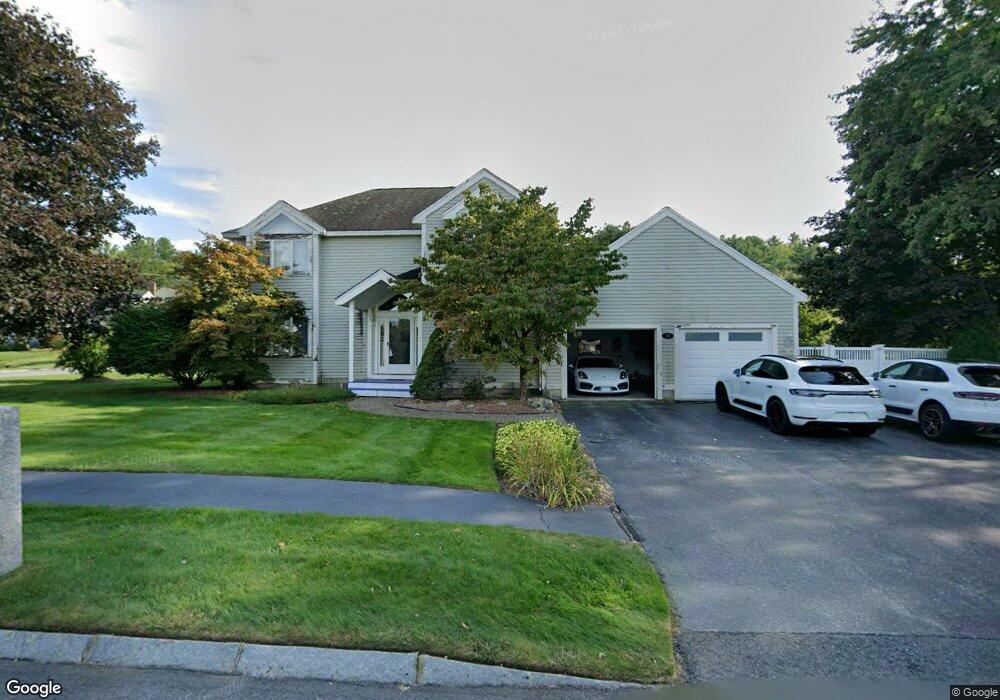
10 Lojko Dr Nashua, NH 03062
Southwest Nashua NeighborhoodEstimated Value: $779,000 - $1,008,000
3
Beds
4
Baths
3,604
Sq Ft
$239/Sq Ft
Est. Value
About This Home
This home is located at 10 Lojko Dr, Nashua, NH 03062 and is currently estimated at $861,286, approximately $238 per square foot. 10 Lojko Dr is a home located in Hillsborough County with nearby schools including Bicentennial Elementary School, Fairgrounds Middle School, and Nashua High School South.
Ownership History
Date
Name
Owned For
Owner Type
Purchase Details
Closed on
Jun 8, 2012
Sold by
Kessel Sari M
Bought by
Robinson Kenneth C
Current Estimated Value
Purchase Details
Closed on
Jun 17, 2005
Sold by
Damelio John A and Damelio Mary C
Bought by
Kessel Sari M
Purchase Details
Closed on
Jan 19, 2001
Sold by
Loken Harlan L and Loken Connie M
Bought by
Damelio John A and Damelio Mary C
Create a Home Valuation Report for This Property
The Home Valuation Report is an in-depth analysis detailing your home's value as well as a comparison with similar homes in the area
Home Values in the Area
Average Home Value in this Area
Purchase History
| Date | Buyer | Sale Price | Title Company |
|---|---|---|---|
| Robinson Kenneth C | $440,000 | -- | |
| Robinson Kenneth C | $440,000 | -- | |
| Kessel Sari M | $505,000 | -- | |
| Kessel Sari M | $505,000 | -- | |
| Damelio John A | $371,000 | -- | |
| Damelio John A | $371,000 | -- |
Source: Public Records
Mortgage History
| Date | Status | Borrower | Loan Amount |
|---|---|---|---|
| Previous Owner | Damelio John A | $374,834 | |
| Previous Owner | Damelio John A | $391,000 | |
| Previous Owner | Damelio John A | $50,000 |
Source: Public Records
Tax History Compared to Growth
Tax History
| Year | Tax Paid | Tax Assessment Tax Assessment Total Assessment is a certain percentage of the fair market value that is determined by local assessors to be the total taxable value of land and additions on the property. | Land | Improvement |
|---|---|---|---|---|
| 2024 | $11,586 | $728,700 | $197,900 | $530,800 |
| 2023 | $10,294 | $564,700 | $110,100 | $454,600 |
| 2022 | $10,204 | $564,700 | $110,100 | $454,600 |
| 2021 | $11,805 | $508,400 | $154,200 | $354,200 |
| 2020 | $11,495 | $508,400 | $154,200 | $354,200 |
| 2019 | $11,063 | $508,400 | $154,200 | $354,200 |
| 2018 | $10,783 | $508,400 | $154,200 | $354,200 |
| 2017 | $10,927 | $423,700 | $142,000 | $281,700 |
| 2016 | $10,622 | $423,700 | $142,000 | $281,700 |
| 2015 | $10,393 | $423,700 | $142,000 | $281,700 |
| 2014 | $10,190 | $423,700 | $142,000 | $281,700 |
Source: Public Records
Map
Nearby Homes
- 32 Cadogan Way Unit UZ257
- 19 Georgetown Dr
- 58 Wilderness Dr
- 8 Hikers Ln
- 65 Wilderness Dr
- 50 Wilderness Dr
- 4 Hikers Ln
- 41 Pinebrook Rd
- 4 Wilderness Dr
- 1 Wilderness Dr
- 7 Doucet Ave
- 63 Wilderness Dr Unit Derby 2
- 79 Wilderness Dr
- 2 Wilderness Dr
- 57 Wilderness Dr
- 6 Wilderness Dr
- 3 Wilderness Dr
- 51 Legacy Dr
- 59 Wilderness Dr
- 7 Wilderness Dr