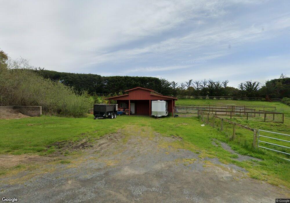
10 Mc Donald Ln Point Reyes Station, CA 94956
Point Reyes NeighborhoodEstimated Value: $1,323,658 - $1,603,000
2
Beds
2
Baths
1,172
Sq Ft
$1,271/Sq Ft
Est. Value
About This Home
This home is located at 10 Mc Donald Ln, Point Reyes Station, CA 94956 and is currently estimated at $1,489,165, approximately $1,270 per square foot. 10 Mc Donald Ln is a home with nearby schools including West Marin Elementary School and Tomales High School.
Ownership History
Date
Name
Owned For
Owner Type
Purchase Details
Closed on
Mar 23, 2017
Sold by
Nichol Charles and Nichol Esther
Bought by
Nichol Charles E and Nichol Esther M
Current Estimated Value
Purchase Details
Closed on
Mar 28, 2012
Sold by
Spoor Robert F
Bought by
Spoor Robert F
Home Financials for this Owner
Home Financials are based on the most recent Mortgage that was taken out on this home.
Original Mortgage
$395,000
Interest Rate
3.91%
Mortgage Type
New Conventional
Purchase Details
Closed on
Mar 19, 2004
Sold by
Spoor Robert F
Bought by
Spoor Robert F
Purchase Details
Closed on
Sep 13, 2000
Sold by
Martin Matthew T and Martin Joann L L
Bought by
Spoor Robert F
Home Financials for this Owner
Home Financials are based on the most recent Mortgage that was taken out on this home.
Original Mortgage
$484,000
Interest Rate
7.87%
Create a Home Valuation Report for This Property
The Home Valuation Report is an in-depth analysis detailing your home's value as well as a comparison with similar homes in the area
Home Values in the Area
Average Home Value in this Area
Purchase History
| Date | Buyer | Sale Price | Title Company |
|---|---|---|---|
| Nichol Charles E | -- | None Available | |
| Spoor Robert F | -- | Stewart Title Of Placer | |
| Spoor Robert F | -- | Stewart Title Of Placer | |
| Spoor Robert F | -- | -- | |
| Spoor Robert F | $605,000 | Old Republic Title Company |
Source: Public Records
Mortgage History
| Date | Status | Borrower | Loan Amount |
|---|---|---|---|
| Previous Owner | Spoor Robert F | $395,000 | |
| Previous Owner | Spoor Robert F | $484,000 | |
| Closed | Spoor Robert F | $60,500 |
Source: Public Records
Tax History Compared to Growth
Tax History
| Year | Tax Paid | Tax Assessment Tax Assessment Total Assessment is a certain percentage of the fair market value that is determined by local assessors to be the total taxable value of land and additions on the property. | Land | Improvement |
|---|---|---|---|---|
| 2025 | $11,001 | $982,470 | $534,889 | $447,581 |
| 2024 | $11,001 | $963,208 | $524,402 | $438,806 |
| 2023 | $10,781 | $944,324 | $514,121 | $430,203 |
| 2022 | $10,664 | $925,813 | $504,043 | $421,770 |
| 2021 | $10,437 | $907,661 | $494,160 | $413,501 |
| 2020 | $10,434 | $898,355 | $489,094 | $409,261 |
| 2019 | $10,148 | $880,743 | $479,505 | $401,238 |
| 2018 | $9,938 | $863,477 | $470,105 | $393,372 |
| 2017 | $9,687 | $846,549 | $460,889 | $385,660 |
| 2016 | $9,256 | $829,955 | $451,854 | $378,101 |
| 2015 | $9,245 | $817,493 | $445,070 | $372,423 |
| 2014 | $8,927 | $801,486 | $436,355 | $365,131 |
Source: Public Records
Map
Nearby Homes
- 7 Linsdale Ln
- 10 Lorraine Ave
- 11160 Sir Francis Drake Blvd
- 11150 Sir Francis Drake Blvd
- 10905 State Route 1
- 0 Douglas Dr
- 1 Dover Rd
- 0 W Robert Dr
- 70 Fox Dr
- 12847 Sir Francis Drake Blvd
- 50 Dundee Way
- 10 Miwok Way
- 215 Via de la Vista
- 531 Via de la Vista
- 17523 California 1
- 200 Road To Ranch
- 1208 Pierce Point Rd
- 1401 Nicasio Valley Rd
- 00 Mountain King Rd
- 0 Lucas Valley Rd
- 12088 State Route 1 None
- 12088 State Route 1 Unkn
- 12075 State Highway 1
- 12086 State Route 1
- 12075 State Route 1 Unkn
- 91 Cypress Dr
- 20 McDonald Ln
- 12071 State Route 1
- 86 Cypress Dr
- 12073 State Route 1
- 12036 State Route 1
- 5 Paige Walk Unkn
- 12430 State Route 1
- 12040 State Route 1
- 15 Mc Donald Ln
- 11975 State Route 1
- 11975 California 1
- 10 Mesa Ave
- 85 Cypress Dr
