Estimated Value: $662,871 - $764,000
1
Bed
2
Baths
2,256
Sq Ft
$318/Sq Ft
Est. Value
About This Home
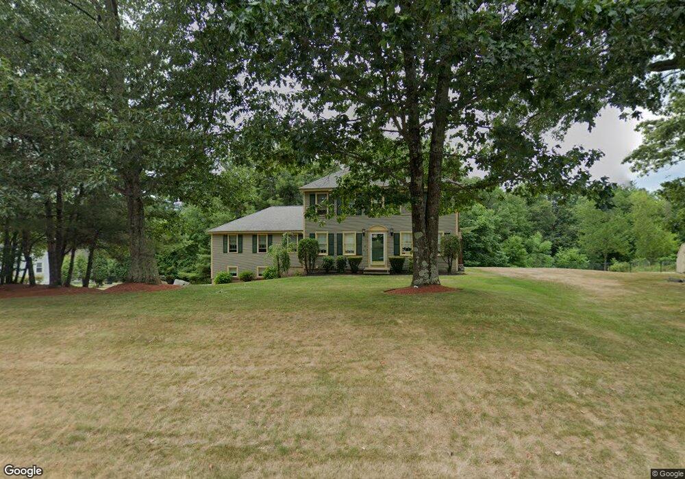
This home is located at 10 Merriam Way, Upton, MA 01568 and is currently estimated at $717,968, approximately $318 per square foot. 10 Merriam Way is a home located in Worcester County with nearby schools including Nipmuc Regional High School.
Ownership History
Date
Name
Owned For
Owner Type
Purchase Details
Closed on
Aug 19, 2023
Sold by
Costello Thomas P and Costello Ann T
Bought by
Costello Thomas P
Current Estimated Value
Purchase Details
Closed on
May 24, 2023
Sold by
Costello Thomas P and Costello Ann T
Bought by
Costello Thomas P and Morin Ann T
Purchase Details
Closed on
Aug 23, 1990
Sold by
Warren St Nominee Rt
Bought by
Costello Thomas
Home Financials for this Owner
Home Financials are based on the most recent Mortgage that was taken out on this home.
Original Mortgage
$125,000
Interest Rate
10.01%
Mortgage Type
Purchase Money Mortgage
Create a Home Valuation Report for This Property
The Home Valuation Report is an in-depth analysis detailing your home's value as well as a comparison with similar homes in the area
Home Values in the Area
Average Home Value in this Area
Purchase History
| Date | Buyer | Sale Price | Title Company |
|---|---|---|---|
| Costello Thomas P | -- | None Available | |
| Costello Thomas P | -- | None Available | |
| Costello Thomas | $164,625 | -- | |
| Costello Thomas | $164,625 | -- |
Source: Public Records
Mortgage History
| Date | Status | Borrower | Loan Amount |
|---|---|---|---|
| Previous Owner | Costello Thomas | $129,000 | |
| Previous Owner | Costello Thomas | $133,700 | |
| Previous Owner | Costello Thomas | $122,000 | |
| Previous Owner | Costello Thomas | $125,000 |
Source: Public Records
Tax History Compared to Growth
Tax History
| Year | Tax Paid | Tax Assessment Tax Assessment Total Assessment is a certain percentage of the fair market value that is determined by local assessors to be the total taxable value of land and additions on the property. | Land | Improvement |
|---|---|---|---|---|
| 2025 | $7,815 | $594,300 | $231,800 | $362,500 |
| 2024 | $7,803 | $570,400 | $225,300 | $345,100 |
| 2023 | $5,726 | $412,800 | $160,900 | $251,900 |
| 2022 | $6,884 | $410,500 | $160,900 | $249,600 |
| 2021 | $7,249 | $436,700 | $196,400 | $240,300 |
| 2020 | $7,275 | $422,500 | $186,700 | $235,800 |
| 2019 | $6,990 | $403,800 | $162,200 | $241,600 |
| 2018 | $6,951 | $403,400 | $168,700 | $234,700 |
| 2017 | $6,975 | $384,100 | $165,500 | $218,600 |
| 2016 | $6,747 | $363,500 | $133,400 | $230,100 |
| 2015 | $6,092 | $359,400 | $133,400 | $226,000 |
| 2014 | $5,899 | $348,000 | $126,800 | $221,200 |
Source: Public Records
Map
Nearby Homes
- 3 Driscoll Ln
- 135 Main St
- 4 Jonathans Way
- 1 Jonathans Way
- 27 Fowler St
- 74 Warren St
- 36 Knowlton Cir Unit 36
- 84 High St
- 13 Plain St
- 3 Stoddard St
- 61 Tulip Cir
- 89 Buttercup Ln Unit 255
- 130 High St
- 49 Grove St
- 27 James Rd Unit 2
- 6 Hickory Ln
- 18 Boot Shop Rd Unit 40
- 15 Shoemaker Ln Unit 7
- 16 Boot Shop Rd Unit 39
- 79-81 Upton St