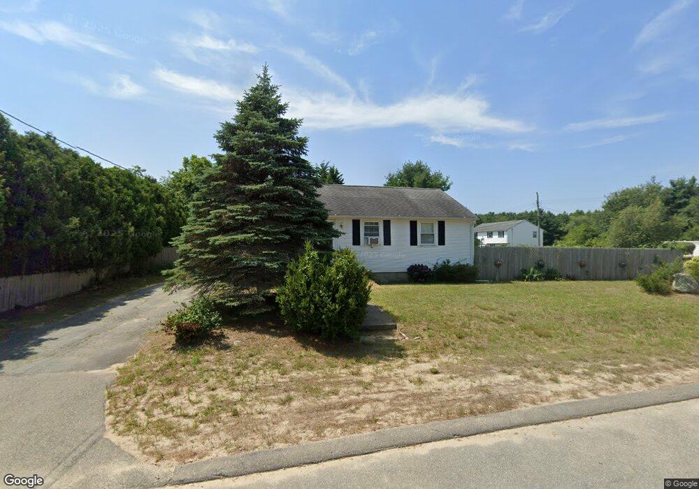
10 Partridge Path Wareham, MA 02571
Estimated Value: $402,529 - $430,000
3
Beds
1
Bath
912
Sq Ft
$455/Sq Ft
Est. Value
About This Home
This home is located at 10 Partridge Path, Wareham, MA 02571 and is currently estimated at $415,382, approximately $455 per square foot. 10 Partridge Path is a home located in Plymouth County.
Ownership History
Date
Name
Owned For
Owner Type
Purchase Details
Closed on
Dec 11, 2018
Sold by
Maxim Thomas B and Maxim Tara M
Bought by
Maxim Thomas B
Current Estimated Value
Home Financials for this Owner
Home Financials are based on the most recent Mortgage that was taken out on this home.
Original Mortgage
$300,000
Outstanding Balance
$261,175
Interest Rate
4.8%
Mortgage Type
FHA
Estimated Equity
$154,207
Purchase Details
Closed on
Jun 15, 2017
Sold by
Maxim Thomas B
Bought by
Maxim Thomas B and Maxim Tara M
Create a Home Valuation Report for This Property
The Home Valuation Report is an in-depth analysis detailing your home's value as well as a comparison with similar homes in the area
Purchase History
| Date | Buyer | Sale Price | Title Company |
|---|---|---|---|
| Maxim Thomas B | -- | -- | |
| Maxim Thomas B | -- | -- | |
| Maxim Thomas B | -- | -- | |
| Maxim Thomas B | -- | -- |
Source: Public Records
Mortgage History
| Date | Status | Borrower | Loan Amount |
|---|---|---|---|
| Open | Maxim Thomas B | $300,000 | |
| Closed | Maxim Thomas B | $300,000 |
Source: Public Records
Tax History
| Year | Tax Paid | Tax Assessment Tax Assessment Total Assessment is a certain percentage of the fair market value that is determined by local assessors to be the total taxable value of land and additions on the property. | Land | Improvement |
|---|---|---|---|---|
| 2025 | $3,325 | $319,100 | $110,000 | $209,100 |
| 2024 | $3,379 | $300,900 | $86,000 | $214,900 |
| 2023 | $3,054 | $269,400 | $78,100 | $191,300 |
| 2022 | $3,054 | $231,700 | $78,100 | $153,600 |
| 2021 | $3,021 | $224,600 | $78,100 | $146,500 |
| 2020 | $2,822 | $212,800 | $78,100 | $134,700 |
| 2019 | $2,709 | $203,800 | $75,300 | $128,500 |
| 2018 | $2,558 | $187,700 | $75,300 | $112,400 |
| 2017 | $2,425 | $180,300 | $75,300 | $105,000 |
| 2016 | $2,214 | $163,600 | $73,000 | $90,600 |
| 2015 | $2,138 | $163,600 | $73,000 | $90,600 |
| 2014 | $2,062 | $160,500 | $69,300 | $91,200 |
Source: Public Records
Map
Nearby Homes
- 2697 Cranberry Hwy Unit 23
- 2711 Cranberry Hwy
- 156 Sandwich Rd
- 2645 Cranberry Hwy Unit A
- 103 Kimberly Ct
- 55 Minot Ave Unit 55
- 110 Mayflower Ridge Dr
- 10 Oak St
- 2838 Cranberry Hwy
- 437 Main St
- 124 Minot Ave Unit 1
- 0 Charge Pond Rd
- 7 Knowles Ave
- 9 Old Glen Charlie Rd
- 106 Circuit Ave
- 91 Agawam Lake Shore Dr
- 102 Maple Springs Rd
- 3 Hazel St
- 6 Bourne Terrace
- 1 Gibbs Ball Park Rd
- 14 Pheasant Ave
- 9 Partridge Path
- 13 Pheasant Ave
- 7 Partridge Path
- 15 Pheasant Ave
- 6 Partridge Path
- 16 Pheasant Ave
- 9 Pheasant Ave
- 5 Partridge Path
- 18 Whipoorwill Way
- 4 Partridge Path
- 16 Whipoorwill Way
- 16 Whippoorwill Way
- 6 Lots Burgess Point Shores
- 0 Beaver Path Unit 20614370
- 0 Beaver Path Unit 70700897
- 0 Minot Ave (Rear) L:1009a Unit 70672788
- 0 Off Hathaway St Unit 70630635
- Lot 7 Sarahbeth Ln
- 14 Whipoorwill Way
Your Personal Tour Guide
Ask me questions while you tour the home.