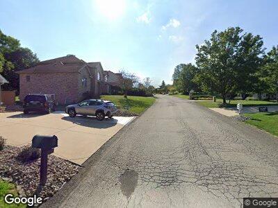
10 Point Cir Trafford, PA 15085
Penn Township NeighborhoodEstimated Value: $416,000 - $502,000
--
Bed
--
Bath
2,578
Sq Ft
$178/Sq Ft
Est. Value
About This Home
This home is located at 10 Point Cir, Trafford, PA 15085 and is currently estimated at $459,333, approximately $178 per square foot. 10 Point Cir is a home with nearby schools including Penn Trafford High School.
Ownership History
Date
Name
Owned For
Owner Type
Purchase Details
Closed on
Mar 12, 2010
Sold by
Long Dianna and Pescatore Frank
Bought by
Dugan William J and Dugan Marci J
Current Estimated Value
Home Financials for this Owner
Home Financials are based on the most recent Mortgage that was taken out on this home.
Original Mortgage
$251,831
Interest Rate
5%
Mortgage Type
FHA
Create a Home Valuation Report for This Property
The Home Valuation Report is an in-depth analysis detailing your home's value as well as a comparison with similar homes in the area
Home Values in the Area
Average Home Value in this Area
Purchase History
| Date | Buyer | Sale Price | Title Company |
|---|---|---|---|
| Dugan William J | $275,000 | None Available |
Source: Public Records
Mortgage History
| Date | Status | Borrower | Loan Amount |
|---|---|---|---|
| Open | Dugan William J | $33,000 | |
| Open | Dugan William J | $271,672 | |
| Closed | Dugan William J | $251,831 | |
| Previous Owner | Long Dianna | $40,000 | |
| Previous Owner | Long Dianna | $337,250 | |
| Previous Owner | Long Dianna | $176,000 | |
| Previous Owner | Long Dianna | $182,158 |
Source: Public Records
Tax History Compared to Growth
Tax History
| Year | Tax Paid | Tax Assessment Tax Assessment Total Assessment is a certain percentage of the fair market value that is determined by local assessors to be the total taxable value of land and additions on the property. | Land | Improvement |
|---|---|---|---|---|
| 2025 | $6,151 | $44,920 | $4,030 | $40,890 |
| 2024 | $6,106 | $44,920 | $4,030 | $40,890 |
| 2023 | $5,792 | $44,920 | $4,030 | $40,890 |
| 2022 | $5,725 | $44,920 | $4,030 | $40,890 |
| 2021 | $5,680 | $44,920 | $4,030 | $40,890 |
| 2020 | $5,635 | $44,920 | $4,030 | $40,890 |
| 2019 | $5,500 | $44,920 | $4,030 | $40,890 |
| 2018 | $5,343 | $44,920 | $4,030 | $40,890 |
| 2017 | $5,208 | $44,920 | $4,030 | $40,890 |
| 2016 | $5,055 | $44,920 | $4,030 | $40,890 |
| 2015 | $5,055 | $44,920 | $4,030 | $40,890 |
| 2014 | $4,965 | $44,920 | $4,030 | $40,890 |
Source: Public Records
Map
Nearby Homes
- 141 Terrace Ct
- 739 Route 130
- 708 State Route 130
- 301 Pine Hollow Rd
- 4092 State Route 130
- 722 Shady Dr
- 703 Meadowbrook Rd
- 102 Olive Dr
- 0 Newell Ln
- 218 Sunrise Dr
- 124 Elm Dr
- 305 Hemlock Rd
- 113 Saunders Station Rd
- 153 Sunrise Dr
- 143 Bradford Square Dr
- 125 Sunrise Dr Unit 2
- 13029 Pine Hollow Road Extension
- 145 Penn Woods Dr
- 233 Saunders Station Rd
- 1426 Lyons Chase Cir
- 10 Point Cir
- 6308 Doe Cir
- 6306 Doe Cir
- 6307 Doe Cir
- 6304 Doe Cir
- 6305 Doe Cir
- 6528 Ten Point Cir
- 6530 Ten Point Cir
- 6526 Ten Point Cir
- 6532 Ten Point Cir
- 6534 Ten Point Cir
- 6302 Doe Cir
- 6303 Doe Cir
- 6540 Ten Point Cir
- 6538 Ten Point Cir
- 10 Point Cir
- 6510 Ten Point Cir
- 6542 Ten Point Cir
- 6522 Ten Point Cir
- 6300 Doe Cir