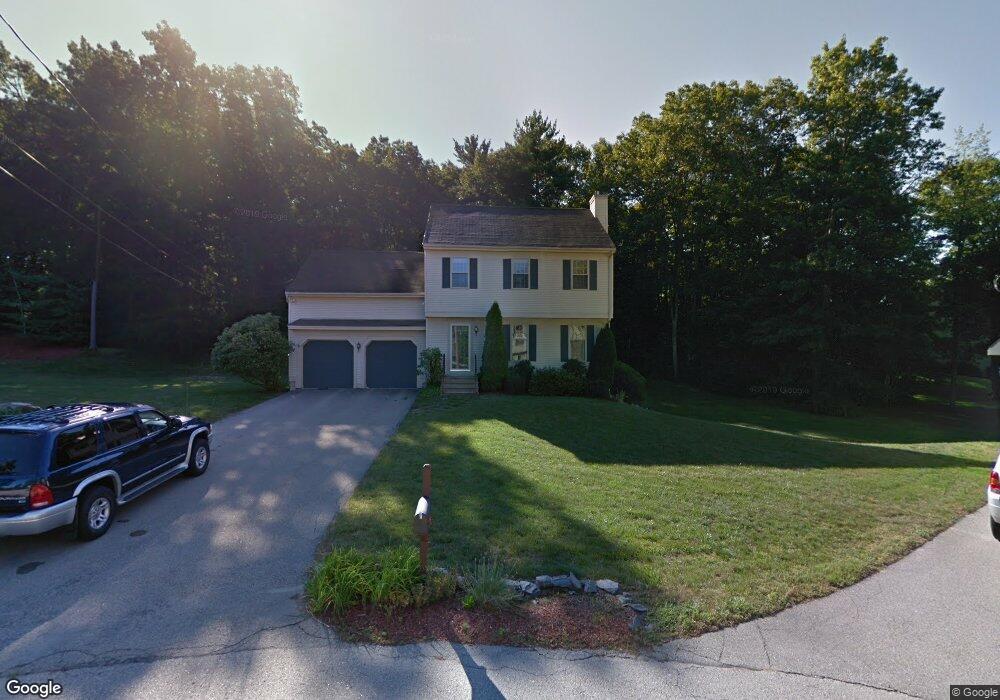
10 Ramsgate Ridge Unit U232 Nashua, NH 03063
Northwest Nashua NeighborhoodEstimated Value: $402,000 - $416,435
2
Beds
2
Baths
1,476
Sq Ft
$279/Sq Ft
Est. Value
About This Home
This home is located at 10 Ramsgate Ridge Unit U232, Nashua, NH 03063 and is currently estimated at $411,109, approximately $278 per square foot. 10 Ramsgate Ridge Unit U232 is a home located in Hillsborough County with nearby schools including Broad Street Elementary School, Pennichuck Middle School, and Nashua High School North.
Ownership History
Date
Name
Owned For
Owner Type
Purchase Details
Closed on
Dec 4, 2024
Sold by
Clark John C and Clark Renee L
Bought by
Clark Renee L and Diorio Renee
Current Estimated Value
Purchase Details
Closed on
Jun 22, 2007
Sold by
Green Joann and Green Walter A
Bought by
Clark John C
Home Financials for this Owner
Home Financials are based on the most recent Mortgage that was taken out on this home.
Original Mortgage
$162,750
Interest Rate
6.14%
Mortgage Type
Purchase Money Mortgage
Create a Home Valuation Report for This Property
The Home Valuation Report is an in-depth analysis detailing your home's value as well as a comparison with similar homes in the area
Home Values in the Area
Average Home Value in this Area
Purchase History
| Date | Buyer | Sale Price | Title Company |
|---|---|---|---|
| Clark Renee L | -- | None Available | |
| Clark Renee L | -- | None Available | |
| Clark John C | $217,000 | -- |
Source: Public Records
Mortgage History
| Date | Status | Borrower | Loan Amount |
|---|---|---|---|
| Previous Owner | Clark John C | $154,874 | |
| Previous Owner | Clark John C | $166,500 | |
| Previous Owner | Clark John C | $162,750 |
Source: Public Records
Tax History Compared to Growth
Tax History
| Year | Tax Paid | Tax Assessment Tax Assessment Total Assessment is a certain percentage of the fair market value that is determined by local assessors to be the total taxable value of land and additions on the property. | Land | Improvement |
|---|---|---|---|---|
| 2024 | $5,799 | $364,700 | $0 | $364,700 |
| 2023 | $5,538 | $303,800 | $0 | $303,800 |
| 2022 | $5,490 | $303,800 | $0 | $303,800 |
| 2021 | $4,885 | $210,400 | $0 | $210,400 |
| 2020 | $4,757 | $210,400 | $0 | $210,400 |
| 2019 | $4,578 | $210,400 | $0 | $210,400 |
| 2018 | $4,463 | $210,400 | $0 | $210,400 |
| 2017 | $3,709 | $143,800 | $0 | $143,800 |
| 2016 | $3,605 | $143,800 | $0 | $143,800 |
| 2015 | $3,527 | $143,800 | $0 | $143,800 |
| 2014 | $3,458 | $143,800 | $0 | $143,800 |
Source: Public Records
Map
Nearby Homes
- 38 Highbridge Hill Rd Unit 186
- 26 Andover Down Unit 276
- 123 Cannongate III
- 5 Dumaine Ave Unit B
- 5 Dumaine Ave Unit N
- 75 Deerwood Dr Unit B
- 77 Deerwood Dr Unit E
- 66 Tinker Rd
- 74 Profile Cir
- 218 Millwright Dr Unit 218
- 201 Millwright Dr
- 3 Roedean Dr Unit C-207
- 47 Hanna Cir Unit 47
- 47 Hanna Cir
- 2 New Haven Dr Unit E303
- 33 Ferry Rd
- 7 Robert Dr
- 18 Swift Ln
- 19 Dunloggin Rd
- 5 Chatfield Dr Unit U18
- 8 Ramsgate Ridge Unit U231
- 6 Ramsgate Ridge Unit U230
- 4 Ramsgate Ridge Unit U229
- 12 Ramsgate Ridge Unit U233
- 14 Ramsgate Ridge Unit U234
- 16 Ramsgate Ridge Unit U235
- 18 Ramsgate Ridge Unit U236
- 24 Ramsgate Ridge Unit U239
- 26 Ramsgate Ridge Unit U240
- 22 Ramsgate Ridge Unit U238
- 20 Ramsgate Ridge Unit U237
- 20 Ramsgate Ridge Dr
- 28 Ramsgate Ridge Unit U241
- 30 Ramsgate Ridge Unit U242
- 32 Ramsgate Ridge Unit U243
- 34 Ramsgate Ridge Unit U244
- 29 Windemere Way Unit U157
- 31 Windemere Way Unit U158
- 3 Windemere Way Unit U145
- 26 Ramsgate Ridge Dr