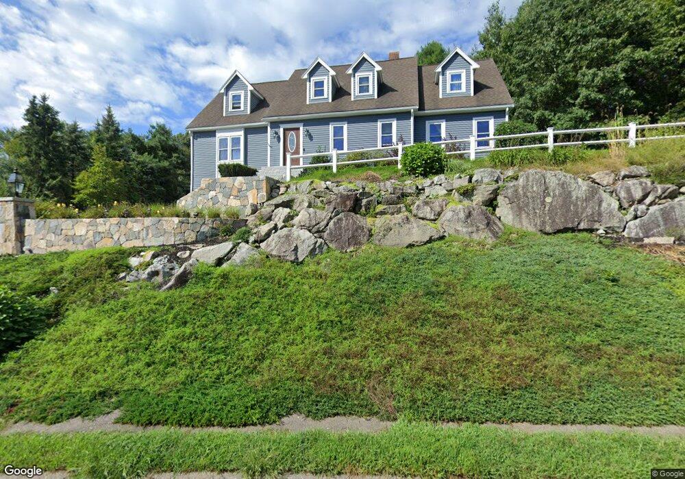
10 Roger Goodwin Dr Wrentham, MA 02093
Estimated Value: $825,000 - $1,032,000
4
Beds
3
Baths
2,646
Sq Ft
$343/Sq Ft
Est. Value
About This Home
This home is located at 10 Roger Goodwin Dr, Wrentham, MA 02093 and is currently estimated at $908,453, approximately $343 per square foot. 10 Roger Goodwin Dr is a home located in Norfolk County with nearby schools including Delaney Elementary School and Charles E Roderick.
Ownership History
Date
Name
Owned For
Owner Type
Purchase Details
Closed on
Jun 27, 1997
Sold by
Milling Richard G
Bought by
Sugrue Mark D and Sugrue Janice
Current Estimated Value
Home Financials for this Owner
Home Financials are based on the most recent Mortgage that was taken out on this home.
Original Mortgage
$185,000
Interest Rate
7.81%
Mortgage Type
Purchase Money Mortgage
Purchase Details
Closed on
Aug 24, 1990
Sold by
Sabatini Tr John F
Bought by
Milling Richard G
Home Financials for this Owner
Home Financials are based on the most recent Mortgage that was taken out on this home.
Original Mortgage
$138,500
Interest Rate
10.01%
Mortgage Type
Purchase Money Mortgage
Create a Home Valuation Report for This Property
The Home Valuation Report is an in-depth analysis detailing your home's value as well as a comparison with similar homes in the area
Purchase History
| Date | Buyer | Sale Price | Title Company |
|---|---|---|---|
| Sugrue Mark D | $235,000 | -- | |
| Milling Richard G | $236,000 | -- |
Source: Public Records
Mortgage History
| Date | Status | Borrower | Loan Amount |
|---|---|---|---|
| Open | Milling Richard G | $185,000 | |
| Closed | Milling Richard G | $185,000 | |
| Previous Owner | Milling Richard G | $138,500 |
Source: Public Records
Tax History
| Year | Tax Paid | Tax Assessment Tax Assessment Total Assessment is a certain percentage of the fair market value that is determined by local assessors to be the total taxable value of land and additions on the property. | Land | Improvement |
|---|---|---|---|---|
| 2025 | $9,033 | $779,400 | $302,300 | $477,100 |
| 2024 | $8,740 | $728,300 | $302,300 | $426,000 |
| 2023 | $8,700 | $689,400 | $274,700 | $414,700 |
| 2022 | $8,210 | $600,600 | $256,200 | $344,400 |
| 2021 | $7,754 | $551,100 | $223,600 | $327,500 |
| 2020 | $8,117 | $569,600 | $198,800 | $370,800 |
| 2019 | $7,780 | $551,000 | $198,800 | $352,200 |
| 2018 | $7,208 | $506,200 | $199,000 | $307,200 |
| 2017 | $7,067 | $495,900 | $195,200 | $300,700 |
| 2016 | $6,917 | $484,400 | $189,500 | $294,900 |
| 2015 | $6,894 | $460,200 | $182,200 | $278,000 |
| 2014 | $6,906 | $451,100 | $175,300 | $275,800 |
Source: Public Records
Map
Nearby Homes
- 10 Earle Stewart Ln Unit Lot 5
- 12 Earle Stewart Ln
- 2 Earle Stewart Ln
- 3 Earle Stewart Ln
- 135 Creek St Unit 2
- 440 Chestnut St
- 613 West St
- 1222 South St
- 500 Franklin St
- 10 Nature View Dr
- 15 Nature View Dr
- 440 South St
- 23 Horseshoe Dr
- 20 Field Cir
- 0 Berry St
- 18 Huntington Ave
- 19 Chestnut St Lot 2
- 19 Chestnut St Lot 3
- 1 Chestnut St
- 18 Northern Spy Rd
- 20 Roger Goodwin Dr
- 101 Bennett St
- 145 Bennett St
- 30 Roger Goodwin Dr
- 96 Bennett St
- 40 Roger Goodwin Dr
- 119 Bennett St
- 15 Roger Goodwin Dr
- 100 Bennett St
- 135 Bennett St
- 7 Cranberry Ln
- 91 Bennett St
- Lot 5 Cranberry Ln
- 25 Roger Goodwin Dr
- 110 Bennett St
- 35 Roger Goodwin Dr
- 3 Cranberry Ln
- 90 Bennett St
- 199 Bennett St
- 8 Cranberry Ln
Your Personal Tour Guide
Ask me questions while you tour the home.