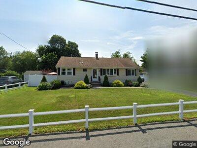
10 Salem Ave Woburn, MA 01801
Walnut Hill NeighborhoodEstimated Value: $569,000 - $696,000
6
Beds
2
Baths
1,228
Sq Ft
$531/Sq Ft
Est. Value
About This Home
This home is located at 10 Salem Ave, Woburn, MA 01801 and is currently estimated at $651,625, approximately $530 per square foot. 10 Salem Ave is a home located in Middlesex County with nearby schools including Goodyear Elementary School, John F. Kennedy Middle School, and Woburn High School.
Ownership History
Date
Name
Owned For
Owner Type
Purchase Details
Closed on
Oct 27, 1995
Sold by
Zipkin Tully and Zipkin Carrie L
Bought by
Buonopane George and Buonopane Karen I
Current Estimated Value
Home Financials for this Owner
Home Financials are based on the most recent Mortgage that was taken out on this home.
Original Mortgage
$129,200
Interest Rate
7.6%
Mortgage Type
Purchase Money Mortgage
Purchase Details
Closed on
Aug 22, 1988
Sold by
Stoner & Co Inc
Bought by
Zipkin Tully
Home Financials for this Owner
Home Financials are based on the most recent Mortgage that was taken out on this home.
Original Mortgage
$137,500
Interest Rate
10.32%
Mortgage Type
Purchase Money Mortgage
Create a Home Valuation Report for This Property
The Home Valuation Report is an in-depth analysis detailing your home's value as well as a comparison with similar homes in the area
Home Values in the Area
Average Home Value in this Area
Purchase History
| Date | Buyer | Sale Price | Title Company |
|---|---|---|---|
| Buonopane George | $161,500 | -- | |
| Zipkin Tully | $172,000 | -- |
Source: Public Records
Mortgage History
| Date | Status | Borrower | Loan Amount |
|---|---|---|---|
| Open | Buonopane George | $72,000 | |
| Closed | Buonopane George | $75,000 | |
| Closed | Stoner & Co Inc | $20,000 | |
| Open | Buonopane George | $225,000 | |
| Closed | Ryan Kelly L | $150,000 | |
| Closed | Buonopane George | $216,000 | |
| Closed | Stoner & Co Inc | $129,200 | |
| Previous Owner | Stoner & Co Inc | $137,500 | |
| Previous Owner | Stoner & Co Inc | $120,000 |
Source: Public Records
Tax History Compared to Growth
Tax History
| Year | Tax Paid | Tax Assessment Tax Assessment Total Assessment is a certain percentage of the fair market value that is determined by local assessors to be the total taxable value of land and additions on the property. | Land | Improvement |
|---|---|---|---|---|
| 2025 | $5,198 | $608,700 | $329,300 | $279,400 |
| 2024 | $4,864 | $603,500 | $313,600 | $289,900 |
| 2023 | $4,917 | $565,200 | $285,100 | $280,100 |
| 2022 | $4,801 | $514,000 | $247,900 | $266,100 |
| 2021 | $4,529 | $485,400 | $236,100 | $249,300 |
| 2020 | $4,249 | $455,900 | $236,100 | $219,800 |
| 2019 | $4,047 | $426,000 | $224,900 | $201,100 |
| 2018 | $3,924 | $396,800 | $206,300 | $190,500 |
| 2017 | $3,814 | $383,700 | $196,500 | $187,200 |
| 2016 | $3,641 | $362,300 | $183,600 | $178,700 |
| 2015 | $3,506 | $344,700 | $171,600 | $173,100 |
| 2014 | $3,292 | $315,300 | $171,600 | $143,700 |
Source: Public Records
Map
Nearby Homes
- 509 William St
- 18 Elizabeth Rd
- 1 Albert Dr Unit 2
- 19 Evans Rd
- 27 Evans Rd
- 107 Pine St Unit 107
- 1 Carter Rd
- 53 Forest St
- 358 William St
- 9 Country Club Rd
- 12 Utica St
- 10A Unicorn Ave
- 6 Stratton Dr Unit 410
- 6 Stratton Dr Unit 407
- 6 Stratton Dr Unit 208
- 7 Mason Way Unit 69
- 5 Mason Way Unit 68
- 182 William St
- 57 Augustus Ct Unit 3004
- 12 Cottage St