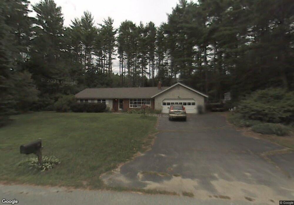
10 Sawmill Rd Pelham, NH 03076
Estimated Value: $617,352 - $688,000
3
Beds
2
Baths
2,036
Sq Ft
$319/Sq Ft
Est. Value
About This Home
This home is located at 10 Sawmill Rd, Pelham, NH 03076 and is currently estimated at $648,588, approximately $318 per square foot. 10 Sawmill Rd is a home with nearby schools including Pelham Elementary School, Pelham Memorial School, and Pelham High School.
Ownership History
Date
Name
Owned For
Owner Type
Purchase Details
Closed on
Nov 23, 2021
Sold by
D W & E Hornbrook Ft
Bought by
Nelson Richard and Nelson Cynthia
Current Estimated Value
Purchase Details
Closed on
Jul 22, 2019
Sold by
Murphy Neal J and Murphy Margaret C
Bought by
Gioia Katie A
Home Financials for this Owner
Home Financials are based on the most recent Mortgage that was taken out on this home.
Original Mortgage
$299,376
Interest Rate
4.87%
Mortgage Type
FHA
Purchase Details
Closed on
Mar 29, 2010
Sold by
Walsh Lynda J M
Bought by
Murphy Neal J and Murphy Margaret C
Home Financials for this Owner
Home Financials are based on the most recent Mortgage that was taken out on this home.
Original Mortgage
$187,120
Interest Rate
5.02%
Mortgage Type
Purchase Money Mortgage
Create a Home Valuation Report for This Property
The Home Valuation Report is an in-depth analysis detailing your home's value as well as a comparison with similar homes in the area
Home Values in the Area
Average Home Value in this Area
Purchase History
| Date | Buyer | Sale Price | Title Company |
|---|---|---|---|
| Nelson Richard | $520,000 | None Available | |
| Gioia Katie A | $304,933 | -- | |
| Murphy Neal J | $234,000 | -- |
Source: Public Records
Mortgage History
| Date | Status | Borrower | Loan Amount |
|---|---|---|---|
| Previous Owner | Gioia Katie A | $299,376 | |
| Previous Owner | Murphy Neal J | $187,120 |
Source: Public Records
Tax History Compared to Growth
Tax History
| Year | Tax Paid | Tax Assessment Tax Assessment Total Assessment is a certain percentage of the fair market value that is determined by local assessors to be the total taxable value of land and additions on the property. | Land | Improvement |
|---|---|---|---|---|
| 2024 | $7,648 | $417,000 | $173,600 | $243,400 |
| 2023 | $7,585 | $417,000 | $173,600 | $243,400 |
| 2022 | $6,933 | $398,000 | $173,600 | $224,400 |
| 2021 | $6,352 | $398,000 | $173,600 | $224,400 |
| 2020 | $6,026 | $298,300 | $138,700 | $159,600 |
| 2019 | $5,787 | $298,300 | $138,700 | $159,600 |
| 2018 | $5,771 | $268,900 | $126,800 | $142,100 |
| 2017 | $5,768 | $268,900 | $126,800 | $142,100 |
| 2016 | $5,633 | $268,900 | $126,800 | $142,100 |
| 2015 | $5,387 | $231,600 | $120,700 | $110,900 |
| 2014 | $5,297 | $231,600 | $120,700 | $110,900 |
| 2013 | $5,297 | $231,600 | $120,700 | $110,900 |
Source: Public Records
Map
Nearby Homes
- 63 Marsh Rd
- 5 Stephanie Dr
- 4 Haystack Cir
- 508 Mammoth Rd
- 436 Mammoth Rd
- 446 Mammoth Rd
- 10 Oakland Ridge Rd Unit 11
- 10 Dutton Rd
- 1 Currier Rd
- 1 Redwood Rd
- 290 Mammoth Rd
- 59 Thistlewood Dr Unit 47
- 50 Dutton Rd
- 25 Misty Ln
- 45 Hobbs Rd
- 96 Simpson Rd
- 9 Cornstalk Ln
- 71 Deer Hill Cir
- 73 Mammoth Rd Unit A&B
- 73 Mammoth Rd