Estimated Value: $374,000 - $509,000
4
Beds
3
Baths
2,845
Sq Ft
$154/Sq Ft
Est. Value
About This Home
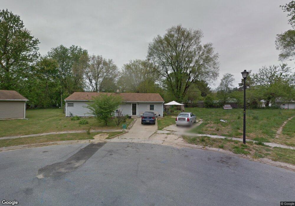
This home is located at 10 State Cir, Dover, DE 19901 and is currently estimated at $437,080, approximately $153 per square foot. 10 State Cir is a home located in Kent County with nearby schools including South Dover Elementary School, William Henry Middle School, and Central Middle School.
Ownership History
Date
Name
Owned For
Owner Type
Purchase Details
Closed on
Mar 5, 2025
Sold by
Seeger Donald and Seeger Tae Chu
Bought by
Obadele Olufemi
Current Estimated Value
Home Financials for this Owner
Home Financials are based on the most recent Mortgage that was taken out on this home.
Original Mortgage
$296,000
Outstanding Balance
$294,508
Interest Rate
6.95%
Mortgage Type
New Conventional
Estimated Equity
$142,572
Purchase Details
Closed on
Aug 30, 2012
Sold by
Fannie Mae
Bought by
Seeger Tae Chu and Seeger Donald
Purchase Details
Closed on
Oct 25, 2011
Sold by
Miller John E
Bought by
Fannie Mae and Federal National Mortgage Association
Purchase Details
Closed on
Aug 28, 2007
Sold by
Mathison Frederic N
Bought by
Miller John E
Home Financials for this Owner
Home Financials are based on the most recent Mortgage that was taken out on this home.
Original Mortgage
$212,500
Interest Rate
6.74%
Mortgage Type
Purchase Money Mortgage
Create a Home Valuation Report for This Property
The Home Valuation Report is an in-depth analysis detailing your home's value as well as a comparison with similar homes in the area
Home Values in the Area
Average Home Value in this Area
Purchase History
| Date | Buyer | Sale Price | Title Company |
|---|---|---|---|
| Obadele Olufemi | $390,000 | None Listed On Document | |
| Seeger Tae Chu | -- | None Available | |
| Fannie Mae | $207,273 | None Available | |
| Miller John E | -- | None Available |
Source: Public Records
Mortgage History
| Date | Status | Borrower | Loan Amount |
|---|---|---|---|
| Open | Obadele Olufemi | $296,000 | |
| Previous Owner | Miller John E | $212,500 |
Source: Public Records
Tax History Compared to Growth
Tax History
| Year | Tax Paid | Tax Assessment Tax Assessment Total Assessment is a certain percentage of the fair market value that is determined by local assessors to be the total taxable value of land and additions on the property. | Land | Improvement |
|---|---|---|---|---|
| 2025 | $2,038 | $515,700 | $198,900 | $316,800 |
| 2024 | $2,038 | $515,700 | $198,900 | $316,800 |
| 2023 | $1,478 | $58,500 | $4,700 | $53,800 |
| 2022 | $919 | $58,500 | $4,700 | $53,800 |
| 2021 | $1,008 | $58,500 | $4,700 | $53,800 |
| 2020 | $985 | $58,500 | $4,700 | $53,800 |
| 2019 | $930 | $58,500 | $4,700 | $53,800 |
| 2018 | $883 | $58,500 | $4,700 | $53,800 |
| 2017 | $823 | $58,500 | $0 | $0 |
| 2016 | $739 | $58,500 | $0 | $0 |
| 2015 | $639 | $58,500 | $0 | $0 |
| 2014 | $636 | $58,500 | $0 | $0 |
Source: Public Records
Map
Nearby Homes
- 161 President Dr
- 153 President Dr
- 168 N Governors Blvd
- 1 Congress Place
- 223 President Dr
- 121 S Governors Blvd
- 648 Kentland Ave
- 190 Evergreen Dr
- 282 Beechwood Ave
- 129 Roosevelt Ave
- 1679 S State St Unit A55
- 97 Glenda Rd
- 200 Beechwood Ave Unit 2
- 149 Lotus St
- 93 Orchard Ave
- 12 Lots Wolf Creek Cir
- 40 Lotus St
- 524 Crawford Ave
- 19 Roosevelt Ave
- 40 Pine St